Download
1 / 106
1.07k likes | 1.23k Vues
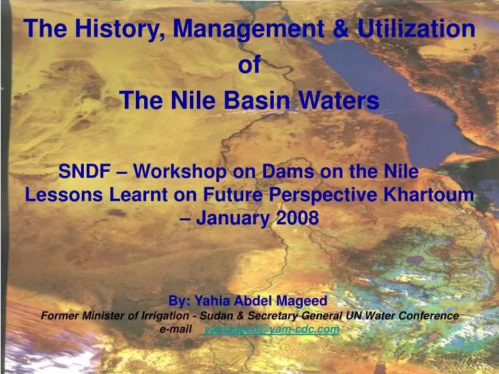
The History, Management & Utilization of The Nile Basin Waters SNDF – Workshop on Dams on the Nile Lessons Learnt on Future Perspective Khartoum – January 2008

E N D
The History, Management & Utilization of The Nile Basin Waters SNDF – Workshop on Dams on the Nile Lessons Learnt on Future Perspective Khartoum – January 2008 By: Yahia Abdel MageedFormer Minister of Irrigation - Sudan & Secretary General UN Water Conference e-mail yamageed@yam-cdc.com
1- Introduction Human interferences in river basins are as old as the history of mankind. The emergence of the fluvial civilizations since times immemorial witnessed the initial forms of human interference & control of rivers for agriculture and navigation.
The river Nile witnessed the initial interference by diversion of its water 4500 years for basin irrigation of the low lying fertile lands in its lower reaches in Egypt. The navigability of the river in its lower reaches also facilitated the unification of upper and lower Egypt.
In search of information on the mysteries of fluctuation of the river flows bringing damaging floods one year and drought, with famine threats the other, the ancient Egyptians pushed south to the forth cataract and came in contact with the Meroitic Civilization, establishing the early forms of contact between the basin societies.
"Trade that flourished in ancient time between the Upper and Lower basin of the river proved that physical unity of, the basin is stronger than the political division" (Teclaff - River Basins in History and Law - New York Library 1967)
2-Concepts of River Basins Control Works & Water Management Control concepts & approaches have developed from simple diversions to complex control structures & management techniques to meet the increasing & diversified needs for human settlements, water supply, agriculture, energy, navigation, flood control & recreation.
In contemporary history the single purpose control works for irrigation, navigation & energy emerged. This was followed by the beginning of twentieth century with the development of sciences & knowledge by the multi purpose control works, providing water demands & services by one structure.
Following World War I & the depression years of the 1930s, in an effort to stimulate employment & economic growth in many parts of the world particularly in Europe & America, the concept of integrated river basins management & development emerged. This concept recognized the hydrological unity of the basins & the pivotal role of water in mobilization of the natural resources base of the basins for the welfare of their societies.
The hydrological boundary of the basin was recognized as the ideal unit for planning & economic & social development. This period witnessed the emergence of the integrated river basin development plans in the Mississippi, St. Lawrena, Missouri, Colorado basins in the United States of America & the Felimendoza & the Rhone basins in Europe.
However this concept did not live long in the industrial countries due to the revival of the world economics after World War II particularly during the fiftieth & sixtieth that witnessed huge progress in industrial development. The river basins in the developed world lost their integrity as an ideal unit area for planning & economic development.
The developed world moved towards the establishment of huge industrial & urban conglomerates & became concerned with the environmental challenges of pollution & chemical hazards, which in turn provided support & subsidies to other economic sectors of development including agriculture, research, education & health.
Contrary to this, the concept of integrated river basin development & management with the basin area as the ideal unit area for planning & economic development remained valid to our present times for development of the natural resources base, in the developing world.
This does not mean closing the activities within the basin, but on the contrary the economic development within the basin will create vast opportunities to move excess production goods over its needs and to receive excess goods from the neighboring basins in terms of electric power, trade, labour & other economic goods.
However we need to recognize the complications in shared basins, associated with political issues concerning sovereignty & territorial integrity. Such issues are no longer difficult to solve in the world of today where the shared benefits & issues of economic integration & environmental stability in the basin countries super-impose over issues of conflicts between them.
However we need to recognize the challenges that have constrained the progress in achieving meaningful development in many basins in the developing world particularly in the African Continent.
The Nile basin is an example, where most of the countries of the basin are among the least developed countries in the world & the majority of the basin societies & population still lack the basic needs & services including water, food, shelter, health, education in addition to forthcoming environmental challenges & problems associated with climate change.
3- The River Basins in History & Law To protect & secure the hydrological & economic unity & integrity of the river basin, the legal & administrative frameworks are considered major factors to guarantee the basin integrated development, realization of shared benefits, management of conflicts & protection of the environmentalstability of the basin ecosystems.
A number of legal frameworks & precedences have been realized for utilization of shared water resources over the years & laid down a number of guidelines to manage conflicts between the basin beneficiaries & water users. Though progress has been rather slow in this context there are a number of achievements that can be quoted from governmental & non-governmental organizations.
Examples include the Helsinki Rules 1963, Stockholm Declaration 1972, Mar del Plata Action Plan 1977, the Dublin Declaration 1992. This in addition to agreements & protocols that have been concluded between & among nations sharing basins.
Finally, the International law Commission of the United Nations after intensive efforts since the Seventies was able to formulate the International Law for Water other than Navigational Uses in 1997. This now provide a useful instrument to help nations sharing river basins save guard their interest, resolve conflicts & protect the ecosystems of the basin.
Following this short introduction of the world heritage of experience in the management & development of basin control concepts & techniques let us now look into the situation in the Nile basin.
4-The Natural Characteristics of the Nile Basin The equator almost bisect the African content which struddle the tropical zone except its northern & southern tips which lies in a temperature zone. This unique location characterized the continent climate & its environmental features which are influenced by the movement of the inter-conversation- zone (ITCZ) north-ward & south-ward behind the sun crossing the equator twice a year causing rainfall with a short dry period in between.
Rainfall decrease as one moves south & north of the equator. Consequently the dry seasons increase from one in the equatorial zone to four in the Sahra desert in the north & Kalahari desert in the south. The northern & southern tips of the continent witness winter rains only. See Fig (1).
The annual rainfall in the whole continent of Africa amount to about 20700 mld m³ 78% of this rain falls between 15° N & 20° S, 75% of it is lost by evaporation leaving 2480 mld m³ for surface run-off, 90% of this surface run-off exists in rivers & lakes between 10° N & 20° S of which 19% in rivers flowing north & south and 77.5% in rivers flowing east & west and 3.5% in islands. • (Source: Regional Report of the Economic Commission for Africa to the UN Water Conference 1977).
The Nile basin constitute one of the most important north flowing basins with an annual mean flow of 84 mld m³ at Aswan which amount to 4% of the total surface flow of the content. The flow at Aswan /km2 of the basin is 29000 m3 compared with other major basins in the African Continent shown below.
The River Nile is a complex hydrological system originating in three distinct geographical and climatological zones. The Ethiopian and Eritrean plateaus, the Equatorial lakes and the Bahr El Ghazal region, the catchment of the basin extend over an area of 2.9 million km2 and incompass ten riparian states including Brundi, Congo, Egypt, Ethiopia, Eritrea, Kenya, Rawande, Sudan, Tanzania & Uganda see Fig. (2).
Almost half of the river length run in arid and desert land. The total length of the river and its tributaries amounts to 37205 km, its main lake areas total 81550 km2 and its swamp reaches extend over an area of 69 720 km2. The river extends from 4° S to 31° N with a length of 5750 Km almost halh of it in desert & falls from 1200 – 1800m m sea level in the Mediterranean. See Figs. (3) & (4).
The Equatorial Lakes Region • The total normal rainfall in the basin in the Equatorial region, which extends over 10-12 month in the year, is estimated at 451 milliard cube meters. The total annual flow entering the Sudan at Nimule is 22.7 mld m3. The flow at Mangalla is 27 mld m3 including torrent flows between the exit of Lake Albert and Managalla.
It constitutes about 6% 0 of the total rainfall in the region. Almost 50% of this flow is lost in the Sudd region, where only about 13.5 mld m3 reaches Malakal. The whole run-off from the Bahr El Ghazal, which originates from within Sudan's borders, is lost in the swamps and only 0.5 mId m3 reaches the Nile at Lake No out of a total of about 20 mld m3 , see Fig. (3).
The Ethiopian and Eritrean Region These comprise four sub-basins: the Baro-Akobo, the Eastern torrents, the Blue Nile and the Atbra. The rainfall duration ranges from three months in the north to eight months in the south. The flows entering the Sudan from these sub-basins are as follows:
The Blue Nile longitudinal Section is shown in Fig. (4) The estimated flows at Aswan are: • R. Sobat 11.78 mld m3 • R. Blue Nile 49.56 mld m3 • R. Atbara 10.92 mld m3 • R. Bahr El Jabal 11.76 mld m3 • Total84.00 mld m3 • Source : (The Kenana Handbook of Sudan- Chapter 48 Water Resources by Yahia Abdel Mageed 2007)
In addition to this mean surface flow potential in the main Nile & its tributaries reaching Aswan of 84 mld m3 the basin is endowed with direct rain potential in the Equatorial Lakes of 400 mld m3, the Ethiopian & Eritrean Plateaus of 250 mld m3 & 480 mld m3 in Sudan. This rainfall potential provide adequate soil moisture to support rainfed farming, grazing lands & forests & irrigated lands.
In addition to this the stored water potential in the lakes in the basin in the Equatorial region is estimated at 2910 mld m3, in Lake Tana 28 mld m3 & the swamps & the water lands of Equatorial region & the Sudd region in Sudan provide 69720 Km2 which could be mobilized for power generation, water conservation & ecosystem protection.
5- The Hydro Polices of the Nile Waters The fall of the Turkish Empire which dominated Egypt and Sudan and other parts of the basin marked the beginning of the stage of political influence by the foreign European powers. This was evidenced by the protocols and boundary agreements made between the British who influenced a major portion of the basin; the Italians in Ethiopia and Congo Free State dominated by the Belgians.
Those include the 1891 Rome Protocol, the 1902 agreement for the Blue Nile, and the 1906 Agreement with Congo Free State. All those Agreements prohibited any construction on the tributaries of the Nile obstructing the flow to Sudan and Egypt without consultation and consent of the downstream riparians.
Since then basin-wide plans started to emerge for annual storage works for control of the river in the interest of Egypt to improve the low summer flows, increase the Nile yield through conservation of water from the swamps and Sudd region in the Southern Sudan, flood control works and the over-year concept in the Equatorial lakes and Lake Tana in the Blue Nile basin to store water from high yielding years to meet shortage during the occurrence of low years. A number of commissions were established to examine those plans and the allocation of waters between Egypt and the Sudan.
Based on the recommendations of those commissions the 1929 Agreement was concluded in the form of exchange of notes incorporating the report of the commissions between the Egyptian Government and the Administration of Sudan and East Africa on behalf of the Government of Great Britain.
This was motivated by the uprising of the Egyptian army and the Sudan defense force against the British army in Sudan: the “1924 Revolution” and the assassination of the governor general of Sudan Sir Lee Stack in Egypt, and expanding cotton irrigation in Sudan.
While this agreement recognized the need for development of irrigation in the Sudan, it stipulated that any increase of the use of the Nile waters as a result of such development should not infringe Egypt natural and historic rights. The working arrangements based on this agreement provided for the Egyptian rights on the whole of the natural flow of the river during low flow period January to July.
Apart from small withdrawals from the natural river during this period, the Sudan has to meet its requirements from water stored at the tail of the flood. So in the years that followed up to independence, the Sudan irrigation development was restricted to the Gezira Project (British Syndicate) with cotton as the main crop in an area of about one million acres and crop intensity of 50%. During the Korean War and the sharp rise in cotton prices further areas were developed by pumping amounting to about 500,000 acres from the Blue and White Niles under flood licenses only.
The 1929 Agreement also required the East African countries not to construct any works in the Equatorial lakes without consultation with Egypt and Sudan. The British government would use its good offices to facilitate establishment of over-year storage in the Equatorial Lakes connected with the conservation project in the Sudd region for increasing the Nile yield for interest of Egypt.
The Egyptians in 1938 also presented to the British Administration in Sudan the plan for the Sudd diversion canal at Jonglie. The canal aim with the over-year storage in Equatorial Lake (known as the Equatorial Nile Project) to conserve about 7.5 mld m3 of timely waters to improve the summer Nile flow at Aswan.
Following World War two a new political environment prevailed characterized by the call for self-determination and liberation of the colonized territories. The Nile Basin became an important political stage in this phase. These included the Egyptian struggles for evacuation of military occupation in the Suez Canal, the Sudan struggle for independence or Unity with Egypt, the Mau land struggle and the Ethiopian struggle against the Italian occupation and influence. Since then the Nile Waters became a central issue in the politics of the area.
The British Administration in Sudan established in 1945 the Jonglie Investigation Team to consider the Egyptian Project Proposal. The team came out with a modified Equatorial Nile Project. While keeping the original objectives of the project, it modified the storage and regulation of flow of the lake Albert to ensure minimum disturbance to the swamp regime in the Southern Sudan and the prevailing subsistence socio-economic systems associated with it.