Download
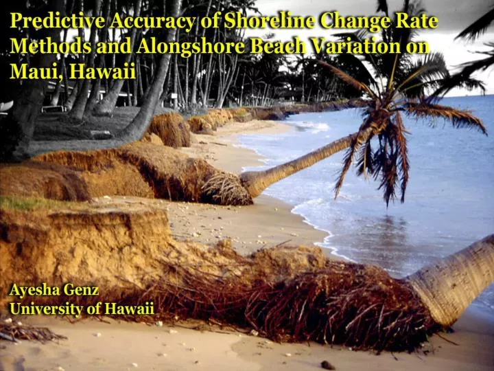
1 / 48
480 likes | 650 Vues
Outline. Objective Shoreline change rate methods Prediction of known positions Synthetic time series analysis Binning adjacent transects Erosion Hazard Maps Conclusion. Objectives. Find the most appropriate shoreline change rate method that describes beach change in Hawaii

E N D
Outline • Objective • Shoreline change rate methods • Prediction of known positions • Synthetic time series analysis • Binning adjacent transects • Erosion Hazard Maps • Conclusion
Objectives • Find the most appropriate shoreline change rate method that describes beach change in Hawaii • Forecasting known data points • Using synthetic data to predict true rate • Study the effects of a priori (storms, tsunamis) outliers • 1960 Tsunami – North Shore • 1963 Kona storms – Kihei, West Maui (Rooney, 2002; Eversole and Fletcher, 2002) • Identify regions of a beach that have indistinguishable change rates (binning) • Create Erosion Hazard maps that incorporate rate method and binning
Study Site Kihei: South Swells, refracted North Swells and kona storm waves West Maui: North Pacific swells, south swells and kona storm waves North Shore: North Pacific swells, tradewind waves
Shoreline Change Rate Methods Foster and Savage, 1989
Shoreline Change Rate Methods Fenster et al., 1993
Forecasting Methodology Step 1: Remove a known data point Remove
Forecasting Methodology Step 1: Remove a known data point
Forecasting Methodology Step 2: Calculate the shoreline change rate
Forecasting Methodology Error in Prediction (EIP) = Predicted – Actual Step 3: Calculate the predicted shoreline and compare it to the actual shoreline
Forecasting Results • For most regions, OLS, WLS, RLS, RWLS, JK, EPR, and LAD are statistically insignificant at the 95% Confidence Interval • MDL and AOR have the highest mean |EIP| • Hardened beaches have lower mean |EIP| than natural beaches Kihei
Forecasting Results • Average improvement for all methods when a priori outliers removed range from < 0.1 m to 15 m • OLS, RLS, WLS, RWLS, JK, and LAD have minimal improvements (avg = 0.7 m) • Each beach reacts differently to storm: a little more than half the beaches showed no significant improvements. Kihei
Synthetic Analysis An alternative to Forecasting analysis Generate a synthetic shoreline time series Slope = 0.1 m/yr Intercept = 75 m
Synthetic Analysis Using various distributions, generate noise into the time series = real position = noisy position
Synthetic Analysis Calculate trend fits with erosion rate methods Compare slope of fits to true slope Add more noise and repeat Add storm point in middle, then at end and repeat
Synthetic Results • Less Noise • No storm • 1000 synthetic time series • = true slope of 0.1 m/yr
Synthetic Results • More Noise • No storm • 1000 synthetic time series • = true slope of 0.1 m/yr
Synthetic Results Weighted methods are generally better with less noise. As more noise is introduced, unweighted methods are similar to weighted methods. No Storms Storm - MID Storm- END WLS, RWLS, WLAD WLS, RWLS, WLAD, OLS, RLS, JK, LAD, EPR RWLS, RLS, WLAD, LAD Less Noise WLS, RWLS, WLAD, OLS, RLS, JK, LAD, EPR WLS, RWLS, WLAD, RLS, JK, OLS WLS, RWLS, WLAD, RLS, JK, OLS, LAD More Noise
Based on Synthetic and Forecasting work, we choose RWLS as our rate method because we know uncertainties, but not storm effects. Available Methods: OLS, RLS, WLS, RWLS, LAD, WLAD, JK Are Uncertainties Known? Yes No Are Storms Known? Are Storms Known? Yes No Yes No Choose WLS, RWLS, or WLAD Choose RWLS or WLAD Choose OLS, JK, RLS, or LAD Choose RLS or LAD
Outliers • Two types of outliers: a priori and statistical outliers • A priori outliers based on historical data and confirmed by tide gauge records • U.S. East Coast studies show that removal of these outliers improve forecasting predictions by 15-30 m. We show an improvement of 0.7 m Zhang et. al, 2002
Outliers • Statistical outliers based on residuals and are important because Least Squares are susceptible to outliers • RLS and RWLS remove statistical outliers by estimating true standard deviation (σ) of population. • For small sample size, less certainty of true σ, causing removal or retention of too many outliers • Conclusion: increase sample size (bin)
Binning Analysis • Identifying statistical outliers is less accurate with only 5-9 unevenly spaced points • We group regions of a beach that have indistinguishable erosion rates to better identify the trend of the data by increasing the signal
Binning Analysis • Start with a window spacing of 4 transects and use Students t-test to compare its rate to the rate of the rest of the beach • Shift window by 1 transect and repeat t-test. Window is shifted in increments of 1 transect until the last 4 transects are grouped together • Increase window size by 2 transects and process is repeated R=binned erosion rate T-test compares R1 to R2
Binning Analysis • Vertical lines = transects • Horizontal lines = transect windows where binned rate is statistically different from binned rate of the rest of the beach
Binning Analysis • Within each window size, a t-test is performed on any overlapping transects
Binning Analysis • If overlapping transects are statistically insignificant, they are grouped together as one bin (A) • If overlapping transects are statistically different, they are grouped separately (B) • Another t-test is performed on any overlapping transects at different window sizes (Comparison of A and B)
Binning Analysis • Bins that are found to be statistically insignificant are clustered together and a rate is calculated for that region (1 and 2) • Transects that fall in both clusters are considered transitional zones
Binning Analysis • Each cluster is assigned a color and each transect within the cluster is given a shade of that color • Transect shade corresponds to frequency of windows that intersect the transect • Groups A and C represent two distinct colors • Group B represents the overlap between Groups A and C 0.10 m/yr Erosion 0.25 m/yr Erosion 0.19 m/yr Erosion
Binning Results • Binned vs Unbinned • 84% of binned rates significant vs. 38% unbinned rates significant (95% C.I.) • 0.1 m decrease in uncertainties with binned rates compared to unbinned rates • Binned Beaches • 15 beaches binned – 8 from Kihei, 4 from West Maui, and 3 from the North Shore. • Kihei further categorized in two geographical groups within study site– 4 central beaches and 4 southern beaches
Binning Results • Summary of bin trends
Binning Results Kaanapali Beach An example at one Beach • Eversole and Fletcher (2003) identify an inflection point at Kaanapali Beach where the seasonal volume trend reverses. They also conclude that the net annual sediment transport is northward • We observe an erosive south and accretive north • The region encompassing the inflection point switches from erosion to accretion -0.070 m/yr Inflection point -0.165 m/yr 0.104 m/yr
Available Methods: OLS, RLS, WLS, RWLS, LAD, WLAD, JK Are Uncertainties Known? Yes No Are Storms Known? Are Storms Known? Yes No Yes No Choose WLS, RWLS, or WLAD Choose RWLS or WLAD Choose OLS, JK, RLS, or LAD Choose RLS or LAD Bin Transects to identify segments of a beach that have indistinguishable erosion rates
Erosion Hazard Maps Calculate 50 yr predicted position and its uncertainty from binned data
Erosion Hazard Maps • Map Assumptions • Erosion is constant • No shoreline change due to storms
Available Methods: OLS, RLS, WLS, RWLS, LAD, WLAD, JK Are Uncertainties Known? Yes No Are Storms Known? Are Storms Known? Yes No Yes No Choose RLS or LAD Choose WLS, RWLS, or WLAD Choose RWLS or WLAD Choose OLS, JK, RLS, or LAD Bin Transects to identify segments of a beach that have indistinguishable erosion rates Calculate 50 year position and its uncertainty from trend line of binned data Project 50 year position and uncertainty on map Erosion Hazard Map
Conclusions • YESUNCERTAINTIES and NOSTORMS = weighted, robust methods (RWLS or WLAD) • YESUNCERTAINTIES and YESSTORMS = weighted methods (WLS, RWLS or WLAD) • NOUNCERTAINTIES and NOSTORMS = unweighted robust methods (RLS or LAD) • NOUNCERTAINTIES and YESSTORMS = unweighted methods (OLS, JK, RLS or LAD) • MDL and AOR produce the most variable results • Increasing sample sizes in a RWLS or RLS analysis improves the identification of statistical outliers • Binning increases sample sizes and improves the signal-to-noise ratio • Erosion Hazard Maps are useful for coastal management purposes
Acknowledgements • Committee Members – Chip Fletcher, Rob Dunn, John Rooney, and Neil Frazer • University of Hawaii Sea Grant College, USGS, Maui County • Coastal Geology Group • Joe Genz • GG faculty and students • Family and Friends