Download
1 / 14
140 likes | 249 Vues
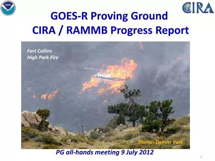
GOES-R Proving Ground CIRA / RAMMB Progress Report. PG all-hands meeting 9 July 2012. Fort Collins High Park Fire. Photo - Denver Post. Outline. User Interactions Product Examples System Report Conferences and Meetings. User Interactions.

E N D
GOES-R Proving Ground CIRA / RAMMB Progress Report PG all-hands meeting 9 July 2012 Fort Collins High Park Fire Photo - Denver Post
Outline • User Interactions • Product Examples • System Report • Conferences and Meetings
User Interactions • WFO Boulder: Presentation at BOU Spring Workshops. Submitted a short email survey on the GeoColor and Low Cloud/Fog products . (BOU has been using these two products the longest). More on the feedback and how it compares to that from CYS next time. • WFO Cheyenne & SPoRT: Coordinated with Satellite Focal Point Rebecca Mazur (CYS forecaster) and Kevin Fuell of SPoRT concerning potential telecon with ABQ. • WFO San Diego: Discussion with WCM Alex Tardy at the AMS WAF/NWP Conference in late May concerning our interactions and feedback. • WFO Eureka / Western Region: Gave a short overview of the CIRA PG products in a teleconto Mel Nordquist (SOO at EKA) and his NWS Western Region SAC (Science Advisory Committee) group in mid-March. Also talked with Mel (and other NWS SOO’s/forecasters) at the Science Week meeting in Kansas City…they will be getting back to us. • WFO Salt Lake City: Feedback on GeoColor and Low cloud/fog imagery in mid-April by SOO Randy Graham; says forecast staff really like both products and some forecasters now use these as their primary fog/low cloud product. Randy recently agreed to use my survey to get more feedback on these and other products.
User Interactions • WFO San Antonio, TX: SOO Jon Zeitier sent feedback in April on the synthetic imagery – “Our forecasters are very impressed with the WRF-simulated fog product”. Included an example that he also shared with the forecast staff. • WFO Grand Junction, CO: SOO Mike Meyers gave feedback on GeoColor – “…which many forecasters use. It provides enhanced or finer details of clouds. At night we can see lower clouds if they are not obscured by higher cloud.” • WFO Monterey, CA and Portland, OR: Interesting feedback about the ORI product that should help us improve it for next winter. • WFO Rapid City, SD: SOO Matt Bunkers gave an overview of staff use of the synthetic IR and Water Vapor imagery: “…find these products helpful in visualizing short-wave troughs, jet streaks, dry slots, and convection”. • WFO Pendleton, OR: Contacted by WFO about installing synthetic imagery. • WFO Charleston, SC:Request for synthetic imagery. It is now flowing to Eastern Region Headquarters. • WFO Buffalo, NY: David Zaff requested synthetic imagery to look at mesoscale lake effect banding (web on-line demonstration).
Support of the 2012 Spring Experiment/SPC • With the help of Darrel Kingfield (NSSL/SPC), CIRA’s ABI Synthetic Imagery is being delivered to the SPC via LDM and displayed in their AWIPS-2 system • The imagery was evaluated during the 5-week Experimental Warning Program, and multiple blog entries by Chris Siewert and others provided valuable feedback • The example below shows an AWIPS-2 screen-grab discussed in one of the blog entries. All feedback can be found here: http://goesrhwt.blogspot.com/search/label/Simulated%20Satellite%20Imagery 6.95 µm 10.35 µm Observed WV 10.35-12.3 µm
Update on NHC Proving Ground • 2011 Final Report and 2012 Project Proposal have been submitted to SDEB for approval • 2012 Operations Plan is being finalized • Experiment period: Aug 1-Nov 30, 2012 • Same products in 2012 as 2011 • More in N-AWIPS format • More formalized feedback procedure • Greater involvement by TAFB (coordinated by M. Folmer) • 2012 Training Activities • Webinar training conducted by product developers (July 31, 2012) • Additional HIE training by CIMSS (visit to NHC July 30-31) • M. Folmer will visit NHC mid-July • SPoRT will visit NHC (through VSP program) • Products will also to be evaluated during NASA HS3 (Hurricane and Severe Storm Sentinel) experiment
CIRA Products: Developments and Case Studies • Depiction of blowing dust by MODIS dust products • Example of synthetic imagery captured by BOU SOO • Colorado fires in June 2012
Visible 1945z True Color 1945z Blowing Dust: Colorado on 6 April 2012Small but intense plume of dust off of Sand Dunes National Park near Alamosa Pink dust product 1805z Yellow dust product 1805z The dust shows up very distinctly in CIRA’s 2 MODIS dust products Observations from Colorado Springs KCOS 062138Z 22033G40KT 6SM BLDU CLR 22/M19 A2976 RMK AO2 PK WND 24045/2100 KCOS 062109Z 21032G45KT 2 1/2SM BLDU CLR 21/M19 A2976 RMK AO2 PK WND 24045/2100 MTNS OBSCD SW-NW KCOS 062054Z 23035G43KT 6SM BLDU CLR 21/M19 A2977 RMK AO2 PK WND 24043/2054 KCOS 061954Z 22037G44KT 6SM BLDU CLR 21/M21 A2978 RMK AO2 PK WND 22044/1954 KCOS 061854Z 20029G38KT 10SM CLR 21/M17 A2980 RMK AO2 PK WND 22044/1840 1945z 1945z
Blowing Dust Example 2: Intermountain West Dust event of 26 May The MODIS dust product does a great job of delineating the dust in both the yellow and the pink versions. Images at 2107z on 26 May. Dust storm associated with a strong trough passage.
Synthetic ImageryEmail from Boulder WFO SOO Eric Thaler to his Forecasters Eric Thaler sent a brief ppt to his forecasters showing the synthetic satellite imagery from 25 March during the day. One forecast issue was the possibility of record high temps. “We were struggling with the sky cover forecast pretty much all day long but one can make the argument that the synthetic imagery would have led us in the right direction. Aside from the high clouds note the low stuff that the synthetic imagery caught over the eastern plains”. Figure right: 10.35-3.9 µm synthetic fog product at 1500 UTC 25 March Eric has been a big proponent of the synthetic imagery as a new and interesting way to look at NWP output. This is an important first step in getting forecasters to use synthetic imagery as a way to try new bands/products that will be available from GOES-R.
Colorado Wildfires June 2012 VIIRS I-04 band (3.7 µm) image of wildfires across Colorado (19:58 UTC, 26 June 2012).
System Report AWIPS II Developments • Currently running 12.3.1 standalone. Will install 12.5 in mid-July. • IDL products (such as GeoColor) have been converted to McIDAS for AWIPS II display. • All CIRA AWIPS I products are available in AWIPS II D2D using satellite McIDAS plugin – thanks to Darrel Kingfield of SPC for the assistance with this. • CIRA/SPoRT RGB Airmass product is also available in AWIPS II. • Real-time data transmission of AWIPS II SIMWRF, GeoColor + LCFOG products is operational. Next step is to test with OAX. • New NOAAPORT ingestor is operational. • Hiro Gosden gave a talk on “AWIPS II Potential Applications” at the NOAA Science Week 2012 in Kansas City, MO.
Conferences / Meetings • Recent: • March 13th: Ed Szoke visited WFO Pueblo, Colorado and gave a seminar and GOES-R Proving Ground Overview • April 2-5: Deb Molenarvisited SPoRT for AWIPS-II interaction • April 6 & 13: Ed Szoke gave PG talk at BOU WFO Spring Workshop • April 16th – 20th: 30th Conference on Hurricanes and Tropical Meteorology, • Ponte Vedra Beach, FL (Mark DeMaria, John Knaff, Andrea Schumacher, Kate Musgrave, Jack Dostalek) • April 30th – May 4th: GOES Science Meeting, Kansas City, MO (Mark DeMaria, Dan Lindsey, Steve Miller, Ed Szoke, Bernie Connell, HiroGosden, Renate Brummer) • May 29th – June 1st: Weather Analysis and Forecasting, NWP Conference, Montreal, Canada (Ed Szoke) • Upcoming: • October 2012: Two abstracts submitted to NWA Annual Meeting in Madison
Thanks! Questions..?