Download
1 / 11
110 likes | 334 Vues
Uncertainty. Introducation. This chapter talk about: uncertainty discusses its principles cases and the sources of geographic uncertainty The ways in which they operate in GIS . Techniques for developing uncertainty in GIS.

E N D
Introducation This chapter talk about: • uncertainty • discusses its principles • cases and the sources of geographic uncertainty • The ways in which they operate in GIS
Techniques for developing uncertainty in GIS • It is impossible to make a perfect representation of the world, so uncertainty about it is inevitable. • Measurement error is one source of uncertainty. • Many geographic representations use inherently vague definitions.
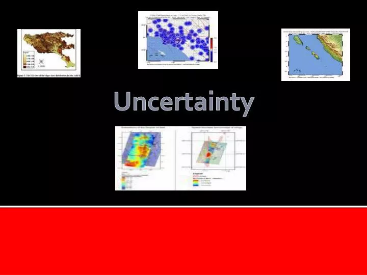
Uncertainty in the conception of geographic phenomena • In many cases there are no natural units of geographic analysis. • Spatial oil:
Uncertainty in the conception of geographic phenomena • Uncertainty can exist both in the position of boundaries of a zone and in its attributes. • Many English terms used to convey geographic information are inherently ambiguous. • Ambiguity is introduced when imperfect indicate of phenomena are used instead of the phenomena themselves.
continued • Identification of homogeneous zones and spheres of influence lies at the heart of traditional regional geography as well as contemporary data analysis. • Relationships typically grow stronger when based on larger geographic units.
Further uncertainty in the measurement and representation of geographic phenomena. • uncertainty can often be conceptualized differently under field and discrete object views. • A pixel whose area is divided among more than one class is termed a mixel. • There are many reasons why measurement of position on the earth’s surface is inherently uncertain. • Difficulties in making accurate measurements from maps were a major impediment to early GIS. • Many errors in digitizing can be remedied by appropriately designed software.
continued • GPS is the first system that allows accurate direct and inexpensive measurement of absolute position on the earth’s surface. • Conflation combines the information from two data source into a single source. • Datasets with different lineages often reveal unsuspected errors when overlaid. • Differences in definitions are a major impediment to integration of geographic data over wide areas.
Further uncertainty in the analysis of geographic phenomena. • uncertainties in data lead to uncertainties in the results of analysis. • Inappropriate inference from aggregate data about the characteristics of individuals is termed the ecological fallacy. • The modifiable areal unit problem can be investigated through simulation of large number of alternative zoning schemes. • Zoning seems similar to sampling but its effects are very different.