Download

1 / 9
90 likes | 167 Vues
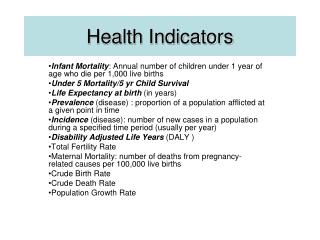
The Molonglo Catchment Health indicators Program ( M-CHiP) 07-08 reporting . Building the community’s capacity for engagement & participation in the local Natural Resource Management issues around surface water & our water use…. M-CHiP 07-08 reporting.

E N D
The Molonglo Catchment Health indicators Program ( M-CHiP)07-08 reporting Building the community’s capacity for engagement & participation in the local Natural Resource Management issues around surface water & our water use…
M-CHiP 07-08 reporting • The M-CHiP – The Molonglo Catchment Health indicators Program • The establishment of this program in each sub-catchment will lead to better monitoring and evaluation of environmental agencies and the community’s on-ground works. • The Program provides simple and practical methods that community groups can use to: • measure the health of their local catchment; • provide input into sub-catchment management planning and enable groups to practice adaptive management; • identify options for remedial action and where to best use grant monies or in-kind services; • monitor and evaluate the effectiveness of their on-ground projects; • identify early warning signals of environmental problems; and • measure over time the trends in the condition of the natural resources in their catchment
M-CHiP 07-08 reporting The purpose of this report is to update the MCG water test workers, members & committee on the findings of the last 12 months of M-CHiP field-work & analysis. • This presentation is a snapshot of that work at three levels of landscape: • Overall catchment condition for the Molonglo R catchment over time, • Current catchment trends for the Molonglo R & Queanbeyan R • Current sub-catchment trends for Jerrabomberra Ck • Site specific reports
M-CHiP 07-08 reporting Landscape Attributes Macro-invertebrate Sampling Turbidity Conductivity pH % urban area Median site value Median site value Median site value % bare soil % tree cover Numerical Score Numerical Score Numerical Score length of roads vs. catchment area Numerical Score Calculations No. of times a road crosses a stream Divide each individual Numerical Score by 3 (the number of parameters monitored) Determine Numerical Scores for each site Length of riparian vegetation vs. total stream length Area of agricultural land on slopes > 5° Areas of forest with stands > 50 Ha Combine Numerical Scores for each parameter at each site and divide by the number of sites in the sub-catchment Combine Numerical Scores and divide by the number of sites in the sub-catchment Combine Numerical Scores and divide by 8 (the number of parameters assessed) Overall Sub-catchment ‘Water’ value Overall Sub-catchment ‘Riparian’ value Overall Sub-catchment ‘Land’ value Add all values and Divide by 3 (the number of Indicator Classes measured) Sub-catchment M-CHiP Rating How it works
M-CHiP 07-08 reporting 2005 2006 2007
M-CHiP 07-08 reporting Sullivan's Sullivan's Sullivan's Sullivan's Sullivan's Sullivan's Sullivan's Sullivan's Sullivan's Woolshed Woolshed Woolshed Woolshed Woolshed Woolshed Woolshed Catchment Indicator trends: September 2007-February 2008 Woolshed Woolshed Coppins Coppins Coppins Coppins Coppins Coppins Coppins Coppins Coppins Lake Burley Griffin Lake Burley Griffin Lake Burley Griffin Lake Burley Griffin Lake Burley Griffin Lake Burley Griffin Lake Burley Griffin Lake Burley Griffin Lake Burley Griffin Kowen Kowen Kowen Kowen Kowen Kowen Kowen Kowen Kowen Fyshwick Fyshwick Fyshwick Fyshwick Fyshwick Fyshwick Fyshwick Fyshwick Fyshwick Weston-Woden Weston-Woden Weston-Woden Weston-Woden Weston-Woden Weston-Woden Weston-Woden Weston-Woden Weston-Woden Lower Queanbeyan Lower Queanbeyan Lower Queanbeyan Lower Queanbeyan Lower Queanbeyan Lower Queanbeyan Lower Queanbeyan Lower Queanbeyan Lower Queanbeyan Jerrabomberra Jerrabomberra Jerrabomberra Jerrabomberra Jerrabomberra Jerrabomberra Jerrabomberra Jerrabomberra Jerrabomberra Googong Googong Googong Googong Googong Googong Googong Googong Googong The Canberra Airport rainfall chart is used throughout this report as an very general record of rain events across the catchment. Different portions of the catchment will have received variations in precipitation & intensity within these rain events Upper Molonglo Upper Molonglo Upper Molonglo Upper Molonglo Upper Molonglo Upper Molonglo Upper Molonglo Upper Molonglo Upper Molonglo Burra Burra Burra Burra Burra Burra Burra Burra Burra Upper Queanbeyan Upper Queanbeyan Upper Queanbeyan Upper Queanbeyan Upper Queanbeyan Upper Queanbeyan Upper Queanbeyan Upper Queanbeyan Upper Queanbeyan
M-CHiP 07-08 reporting 12 month medians • Molonglo R catchment– the graph opposite uses the median values of several sites over the year – from left to right the sites are going down the catchment from MOL 109 at below Captains Flat village, to MOL 401 near the mouth of the Molonglo R, upstream of the Murrumbidgee R. Much of the water quality conditions over the last year have been driven by low flows, no flows and the continued drying out of the land between the occasional rain events. • In summary • Despite the catchment remaining in in drought condition, the upper portions of the are faring better than the lower portions. • Much of the middle to lower parts of the catchment lie over shallow limestone (calcium salts) rock units with other portions having local rock units of metamorphic/igneous origins minerals (esp. iron) – all of which are picked up by the water table and transported. • The steady increase in water salinity (EC) down the catchment reflects a wholesale reduction in river flow and a lowering of the water table with a subsequent inflow of more saline groundwater, undiluted by average rainfall conditions in the catchment waterways and groundwater recharge locations. Rising EC values have been recorded across the catchment from the forested, agricultural and urban landuses within the catchment. • The pH values have remained fairly constant and are slightly alkaline – due to the influence of the limestone geology and the lack of organic material accumulating within the waterway. • What are the some of the trends showing for particular sites? • MOL109 – the local land use (TSR reserve) and good quality riparian vegetation has mitigated the effects of rain events with run-off of low turbidity, but does show the influence of saline groundwater inflows. • MOL110 – the salinity and turbidity spike at the top edge of the Foxlow Floodplain has captured the cumulative aftermath of a rain events with corresponding salt and sediment transport. The salt load is inevitable (land use and groundwater sources), but the sediment load can be attributed to the poor and sparse nature of the local riparian condition and the site is where a road crosses a river, essentially producing a ‘gutter’ for erosion and sediment flow into the river. The stream banks can also be unstable & mobile esp. after strong rain events locally & upstream – also contributing to the high turbidity in the river.
M-CHiP 07-08 reporting 12 month medians • Molonglo R catchment • What are the some of the trends showing for particular sites? – cont’d • MOL 216 – the Carwoola district reflects a marked lowering of the river’s saline load partly due to the dilution effects waters of tributary streams along those reaches of the river. The sediment loads from upstream (esp. the Foxlow floodplain) have been deposited. The drop in the water temp is partly due to the increase in the stream coverage by the local riparian vegetation. • MOL270 – Oaks Estate - as the river passes Queanbeyan city - is showing a rise in temperature, salinity and turbidity due to the city’s landuses and stormwater contributions with effects of the Queanbeyan Sewer Treatment Plant (STP). • MOL295 – the river at the Waterski site continues to reflect, slightly increased turbidity from inputs from upstream Queanbeyan city, with some contribution from Fyshwick stormwater and local upstream landuses, plus saline inflows from Reedy Ck. • MOL350 – Coppins Crossing – the river after it has passed through Canberra city. Lake Burley Griffin has some mitigating/diluting effects on the salinity, turbidity and temperature of the river but not much, mainly due to the low inflows from the rest of the catchment, some of which are saline. Canberra city contributes the same sort of loadings as Queanbeyan city in terms of heat, salinity and sediments. • MOL401 – Sturt Is – just below the Lower Molonglo Water Quality Control Center (LMWQCC sewer treatment plant). The impacts of Canberra city can be seen via the sewer plant contributions to the river. The high volume of the STP effluent stream is warmer and its salinity is around double the river’s. The turbidity of the treatment plant discharge water is much better than the receiving water of the Molonglo R clearer and the high salinity so helps clarify the river water’s as they mix.
M-CHiP 07-08 reporting 12 month medians • Queanbeyan R catchment • a good example of insufficient sampling points • Explanatory note • Part of the problem with the reporting on the Queanbeyan R catchment is that the M-CHiP partly relies on the acquisition of water-quality data collected by other agencies & in the case of the Lower Queanbeyan R data, the QBNCC has been collecting the data. As happens from time to time the data becomes unusable if there is reasonable doubt that the data might be erroneous or flawed – in the case of the QBNCC data, it was an equipment malfunction that wasn’t picked up in time to make the data usuable by the M-CHiP. • EC-shows a general rise in EC as the water progresses down the catchment • pH-Constant & within normal range across the catchment showing an slightly pH due to the underlying limestone rock units & subsequent alkaline groundwater inflows – mainly calcium salts • Turbidity-correlations with salinity & land use • QUE 495 showing impacts of the Qbn city as a heat sink & its stormwater impacts • Temperature-very consistent with the predominant rural nature between the 2 sites