Download
1 / 48
480 likes | 623 Vues
Hydrometeorological Prediction Center (HPC) Forecast Operations Branch. Michael Eckert Senior Branch Forecaster. Who/What is HPC?. NOT headquarters Part of NCEP & co-located with EMC, CPC, NCO, OPC, and NESDIS Access to tremendous amounts of model data (too much?) Work on a national scale

E N D
Hydrometeorological Prediction Center (HPC)Forecast Operations Branch Michael Eckert Senior Branch Forecaster
Who/What is HPC? • NOT headquarters • Part of NCEP & co-located with EMC, CPC, NCO, OPC, and NESDIS • Access to tremendous amounts of model data (too much?) • Work on a national scale • Resource to field forecasts, partners & customers • Forecast Operations Branch • 30 Meteorologists, 2 Met Techs • Development & Training Branch • 6 Meteorologists/programmers (includes the SOO)
Partners & Customers • NWS Field offices – WFOs, RFCs & CWSUs • Other NCEP centers – OPC, TPC, AWC, SPC, EMC, NCO & CPC • Federal Agencies - DHS/FEMA, COE, FAA, NTSB, DoD, EPA, White House • State Agencies – EMA, water resources, flood management & DOT • Media – TV, Radio, Internet, newspapers, wire services (AP/UPI) • Private Sector – data vendors, forecast services, utilities, forensics, retailers, researchers • Aviation – General aviation, AWC • Academia – Universities & colleges • International – MET services, media, travelers • General Public – Analysis/forecast products
NWS OPERATIONAL FORECAST OFFICES (CWSUs not depicted) WFOs RFCs
Collaboration(increasingly more important past 2-3 years) • Several combination of players • WFO – WFO • WFO – RFC • RFC – HPC • WFO – HPC • HPC – TPC • WFO – SPC • HPC - SPC HPC IDs • hpc_LEAD • hpc_QPF1 • hpc_QPF2 • hpc_MEDR • hpc_bawx • hpc_SFC • hpc_wwd • hpc_MDLDIAG
QPF 6 hourly through D3 48 hr QPF D4-5 QPFPFD Flood Products Excessive Rainfall (94e) QPFERD River Flood Outlook Winter Weather (9/15 - 5/15) Snow/ZR Probability Snow/ZR accumulation thru D3 QPFHSD Winter Storm Summaries Low Track 3 hourly Surface Analyses Short Range (D 1-2) Fronts/Pressures Instantaneous Pcpn & Pcpn Type Medium Range (D3-7) 24 hr Front/Pressures Max/Min/12 hr PoPs PREEPD and PMDEPD Hawaii Narrative Model Diagnostics 500mb prog for West/E Pac PMDHMD PMDEPD NDFD Chat Coordination Tropical Weather (6/1 – 11/30) Backup/guidance for TPC Public Advisories for inland tropical systems South Amer. & Caribbean text products Selected Cities/Travelers Daily Weather Map Air Quality Narrative (summer) Products HPC Issues
HPC MEDIUM RANGE PRODUCTS • Model Diagnostics Desk • Prelim Day 3-7 Frontal Progs 0900 Z • Prelim PREEPD 0900 Z • Medium Range Pressure/Fronts • Prelim Day 3-7 500 mb Progs 1130 Z • Updated Day 3-7 Frontal Progs 1315 Z • Updated PREEPD 1400 Z • Targeted Observations (seasonal) 1430 Z • Tropical Hotline Call (seasonal) Noon ET • Final Day 3-7 Fronts/500mb Progs 1900 Z • PMDEPD (Final) 1930 Z • Medium Range Temps/PoPs/QPF • Hawaiian 1-7 Day Discussion 1130 Z • Morning Day 4/5 and 1-5 QPF 1200 Z • Prelim Day 3-7 Min/Max/PoPs 1400 Z • Prelim Medium Range Grids 500 Z • Final Day 3-7 Min/Max/PoPs 1900 Z • Final Medium Range Grids 2000 Z • Afternoon Day 4/5 and 1-5 QPF 2300 Z Two Forecaster Team Hours 1030-1930 Z Operates 24/7
PRIMARY MEDIUM RANGE MODELS USED BY HPC MODEL RUN TIME RUN DURATION MIN HORIZONTAL MEMBERS (UTC) (DAYS) GRID SPACING (KM) PER DAY DGEX 6,18 8 12 2 ECMWF 0,12 10 15 2 ECM ENS 12 10 30 51 GFS 0,6,12,18 16 35 4 CANADA 0,12 10/6 35 2 NOGAPS 0,12 6 55 2 UKMET 0,12 6 60 2 NGPS ENS 0 10 85 10 CAN ENS 0 10 90 17 GFS ENS 0,6,12,18 16 105 60 152 / DAY!
Model verification Bad Day MODEL SCORES CAN VARY SIGNIFICANTLY ON A DAILY BASIS. IT’S OFTEN DIFFICULT TO IDENTIFY IN ADVANCE MODELS THAT ARE HAVING A BAD DAY EMC
Skill improvements Day 7 = Day 3 from 1976 & Day 5 from 1996 Day 5 = day 3 from 1996
NORTHERN HEMISPHERE 500 MB A.C. SCORES WINTER 2004-2005 SUMMER 2005 NCEP AND ECMWF ENSEMBLE MEANS (SOLID LINES) MAINTAIN SKILL LONGER THAN THE GLOBAL MODELS IN THE WARM SEASON THE ECMWF AND ECMWF ENSEMBLE MEAN SCORE VERY WELL IN THE COLD SEASON THRU THE MEDIUM RANGE EMC
HPC HAS LIMITED INTERNET ACCESS TO ECMWF ENSEMBLES THRU DAY 9 HPC MASTERBLENDER (PMSL/500 MB/QPF ETC.)
Day 1-5 QPF Issued twice daily 00z & 12z Day 4-5 QPF Issued twice daily 00z & 12z
HPC 5 KM GRIDDED MEDIUM RANGE FORECASTS MIN TEMPS MAX TEMPS WINDS 12 HOUR POPS DEWPOINTS CLOUD COVER WEATHER TYPE This is what is fed to the NDFD
BIGGER HPC IMPROVEMENT OVER GFS MOS BECOMES EVIDENT AT A MORE REGIONAL LEVEL DAY 5 MAX TEMP BIG HPC CHANGES TO GFS MOS 2004
HPC SHORT RANGE PRODUCTS • Surface progs • Lows & Highs • Fronts • Isobars • Precipitation coverage/intensity • Valid Times • 12, 18, 24, 30, 36 & 48 Hours (from model initialization time) • Low Tracks (thru 72 hours) One Forecaster 0000 – 0900z 1200 – 2100z Two shifts per day Used heavily by: AWC Private Weather companies TV stations
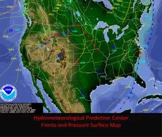
Surface Analysis • Every 3 hours • Collaboration with OPC & TPC • HPC Coverage is North America • National Forecast Chart • Quick look at US Weather • Once per day (10Z) • Storm summaries • Inland Tropical Systems • Well organized Winter storms • Up to 4 times each day • 02z, 08z, 14z & 22z
Storm Summary STORM SUMMARY NUMBER 3 FOR SOUTHEASTERN U.S. WINTER STORM NWS HYDROMETEOROLOGICAL PREDICTION CENTER CAMP SPRINGS MD 1000 PM EST THU FEB 1 2007 ...PRECIPITATION ENDING ACROSS THE SOUTHEAST... ALL WINTER STORM WARNINGS HAVE NOW EXPIRED. WINTER WEATHER ADVISORIES ARE CURRENTLY IN EFFECT FOR EASTERN MARYLAND...DELAWARE...SOUTHEASTERN PENNSYLVANIA...AND MUCH OF NEW JERSEY. SNOW ADVISORIES ARE CURRENTLY IN EFFECT FOR EASTERN KENTUCKY. FREEZING RAIN ADVISORIES ARE CURRENTLY IN EFFECT FOR PORTIONS OF SOUTHWESTERN VIRGINIA AND NORTHWESTERN NORTH CAROLINA. ONE FLOOD WARNING REMAINS IN EFFECT FOR MARTIN COUNTY IN NORTH CAROLINA. AT 10 PM EST...A WEAK STORM SYSTEM MOVING ACROSS THE SOUTHEASTERN U.S. WAS PRODUCING AN AREA OF PRECIPITATION ACROSS SOUTHEASTERN VIRGINIA...THE CAROLINAS...GEORGIA...AND INTO FLORIDA. THIS AREA OF PRECIPITATION WAS DECREASING IN INTENSITY AND MOVING RAPIDLY NORTHEASTWARD. NEARLY ALL OBSERVATIONS WERE REPORTING JUST LIGHT RAIN...WITH ONLY A FEW REPORTS OF LIGHT SNOW OR SLEET. ...SELECTED STORM SNOW TOTALS IN INCHES AS OF 9 PM EST THURSDAY...
Model Diagnostics Discussion • Two discussions each day (no graphics) • 0530z & 1730z • Resolve differences between models and ensemble solutions • Model initialization… • Model trends... • Model differences and preferences… • Summer Air quality discussion (conference call as needed) • CARCAH (Chief, Aerial Reconnaissance Coordination, All Hurricanes) • USAF Reserve Flying squadron • Winter storm reconnaissance for Gulf/East Coast winter storms • Midnight shift also produces preliminary medium range forecasts • Fronts & Pressures • Preliminary EPD
Winter Weather • Snow and ice accumulations • Days 1, 2 & 3 • Probabilistic Accumulations • Low, Moderate & High Risk • 4”, 8”, 12” snow and 0.25” ice • Impact Graphics • Based solely on SREF members • Eta, WRF & RSM • Surface Visibility • Snow rate • Duration
Impact Graphics Snowfall Rate >1” per hour
Tropical Weather • Backup to TPC • Second opinion for TPC • Track forecast for west of 60W • E of 60W handled by OPC • HPC forecast based on non-tropical models • 03, 09, 15 & 21z • Rainfall statement for public advisories • Public advisories • After system is below TS status • While heavy rain threat exists • US & Mexico
International Forecast Desk • Training visitors in the use of NWP • Central, South American & Caribbean • Assist HPC forecaster with QPF related to tropical cyclones
Miscellaneous Duties • Selected cities (twice each day) • Travelers (twice each day) • Daily Weather map • Significant River Flood Outlook
QPF • Six hour QPF through Day 3 • Day 1 & 2 – 06, 10, 18 & 22z • Day 3 – 10 & 22z • 24 hour QPF through Day 3 • Day 1 & 2 – 06, 10, 18 & 22z • Day 3 – 10 & 22z • CONUS, Columbia & Rio Grande Rivers • Fuel for RFC hydrologic models • Fuel for NDFD (future) • Work closely with SAB • Satellite Briefings
Little or no threat • Rainfall not expected to exceed FFG • No excessive rainfall is expected during the forecast time period • SEE TEXT • < 5% chance of rainfall exceeding FFG • Slight Risk of rainfall exceeding FFG • 5% - 10% chance of rainfall exceeding FFG • Delineated by a green arrow/line encompassing an area Slight Risk
Moderate & High Risk • Moderate Risk of rainfall exceeding FFG • 10% - 15% chance of rainfall exceeding FFG • Delineated by a bluearrow/line encompassing an area • High Risk of rainfall exceeding FFG • >15% chance of rainfall exceeding FFG • Delineated by a redarrow/line encompassing an area High Risk Moderate Risk
Total Rainfall > 5 inches • Threat of 5 or more inches of rain during the forecast period • Used mostly for: • Well organized MCS • Tropical systems • Persistent overrunning events 5 Inch
What is the Flash Flood Guidance? • Defined as a specific rainfall amount, in a specific time period, that will result in flash flooding • One, three, six and twelve hour FFG values are provided daily by RFCs • At HPC we focus on the one and three hour FFG • 6 & 12 hour FFG values represent time periods too long to accurately define a flash flood
1 or 3 hour FFG? • Very difficult question to answer • Different answer for each event & day • One hour FFG generally used for convective rainfall • Three hour FFG generally used for convective/stratiform rainfall
FFG • Can be misleading at times • Based on county average • 5km values are run experimentally once per day • RFCs don’t have an agreed upon method for computing FFG • FFG in steep terrain & urban areas is not very useful • FFG is constantly changing, especially during periods of heavy rainfall • High FFG does not necessarily mean a low excessive rainfall threat
Issue/Valid Times • 00 UTC 00 UTC to 00 UTC (24 hours) (Optional) • 03 UTC 03 UTC to 00 UTC (21 hours) • 06 UTC 06 UTC to 12 UTC (30 hours) • 12 UTC 12 UTC to 12 UTC (24 hours) (Optional) • 15 UTC 15 UTC to 12 UTC (21 hours) • 18 UTC 18 UTC to 00 UTC (30 hours) • 21 UTC 21 UTC to 00 UTC (27 hours) (Optional)
Questions ??? michael.eckert@noaa.gov 301-763-8201