Download
1 / 32
340 likes | 728 Vues
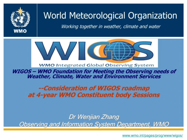
World Meteorological Organization Working together in weather, climate and water. WMO. WMO Standards NOAA System Of Systems Workshop October 06, 2009. Fredrick R. Branski President of CBS. WMO/OBS. www.wmo.int. What is the WMO? (World Meteorological Organization).

E N D
World Meteorological OrganizationWorking together in weather, climate and water WMO WMO Standards NOAA System Of Systems Workshop October 06, 2009 Fredrick R. Branski President of CBS WMO/OBS www.wmo.int
What is the WMO?(World Meteorological Organization) • A specialized agency of the United Nations • The UN system's authoritative voice on the state and behavior of the Earth's atmosphere, its interaction with the oceans, the climate it produces and the resulting distribution of water resources • 188 Member States • NWS is the U.S. representative • to the WMO
FM SYSTEM OF CODE FORMS - Traditional Alphanumeric Codes (TAC) FM 12–XII Ext. SYNOP Report of surface observation from a fixed land station FM 13–XII Ext. SHIP Report of surface observation from a sea station FM 14–XII Ext. SYNOP MOBIL Report of surface observation from a mobile land station FM 15–XIII Ext. METAR Aerodrome routine meteorological report (with or without trend forecast) FM 16–XIII Ext. SPECI Aerodrome special meteorological report (with or without trend forecast) FM 18–XII BUOY Report of a buoy observation FM 20–VIII RADOB Report of ground radar weather observation FM 22–IX Ext. RADREP Radiological data report (monitored on a routine basis and/or in case of accident) FM 32–XI Ext. PILOT Upper-wind report from a fixed land station FM 33–XI Ext. PILOT SHIP Upper-wind report from a sea station FM 34–XI Ext. PILOT MOBIL Upper-wind report from a mobile land station Rec. 22 (CBS-89), approved by the President of WMO and Res. 8 (EC-LI) FM 35–XI Ext. TEMP Upper-level pressure, temperature, humidity and wind report from a fixed land station FM 36–XI Ext. TEMP SHIP Upper-level pressure, temperature, humidity and wind report from a sea station
FM SYSTEM OF CODE FORMS - Traditional Alphanumeric Codes (TAC) FM 37–XI Ext. TEMP DROP Upper-level pressure, temperature, humidity and wind report from a sonde released by carrier balloons or aircraft FM 38–XI Ext. TEMP MOBIL Upper-level pressure, temperature, humidity and wind report from a mobile land station FM 39–VI ROCOB Upper-level temperature, wind and air density report from a land rocketsonde station FM 40–VI ROCOB SHIP Upper-level temperature, wind and air density report from a rocketsonde station on a ship FM 41–IV CODAR Upper-air report from an aircraft (other than weather reconnaissance aircraft) FM 42–XI Ext. AMDAR Aircraft report (aircraft meteorological data relay) FM 44–V ICEAN Ice analysis FM 45–IV IAC Analysis in full form FM 46–IV IAC FLEET Analysis in abbreviated form FM 47–IX Ext. GRID Processed data in the form of grid-point values FM 49–IX Ext. GRAF Processed data in the form of grid-point values (abbreviated code form) FM 50–XIII WINTEM Forecast upper wind and temperature for aviation FM 51–XIII Ext. TAF Aerodrome forecast FM 53–X Ext. ARFOR Area forecast for aviation FM 54–X Ext. ROFOR Route forecast for aviation
FM SYSTEM OF CODE FORMS - Traditional Alphanumeric Codes (TAC) FM 57–IX Ext. RADOF Radiological trajectory dose forecast (defined time of arrival and location) FM 61–IV MAFOR Forecast for shipping FM 62–VIII Ext. TRACKOB Report of marine surface observation along a ship’s track FM 63–XI Ext. BATHY Report of bathythermal observation FM 64–XI Ext. TESAC Temperature, salinity and current report from a sea station FM 65-XI Ext. WAVEOB Report of spectral wave information from a sea station or from a remote platform (aircraft or satellite) FM 67–VI HYDRA Report of hydrological observation from a hydrological station FM 68–VI HYFOR Hydrological forecast FM 71–XII CLIMAT Report of monthly values from a land station FM 72–XII CLIMAT SHIP Report of monthly means and totals from an ocean weather station FM 73–VI NACLI CLINP SPCLI CLISA INCLI Report of monthly means for an oceanic area FM 75–XII Ext. CLIMAT TEMP Report of monthly aerological means from a land station FM 76–XII Ext. CLIMAT TEMP SHIP Report of monthly aerological means from an ocean weather station
FM SYSTEM OF CODE FORMS - Traditional Alphanumeric Codes (TAC) FM 81–I SFAZI Synoptic report of bearings of sources of atmospherics FM 82–I SFLOC Synoptic report of the geographical location of sources of atmospherics FM 83–I SFAZU Detailed report of the distribution of sources of atmospherics by bearings for any period up to and including 24 hours FM 85–IX SAREP Report of synoptic interpretation of cloud data obtained by a meteorological satellite FM 86–XI SATEM Report of satellite remote upper-air soundings of pressure, temperature and humidity FM 87–XI SARAD Report of satellite clear radiance observations FM 88–XI SATOB Report of satellite observations of wind, surface temperature, cloud, humidity and radiation
FM SYSTEM OF CODE FORMS – Table Driven Code Forms (TDCF) FM 92–XI Ext. GRIB edition 1 Processed data in the form of grid-point values (gridded binary) expressed in binary form FM 92–XIII Ext. GRIB edition 2General regularly-distributed information in binary form FM 94–XIII Ext. BUFR Binary universal form for the representation of meteorological data FM 95–XIII Ext. CREX Character form for the representation and exchange of data
What is the WIS?(WMO Information System) • An overarching approach to meet information exchange requirements of all WMO Programmes • Data centric vs communications centric (legacy approach) • Aid WMO to avoid data incompatibilities & problems in sharing valuable data across various programmes • Ensure interoperability of Information Systems between WMO Programmes and those outside of the WMO community
What is the WIS?(WMO Information System) • WMO Data Representation Systems (DRS) were historically developed with an inward looking approach to meet Member needs for utilization and exchange of information • Beside legacy exchange systems the WIS offers a Data Discovery, Access & Retrieval (DAR) service • The WIS DAR will open WMO Member data services and stores up to a wider COI • The WIS DAR will expose data services and stores of the wider COI across the community
WIS Standards • WMO has been developing DRSs for many decades • Work precedes ISO and many other standards bodies • Over 50 legacy DRS • Tremendous “richness” of capability already exists • WMO has captured this “richness” in its Binary Uniform Format for Representation (BUFR)
WIS DRM • BUFR was developed with an inherent data model • From this data model all other DRS needs will be driven • ISO compatible feature catalogues • Legacy formats • OASIS, OGC, JMBL other requirements
Full BUFR Model Aviation Other Needs ? Hydrology Public Weather Service Other Catalogues ? Aviation Feature Catalogue Public Weather Service Feature Catalogue Hydrological Feature Catalogue ISO 19000 Modelling process for BUFR BUFR is too big to be represented in a single ISO Feature Catalogue, which should be small enough to be useable by external communities. No external community uses the full BUFR model, and most communities use a small subset, augmented with extractions, aggregations, and compounds of this subset. The ISO model is intended for this sort of use. Aviation Feature Catalogue Aviation community names linked to (one or more) BUFR table elements Hydrological Feature Catalogue Hydrological community names and common aliases Public Weather Service Feature Catalogue Common names, aliases and language variants linked to relevant BUFR table elements
WIS DRS Development • WMO Expert Teams are tasked with working directly on DRS standards in the following areas • Maintenance and update of existing DRS including BUFR • Developing and maintaining WMO metadata standards and improving interoperability • Migrating off legacy systems to new standards • Addressing the DRS requirements of aviation meteorological needs • Assessing all DRS requirements of the wider WMO COI and developing policy recommendations regarding how to meet those needs.
ICAO-WMO PILOT PROJECT FOR REPRESENTING OPMET DATA • OPMET data delivery via XML proof of concept - Representation and exchange of TAC OPMET data in XML, initially by wrapping the TAC data in XML and demonstrating the ability to exchange this data over aeronautical telecommunication systems. This phase also includes parsing the contents of the TAC OPMET data into XML and exchanging them as well; • Direct conversion of BUFR OPMET data into XML; • Development of an ISO compliant modeling process from which feature catalogues are derived. These will include OPMET data in XML/GML as an application of the ISO 19100 series of standards. • Support for conjoint development of future versions of WXCM, WXXM, WXXS Weather Information Models and Schema
WIS Data Dictionary • The WIS Data Dictionary is a conjoin of definitions from: • BUFR • WMO Core Metadata Profile • Services metadata • BUFR as the parent data model is the primary component • BUFR contains: • Over 450 Code tables • Over 370 flag tables • Over 7,000 total features, elements, codes and flags
WIS Tie in to Other Standards • WMO identified Common Alerting Protocol (CAP), OASIS, as a standard for dissemination of warning messages • Development underway through Members • WMO hosted a CAP Implementers Workshop December 9-10, 2008 in Geneva • WMO is assessing Geographic Information Systems (GIS) such as those based on OGC standards • Workshop on the use of GIS systems was held at the European Centre for Medium Range Weather Forecasting (ECMWF) in Reading, UK from 24-26 November 2006 • This workshop reviewed the use of OGC standards to promote collaboration to define a set of common standards to enhance interoperability • WMO and ISO have developed an agreement on recognition of each other’s standards and are developing the administrative protocols
WIS Tie in to Other Standards • The WMO is continuing to assess other DRS standards some of which are already in use in the COI • Network Common Data Form (NetCDF) ,University Corporation for Atmospheric Research (UCAR) • Hierarchical Data Format (HDF), National Center for Supercomputing Applications (NCSA) • eXtensible Markup Language (XML), World Wide Web Consortium (W3C) (CAP is based on XML) • Abstract Syntax NotationOne (ANS.1), joint ISO/IEC and ITU-T • Joint METOC Broker Language (JMBL), DoD • Usage recommendations are underway • Semantic interoperability being pursued with DRS “owners” • Syntactic interoperability being reviewed for development where needed
BUFR Table Descriptors Services Metadata WMO Core Metadata Profile Summary - WIS DRM based on: Full BUFR Model Aviation Other Needs ? Hydrology Other Catalogues ? Public Weather Service WIS Data Dictionary Aviation Feature Catalogue Hydrological Feature Catalogue Public Weather Service Feature Catalogue WMO Commission for Basic Systems (CBS) is the official steward for these standards
What are the advantages • ISO models are derived from the BUFR model • The maintenance process is fundamental and is not changed • References to BUFR entries from Feature Catalogues are invertible. • Relevant changes to the BUFR model can be mapped and notified to the user communities • The structure allows an automatic mapping from BUFR to XML/GML • Not necessarily the implementation (although likely to be possible using XML tools) • The structure allows servicing of data requests which include extraction of data subsets across sets of BUFR data. • e.g. query for all air temperatures within a space and time window. • All surface BUFR bulletins expanded into BUFR XML • All mappings of air temperature to BUFR elements selected (with relevant position and times) • The data returned in an XML/GML encoding under WFS.
Discovery Access and Retrieval (DAR) • Because DAR metadata must be homogeneous in form and in content, ISO 19115 and ISO 19139 are used for the description of discovery metadata. • Metadata could be: • Sent as a metadata file via WIS to a GISC prior to publishing the data or product, • Collected from the data / product producer (batch mode), • Manually edited and validated via a web based interface provided by the system, • Automatically generated from existing reference catalogues, • Possibly built on the fly during the data ingestion.
Example: Standardized Interface - Information Search and Retrieval (ISO 23950) • Standard used by libraries worldwide for searching online catalogs, and it also used for searching geospatial metadata. • Defines how to specify searches precisely for accurate results. Includes lat & long boundaries and scientific terms, as well as bibliographic citations. • Can be used simply with Internet search engines. But has the expressive power for complex data searches like chemical formulas and pattern-matching needed for images.
Summary • http://wis.wmo.int/2008/metadata/draft_version_11/WMOCore_ver1_1_UML_20081030.pdf • WMO has a long history of DRS development • WMO is committed to interoperability with the wider COI at semantic and syntactic levels • WMO will leverage its existing data model (BUFR) including an extensive data dictionary to implement ISO, OGC, OASIS and other standards as needed to support requirements • WMO & the NWS is interested in continuing standards development opportunities and relationships with other agencies
Questions Contact info: Fred Branski: U.S. National Weather Service Office of the CIO International Data Exchange and Requirements Liaison President, WMO Commission for Basic Systems E-mail:fred.branski@noaa.gov