Download
1 / 16
160 likes | 284 Vues
Toward Computing An Optimal Trajectory For An Environment-Oriented Unmanned Aerial Vehicle (UAV). Rodrigo Romero, Jerald Brady, Octavio Lerma, Vladik Kreinovich, and Craig Tweedie. Goals of This Project (ES Perspective). To develop a mobile Environmental Science data collection platform

E N D
Toward Computing An Optimal TrajectoryFor An Environment-Oriented UnmannedAerial Vehicle (UAV) Rodrigo Romero, Jerald Brady, Octavio Lerma, Vladik Kreinovich, and Craig Tweedie Joint Annual Meeting NSF Division of Human Resource Development
Goals of This Project (ES Perspective) To develop a mobile Environmental Science data collection platform • Ensure system design is well documented and customizable • Near real time collection of data wirelessly • To optimize data collection by maximizing coverage and minimizing time taken Joint Annual Meeting NSF Division of Human Resource Development
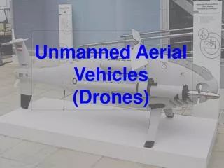
Why an Unmanned Aircraft System? • Provides Access to Remotely Sense Regions • Covers Large Areas Fairly Easily • Dirty Dull and Dangerous flying • Can be Utilized Frequently • Smaller Carbon Footprint when Compared to Other Craft and More Inexpensive Joint Annual Meeting NSF Division of Human Resource Development
Unmanned Aerial Vehicle - Powered Paraglider Joint Annual Meeting NSF Division of Human Resource Development
Unmanned Aircraft System (UAS) • Onboard • Flight Telemetry @ 900 MHz • Environmental Science Data - @ 2.4 GHz • Ground Station • Laptop collects wireless data • Custom developed C# software displays data Joint Annual Meeting NSF Division of Human Resource Development
UAV In Flight – UAV Movie 9625 Joint Annual Meeting NSF Division of Human Resource Development
UAV Landing – UAV Movie 9627 Joint Annual Meeting NSF Division of Human Resource Development
Ground Station Software Screenshot Joint Annual Meeting NSF Division of Human Resource Development
Area Coverage Tool • Ground Station Software Needs • Visualization of data collection while flying • Evaluation of how effective data collection is while flying • Display an “optimal path” for users to take Joint Annual Meeting NSF Division of Human Resource Development
Need for an Optimal Trajectory Complete coverage of a given area with senor readings • UAVs have limited flight time. • All sensors do not record at the same speed or at the same rate • Design a trajectory to account for these issues Joint Annual Meeting NSF Division of Human Resource Development
Corner Coverage Is Not Complete Joint Annual Meeting NSF Division of Human Resource Development
Solution – Fishtail Pathing Joint Annual Meeting NSF Division of Human Resource Development
Sensor Readings and Area Coverage • Evaluation of Our Technique • While mathematically sound the fishtail solution is not practical while flying • Wind and weather conditions for the day can effect flight patterns • Areas inside the flight zone that have high levels of change need to be flown over more Joint Annual Meeting NSF Division of Human Resource Development
Very Heterogeneous Areas Require More Flight Coverage Joint Annual Meeting NSF Division of Human Resource Development
Future Directions • Designing a Smarter Tool • Improving upon existing design by including optimal pathing • Drawing an optimal path based on data already collected • Testing in field to verify improvement in design Joint Annual Meeting NSF Division of Human Resource Development
Further Questions? • Jerald Brady -GraduateStudent- jerald.brady@gmail.com • Vladik Kreinovich –CS Researcher- vladik@utep.edu • Craig Tweedie – ES Researcher - ctweedie@utep.edu • Rodrigo Romero –Presenter- raromero2@utep.edu Joint Annual Meeting NSF Division of Human Resource Development