Download

1 / 10
100 likes | 369 Vues
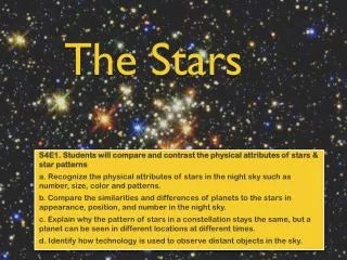
Pgs. 11 - 17. Mapping the Stars. Organizing the Sky. Ancient cultures organized the sky by linking stars together in patterns. Each pattern reflected the cultures beliefs and legends. Today, astronomers use a precise number to describe a stars location.

E N D
Pgs. 11 - 17 Mapping the Stars
Organizing the Sky • Ancient cultures organized the sky by linking stars together in patterns. • Each pattern reflected the cultures beliefs and legends. • Today, astronomers use a precise number to describe a stars location. • We do, however, still use the same name given to stars centuries ago.
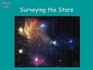
Constellations • Constellations are sections of the sky that contain recognizable star patterns. • Ancient cultures organized the star patterns to honor their gods or objects in their daily lives. • Some cultures even gave different names to the same constellations • For example, Greeks saw Orion the Hunter, but the Japanese saw a tsuzumi (drum).
Regions of the Sky • A constellation is not just the figure you see in the sky based upon the pattern of stars. • A constellation is the entire region of the sky and borders other constellations. • The sky is divided up into 88 total constellations.
Seasonal Changes • As Earth goes around the sun, the night sky experiences different constellations each season. • This is how ancient cultures could keep track of the time of year. • Sky maps are made to reflect one season and are only accurate for that season. • Also, sky maps are limited to Northern and Southern Hemispheres.
Finding Stars in the Night Sky • For astronomy, altitude is the angle between the object and the horizon. • The zenith is an imaginary point in the sky directly above an observe on Earth. • The Zenith always has an altitude of 90 degrees. • The horizon is the line where the sky and the Earth appear to meet.
Describing a Star’s Position • The Celestial Sphere is the reference system astronomers created to locate the position of objects in the night sky. • The celestial sphere surrounds the Earth. • On the celestial sphere is the celestial equator, which is an imaginary projection of the Earth’s equator. • The ecliptic is the apparent path the sun take s across the celestial sphere each year as seen from Earth.
Locating Stars • The celestial equator and ecliptic are reference lines like we use on a globe. • We use right ascension (RA) just like longitude, but we measure it in hours. • Declination (dec) is used like latitude that we measure in degrees north or south of the celestial equator. • Ex. 8 hours RA and 50 degrees declination.
Measuring Distance in Space • The stars are very far away from the Earth, because, if they were closer, they would move across the sky. • They are so far away we measure them in Light years. • A light year is a unit of length equal to the distance that light travels through space in 1 year. • It is equal to 9.46 trillion kilometers.
The Scale of the Universe • Today, astronomers can see further into our universe than ever before. • We can see objects that are 10 billion light years away. • These objects were once thought to be part of our own Milky Way Galaxy, but with technological advances, we can see that they are their own galaxies.