Download
1 / 37
370 likes | 374 Vues
Discover the diverse regions, landforms, and natural resources of Africa, the second-largest continent in the world. Learn about the major rivers and their importance for transportation, irrigation, and hydroelectric power. Explore the challenges and opportunities posed by Africa's climate and resource distribution. Gain insights into how societies have adapted to the land and how modernization has impacted the lives of people living in Africa.

E N D
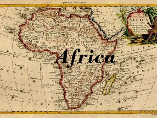
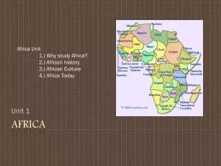
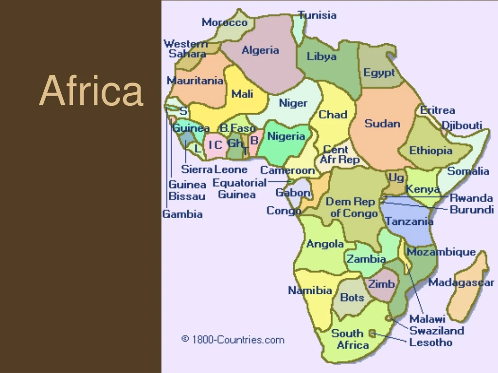
Geography • The worlds second largest continent • 55 Nations; most of any continent • Between two oceans; Atlantic & Indian • Part of major trade routes since ancient times
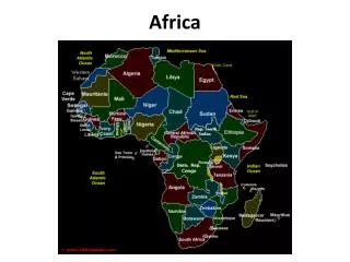
Regions • North Africa – above the Sahara Desert • Linked to the Middle East culturally • West Africa – extends into Atlantic • Part of major slave trade routes to new world • Central Africa – home to Africa’s tropical rain forests • South Africa – crucial to trade b/w oceans • East Africa – Great Rift Valley, fertile land
Landforms • Africa is a continent of Plateaus • The land made exploration difficult for Europeans • Great Rift Valley – a split in the African Continent • Rich in natural resources • Hard to mine and transport because of the rough terrain
Rivers • Provide food, transportation, and irrigation and hydroelectric power • Major Rivers • Nile, Zaire (Congo), Niger, Zambezi
Nile River – East Africa • Longest flowing river in the world 4,160 miles • Home to early civilizations • Predictable floods supported huge population • Aswan High Dam • Pros – Hydroelectric Power, Irrigation • Cons – Farmers upstream now need to purchase fertilizers
Zaire (Congo) River Central Africa Provides hydroelectric power Cannot be navigated with boats Poor for trade Niger River West Africa Provides water for irrigation Floods predictably
Zambezi River • Southern Africa • Creates Victoria Falls, 1 mile wide and 420 ft. high, between Zambia and Zimbabwe • The Kariba Dam provides hydroelectric power
Homework • Page 61 – Great Rift Valley 1, 2 • Page 64 – 3 a, b, c
Rich source of resources • Gold and Diamonds can be found in Africa’s rivers • Europeans mined much of their gold from west Africa beginning in the Age of Discovery • Power-Wealth-Trade
Africa’s Resources Today • Copper – Zaire and Zambia • Platinum and Cobalt – S. Africa, Zaire, and Botswana • Oil – Nigeria, Botswana, Libya, Algeria, and Gabon • Profits from African nations often end up in foreign countries
Resource Distribution • The countries without resources must purchase their goods and resources • Countries without mineral resources grow cash crops if the soil and climate cooperate
Adapting to the Land • Societies developed near sources of water • Farming, hunting and gathering, herding, fishing, urban • Major urban areas developed on the Mediterranean Coast, western savannas, and East Coast
Language • More than 1,000 languages • Groups only a few miles apart often speak different languages • Small tribes migrated constantly and used their own language • Scholars group African Languages into large families • Trade and diffusion created new languages
Climate Facts • Most tropical of all the continents • Temperature is warm to hot • Therefore, rainfall determines the climate in Africa • Colder temperatures seen in higher elevations • Precipitation – Less than an inch to more than 80 inches
Tropical Wet – 8% of Africa • Home of the rainforests • Average Temp – 80 F • Average Rain – 60-120 inches per year • Leaching destroys soil, unsuitable for farming • Moisture feeds disease and destroys daily items • Concrete and steel are expensive fixes
Tropical Wet and Dry – 50% of Africa • Rainfall varies by season • Summer – Hot temps & Rainy Season • Winter – Warm temps & Dry Season • Major Feature • Savanna – grasslands that cover half the continent. More rain near the equator support plant and wild life • Unpredictable rainfall makes daily life difficult • Desertification – land turning into deserts
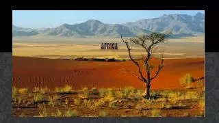
Deserts – 40% of Africa • Sahara – Means ‘desert’ in Arabic • Larger than the continental United States • Rain rarely falls, less than 10 inches a year • Temperatures reach as high as 130 F • Traders traveled across the Sahara • Diffusion of European, Asian, and African cultures • Kalahari – Southern Africa • More rain than the Sahara allows food to grow
Deserts – 40% of Africa • Namib Desert – one of the driest places on Earth • One of the oldest deserts in the world: 80 million years • Averages less than .4 inches of rain a year • Dune 7: the highest sand dune in the world, 383 meters ~ 1200 feet
Namib Desert
Mediterranean - ~2% • The Southern Tip and the Northern Coast • Climate similar to LA • Hot, Dry Summer • Cool, Wet Winter • Fertile soil good for farming • Major travel destination
Homework • Why does uneven resource distribution affect a nations ability to modernize? • How has modernization altered life for people who live on Africa’s rivers? • How has unpredictable rainfall and desertification complicated life in Central Africa? • Read page 69-70 • What diseases come from the different climate zones?
Homework • Page 71 #6 • AND • How can scientists use language to track the movement of groups of people?
Escarpment • Cataract • Leaching • Diffusion • Desertification • Pharaoh • Hieroglyphics • Olduvai Gorge • Sahel • Swahili Identifications