Download
1 / 65
650 likes | 780 Vues
Mn/DOT Metro Planning - Access Management. http://whitmanintersection.com/bad_signs.htm. http://carhugger.blogspot.com/2008/10/ferrari-car-crash-pictures.html. Mn/DOT Access Management Manual, January 2, 2008. Indiana Department of Transporation Access Management Study, Urbitran.

E N D
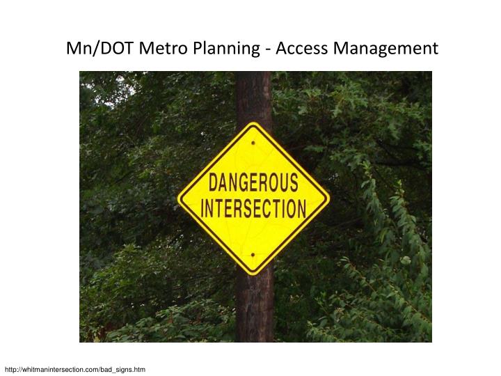
Mn/DOT Metro Planning - Access Management http://whitmanintersection.com/bad_signs.htm
http://carhugger.blogspot.com/2008/10/ferrari-car-crash-pictures.htmlhttp://carhugger.blogspot.com/2008/10/ferrari-car-crash-pictures.html
Indiana Department of Transporation Access Management Study, Urbitran
http://www.isourcetextures.com/catalogue/rubish-signs/traffic-signs/signs-and-posts-traffic-signshttp://www.isourcetextures.com/catalogue/rubish-signs/traffic-signs/signs-and-posts-traffic-signs http://commons.wikimedia.org/wiki/File:No_Left_Turn_sign.svg Bing Maps, Pictometry Bird’s Eye @2010 MDA Geospatial Services Inc. Pictometry Bird’s Eye @ 2010 Pictometry International Cop @ AND @ 2010 NAVTEQ @ 2011 Microsoft Corporation Images courtesy of USGS http://www.fhwa.dot.gov/publications/research/safety/08042/index.cfm Mn/DOT Access Management Manual, January 2, 2008
http://www.fhwa.dot.gov/publications/research/safety/08042/index.cfmhttp://www.fhwa.dot.gov/publications/research/safety/08042/index.cfm
http://articles.herald-mail.com/2010-12-26/news/26287644_1_bike-lane-left-turn-lane-bicyclistshttp://articles.herald-mail.com/2010-12-26/news/26287644_1_bike-lane-left-turn-lane-bicyclists
Bing Maps, Pictometry Bird’s Eye @2010 MDA Geospatial Services Inc. Pictometry Bird’s Eye @ 2010 Pictometry International Cop @ AND @ 2010 NAVTEQ @ 2011 Microsoft Corporation Images courtesy of USGS
Bing Maps, Pictometry Bird’s Eye @2010 MDA Geospatial Services Inc. Pictometry Bird’s Eye @ 2010 Micrometry International Cop @ AND @ 2010 NAVTEQ @ 2011 Microsoft Corporation Images courtesy of USGS
Bing Maps, Pictometry Bird’s Eye @2010 MDA Geospatial Services Inc. Pictometry Bird’s Eye @ 2010 Pictometry International Cop @ AND @ 2010 NAVTEQ @ 2011 Microsoft Corporation Images courtesy of USGS
Bing Maps, Pictometry Bird’s Eye @2010 MDA Geospatial Services Inc. Pictometry Bird’s Eye @ 2010 Pictometry International Cop @ AND @ 2010 NAVTEQ @ 2011 Microsoft Corporation Images courtesy of USGS
U.S. 61 in Forest Lake – Access Management Plan, June 8, 2010 Bing Maps, Pictometry Bird’s Eye @2010 MDA Geospatial Services Inc. Pictometry Bird’s Eye @ 2010 Pictometry International Cop @ AND @ 2010 NAVTEQ @ 2011 Microsoft Corporation Images courtesy of USGS
2030 Regional Development Plan, Planning Area Metropolitan Council, January 14, 2004
2030 Comprehensive Plan, City of Forest Lake, Bonestroo, Inc.
Bing Maps, Pictometry Bird’s Eye @2010 MDA Geospatial Services Inc. Pictometry Bird’s Eye @ 2010 Pictometry International Cop @ AND @ 2010 NAVTEQ @ 2011 Microsoft Corporation Images courtesy of USGS
2030 Comprehensive Plan, City of Forest Lake, Bonestroo, Inc.
U.S. 61 in Forest Lake – Access Management Plan, June 8, 2010
2030 Comprehensive Plan, City of Forest Lake, Bonestroo, Inc.
2030 Comprehensive Plan, City of Forest Lake, Bonestroo, Inc.
http://genesisresound.com/2011/03/influenced-or-influencers/crowd-of-people-1/http://genesisresound.com/2011/03/influenced-or-influencers/crowd-of-people-1/
Minnesota Rule 8810.5200 “In the event of a change in land use or major change in the traffic pattern on the existing facility, existing driveways are not automatically perpetuated and new driveway access applications shall be submitted.”
Bing Maps, Pictometry Bird’s Eye @2010 MDA Geospatial Services Inc. Pictometry Bird’s Eye @ 2010 Pictometry International Cop @ AND @ 2010 NAVTEQ @ 2011 Microsoft Corporation Images courtesy of USGS
Bing Maps, Pictometry Bird’s Eye @2010 MDA Geospatial Services Inc. Pictometry Bird’s Eye @ 2010 Pictometry International Cop @ AND @ 2010 NAVTEQ @ 2011 Microsoft Corporation Images courtesy of USGS
Walgreens, MFRA, McCombs, Frank, Ross, and Associates, Plymouth, MN
Bing Maps, Pictometry Bird’s Eye @2010 MDA Geospatial Services Inc. Pictometry Bird’s Eye @ 2010 Pictometry International Cop @ AND @ 2010 NAVTEQ @ 2011 Microsoft Corporation Images courtesy of USGS
Max-It Pawn Site Plan, DJR Architecture, Inc., Minneapolis, MN
Bing Maps, Pictometry Bird’s Eye @2010 MDA Geospatial Services Inc. Pictometry Bird’s Eye @ 2010 Pictometry International Cop @ AND @ 2010 NAVTEQ @ 2011 Microsoft Corporation Images courtesy of USGS
Bing Maps, Pictometry Bird’s Eye @2010 MDA Geospatial Services Inc. Pictometry Bird’s Eye @ 2010 Pictometry International Cop @ AND @ 2010 NAVTEQ @ 2011 Microsoft Corporation Images courtesy of USGS
Bing Maps, Pictometry Bird’s Eye @2010 MDA Geospatial Services Inc. Pictometry Bird’s Eye @ 2010 Pictometry International Cop @ AND @ 2010 NAVTEQ @ 2011 Microsoft Corporation Images courtesy of USGS
Minnesota Statewide Transportation Policy Plan: 2009-2028, August, 2009 Mn/DOT Metro District 20-Year Highway Investment Plan 2009-2028, August 2009
Bing Maps, Pictometry Bird’s Eye @2010 MDA Geospatial Services Inc. Pictometry Bird’s Eye @ 2010 Pictometry International Cop @ AND @ 2010 NAVTEQ @ 2011 Microsoft Corporation Images courtesy of USGS
Bing Maps, Pictometry Bird’s Eye @2010 MDA Geospatial Services Inc. Pictometry Bird’s Eye @ 2010 Pictometry International Cop @ AND @ 2010 NAVTEQ @ 2011 Microsoft Corporation Images courtesy of USGS
Bing Maps, Pictometry Bird’s Eye @2010 MDA Geospatial Services Inc. Pictometry Bird’s Eye @ 2010 Pictometry International Cop @ AND @ 2010 NAVTEQ @ 2011 Microsoft Corporation Images courtesy of USGS
Bing Maps, Pictometry Bird’s Eye @2010 MDA Geospatial Services Inc. Pictometry Bird’s Eye @ 2010 Pictometry International Cop @ AND @ 2010 NAVTEQ @ 2011 Microsoft Corporation Images courtesy of USGS
Bing Maps, Pictometry Bird’s Eye @2010 MDA Geospatial Services Inc. Pictometry Bird’s Eye @ 2010 Pictometry International Cop @ AND @ 2010 NAVTEQ @ 2011 Microsoft Corporation Images courtesy of USGS
Bing Maps, Pictometry Bird’s Eye @2010 MDA Geospatial Services Inc. Pictometry Bird’s Eye @ 2010 Pictometry International Cop @ AND @ 2010 NAVTEQ @ 2011 Microsoft Corporation Images courtesy of USGS
Bing Maps, Pictometry Bird’s Eye @2010 MDA Geospatial Services Inc. Pictometry Bird’s Eye @ 2010 Pictometry International Cop @ AND @ 2010 NAVTEQ @ 2011 Microsoft Corporation Images courtesy of USGS
Bing Maps, Pictometry Bird’s Eye @2010 MDA Geospatial Services Inc. Pictometry Bird’s Eye @ 2010 Pictometry International Cop @ AND @ 2010 NAVTEQ @ 2011 Microsoft Corporation Images courtesy of USGS
Bing Maps, Pictometry Bird’s Eye @2010 MDA Geospatial Services Inc. Pictometry Bird’s Eye @ 2010 Pictometry International Cop @ AND @ 2010 NAVTEQ @ 2011 Microsoft Corporation Images courtesy of USGS