Download
1 / 75
750 likes | 985 Vues
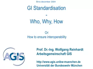
Brno december 2004. GI Standardisation - Who, Why, How. Or: How to ensure interoperability. Prof. Dr.-Ing. Wolfgang Reinhardt Arbeitsgemeinschaft GIS http://www.agis.unibw-muenchen.de Universität der Bundeswehr München. UniBw München.

E N D
Brno december 2004 GI Standardisation-Who, Why, How Or: How to ensure interoperability Prof. Dr.-Ing. Wolfgang Reinhardt Arbeitsgemeinschaft GIS http://www.agis.unibw-muenchen.de Universität der Bundeswehr München
UniBw München About 3000 Students (mostly living on campus, mostly soldiers, staff is civil, Trimester system!) 10 Faculties / Departments – 13 programs The Faculties: • Civil Engineering, Geodesy and Geoinformatics (Univ) • Electro and Information Technology • Computer Science • Aeronautics and Aerospace Technologies • Education Sciences • Social Sciences • Economics • Business Management (FH) • Electrical Engineering • Mechanical Engineering
AGIS – GI lab GI-Lab at UniBw M, civil engineering faculty founded: 1997 (Caspary/Reinhardt) tasks: • Education, professional training • Research • Research transfer 15 scientists, mostly financed from 3. Party funds
Mobile GI Services GI-based positioning of locomotives VISPA, Paramount (LBS for hiker / wanderer Advanced Geo-Services (BMBF / DFG – Geotechnologien) Interoperability / standards GI-Interoperability based on XML/GML GI Normung / Standardisation (Quality procedures) Concepts for meta data Current research projects • GI education • GI teaching modules (BMBF) • GIS- Introduction / Virtuelle Hochschule Bayern (vhb) • Projects with utilities • Quality management • Q-assurance • Process optimisation • Object oriented classification / RS • Data Visualization (SVG)
Background • Member of German standardisation body (DIN) • Staff is member of German delegation in ISO • OGC member • Projects to apply and / or to test standardisation results
Overview • Who does Standardisation in GI • Why Standardisation in GI • Examples (standards in practical use) • Applications • No systematic overview on all the topics of GI standardisation!
Situation: Why standardisation? • Many GI data bases available, but distributed in different systems, different models .. • Searching for data is still difficult (Metadata!) • Access to data still not „fluent“ • Usability of data can be improved • Integration of GI data into all kinds of applications required • ..
Who? Standardisation bodies (and others)!
Germany US/International Norm Standard Standard“Defacto“-Standard Standardisation bodies Authorised standardisation bodies: DIN • CEN • ISO Defacto standards: OGC Cooperation: ISO und OGC!
ISO / TC 211, Geographic information Started: 1994! Chairman Olaf ØstensenSecretaryBjørnhild SæterøyNorway AG Strategy AG WSI AG Outreach TMG MHT TF 211/204 WG 9 Hiroshi ImaiJapan WG 8UK WG 7Antony CooperSouth Africa WG 6 Douglas O’BrienCanada WG 4Morten BorrebækNorway Geospatial services Locationbasedservices Imagery Informationcommunities Informationmanagement Src: H. Knoop, 7. Seminar GIS & Internet, UniBw München, 2004
Standards Standards ISO/TR 19122- Qualifications andcertification of personnel Standards for Spatial Data Infrastructures Content (data) Access, technology Education Organization ISO 19103 - Conceptual schema language ISO 19107 - Spatial schemaISO 19108 - Temporal schemaISO 19109 - Rules for application schemaISO 19110 - Feature cataloguing methodologyISO 19111 - Spatial referencing by coordinatesISO 19112 - Spatial referencing by geographic identifiersISO 19113 - Quality principlesISO 19114 - Quality evaluation proceduresISO 19115 – MetadataISO/TR 19121 - Imagery and gridded data ISO 19123 - Schema for coverage geometry and functions ISO 19124 - Imagery and gridded data componentsISO 19126 - Profile - FACC Data DictionaryISO 19127 - Geodetic codes and parametersISO 19129 - Imagery, gridded and coverage data frameworkISO 19130 - Sensor and data model for imagery and gridded dataISO 19131 - Data product specificationISO 19137 - Generally used profiles of the spatial schema and of similar important other schemas Documentation Src: H. Knoop, 7. Seminar GIS & Internet, UniBw München, 2004
Standards Standards ISO 19101 – Reference modelISO 19104 – TerminologyISO 19105 – Conformance and testingISO 19106 – ProfilesISO/TR 19120 – Functional standardsISO 19135 – Procedures for registration of geographic information items Standards for Spatial Data Infrastructures Access and services ISO 19116 - Positioning servicesISO 19117 – PortrayalISO 19118 – EncodingISO 19119 – ServicesISO 19125-1 - Simple feature access – Common architectureISO 19125-2 – SFA – SQL option ISO 19125-3 – SFA – COM/OLEISO 19128 - Web Map Server InterfaceISO 19132 - Location based services possible standards ISO 19133 - Location based services tracking and navigation ISO 19134 - Multimodal location based services for routing and navigationISO 19136 – Geography Markup Language (GML) Access, technology Content (data) Organization Education Remark: Is everyting necessary? Is everything of high quality? Evaluation? Src: H. Knoop, 7. Seminar GIS & Internet, UniBw München, 2004
Examples Not the data model or the FACC is standardised But e.g.: The way to describe features (UML) The basic geometry types The access to data The access to services The encoding (GML) .....
Open Geospatial Consortium (OGC) OGC Mission “Our core mission is to deliver interface specifications that are openly available for global use” Founded: 1994 http://www.opengeospatial.org/ - www.opengis.org (still!) OGC is an international industry consortium of 258 companies, government agencies and universities participating in a consensus process to develop publicly available geoprocessing specifications.
ISO/TC 211 & OGC 1994 • ISO/TC 211 - de jure formal standards technical committee • OGC - de facto industry technical specifications • 1999 - OGC - ISO/TC 211 Class A Liaison status • ISO/TC 211 & OGC Joint Advisory Group (JAG) • ISO standardization of OGC specifications: Simple • Features Access, Web Mapping Server Interface • Jointly develop the Imagery & gridded data Reference • Model, Framework, and the OGC Sensor Markup Language • Geography Markup Language (GML)
OpenGIS Consortium (OGC) • Non-profit Organisation, founded 1994 • US-based, european subsidiary (OGC-E) • Around 258 members from all over the world and different background: • IT companies, GIS vendors, Data producers, Mapping agencies, users, universities .. • Around 5 TC meetings/year • Members have to agree on decisions
OGC • Interface specifications • Communication via standardised interfaces • Trouble free access to heterogenous data • Replace proprietary systems by component software • Promotion of web technologies • Membership levels: • Strategic Members • Principal Membership • Technical Committee Membership • Associate Membership
GIS A GIS B GIS C OGC OGC OGC Internet OGC OGC OGC GIS-user z (mobile) GIS-User x GIS-user y Scenario: Distributed Data Bases
Remark • Not mentioned: CEN: • european Standardisation body • Stopped GI work to wait for ISO results • It is very important because CEN members like GE (I think also CZ?) have to adopt CEN standards! (but not ISO standards)
Why do we need standardisation? Heterogenous Models / Systems
Buildung Adress Age No. of floors GeomType: Polygon Example Schema: describes the model, usage of standardised languages Modelling Real World Requirement analysis Description language
! Modelling
Problems with data exchange („syntax“)
Syntactical interoperability Syntactical interoperability means the ability of information systems to exchange data without loss of information under the pre condition that the data schema and the semantics in the systems are identical or at least known.
Schema based interoperability 2 Notice: In this special case System B adopts data and schema from System A (not a „real“ interoperabilty problem).
Interoperability • 3 levels: • Syntax • Schema • Semantics
Ambiguity of terms Ontology in GI: Used to describe semantics
How? Examples of specifications WMS / WFS
Another important specification: Example: • Used in WFS! • Also very important as transfer format!