Download
1 / 76
760 likes | 765 Vues
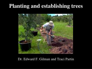
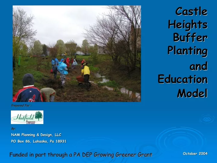
Castle Heights Buffer Planting and Education Model. Prepared For : By: NAM Planning & Design, LLC PO Box 86, Lahaska, Pa 18931. Funded in part through a PA DEP Growing Greener Grant. October 2004. The Purpose of this CD is to:

E N D
Castle Heights Buffer Planting and Education Model Prepared For : By: NAM Planning & Design, LLC PO Box 86, Lahaska, Pa 18931 Funded in part through a PA DEP Growing Greener Grant October 2004
The Purpose of this CD is to: • Provide useful information on how to manage your neighborhood stream to enhance water quality, prevent streambank erosion, encourage biodiversity and achieve natural beauty/balance. • Summarize the positive results of the streambank planting project Hatfield Township implemented as a model in the Castle Heights development.
It is about the ways in which Hatfield Township has made improvements in the water quality of the West Branch of the Neshaminy CreekWatershed through a model creek planting project. The project was generously funded through a Growing Greener Grant from ThePennsylvania Department of Environmental Protection (PA DEP), Praxair, Inc. and Hatfield Township.
In 2002, Hatfield Township hired a planning consultant to assess all of its streams. The assessment found negative practices occurring throughout Hatfield and on all waterways. The most common problem was that the CREEK buffer was missing—usually because it was mowed to the bank.
What is a Watershed? A watershed is the entire area of land that drains into a common waterway.
Do you know what watershed you live in? Watershed boundary line NESHAMINY CREEK WATERSHED SCHUYLKILL RIVER WATERSHED North GIS map prepared by Heritage Conservancy 2002
Neshaminy Creek WatershedIn Hatfield Township, the Neshaminy Creek is the largest watershed, with an estimated 18.35 linear miles, and 5,529 acres. GIS map prepared by Heritage Conservancy 2002
The Schuylkill River WatershedIn Hatfield Township, the Schuylkill River has the headwaters of 2 of its main branches, the Towamencin and Skippack Creeks. Together they comprise only about 3.94 linear miles, and 1,263 acres, and are located in the southwestern area of the township. GIS map prepared by Heritage Conservancy 2002
The water quality of the Neshaminy Creek is listed as “impaired” by PA DEP, 1 of the 4 regional watersheds with the worse Non-point source(NPS) pollution in the Delaware River Watershed. The Neshaminy Creek flows into the Delaware River in lower Bucks County.
What is Non-Point Source (NPS) Pollution NPS pollution is runoff from many indirect sources after it is washed from its source and transported downstream in stormwater. Typical NPS pollution in the West Branch of the Neshaminy Creek is: • Residential development: lawns, gardens, driveways • Numerous gas stations, car repair,& body shops, industrial plants • Winter road salts The worse pollution comes directly after the “1st flush” of each storm event – it washes the NPS pollution into the creek.
Non-point source (NPS) pollutioncan be minimized if a buffer of native vegetation along the creek banks is there to filter theNPS pollutants.The assessment found many of Hatfield Township’sriparian buffersas too small or non-existentto function effectively.The riparian buffer is composed of trees shrubs, grasses and herbaceous plants. The buffer serves many purposes in a watershed.
The Functions of Riparian Buffers in a Watershed • Filtering Runoff A healthy riparian buffer has infiltration rates 10-15 times higher than grass lawns, and 40 times higher than plowed fields! • Nutrient Uptake Plants have the capacity to absorb some NPS pollution through their roots and transform it into beneficial compounds and as a source of food for growth, such as nitrogen and phosphorous.
The Functions of Riparian Buffers in a Watershed 3. Canopy & Shade The trees and vegetation shade the water and encourage the beneficial aquatic insects and algae. More Fish live in cooler water—Ask any fisherman where he will find his best fish— in the shade of a tree!
The Functions of Riparian Buffers in a Watershed 4. Leaf Food Leaves fall into a creek and are trapped on woody debris where they provide food for small aquatic insects and small fish. 5. Fish / Wildlife Habitat Forest diversity is valuable for birds and other wildlife that need corridors that connect to larger open spaces. Wood & leaf debris provides fish habitat in the creek.
The Water or “Hydrological” Cycle In watersheds with new residential, commercial and industrial developments like much of Hatfield Township, the water cycle becomes imbalanced as the impervious surfaces increase, such as roofs, pavements and buildings. Wooded areas that once were home to a wide range of wildlife have become mowed lawns and hard surfaces in subdivisions and shopping areas. Often, flooding occurs downstream because the water can no longer infiltrate into the soil where it falls.
The Hydrological Cycle on a Watershed Scale (Daigle, Jean-Marie and Havinga, Donna. Restoring Nature’s Place. 1995)
The project area before the replanting… Small, or no riparian buffer on areas of the creek - 35-75 feet is ideal Few trees shading the creek Looking from Bergey Road downstream
Property owners were storing things in the riparian buffer area on township public property. Vegetation cannot grow, reducing the potential area for stormwater infiltration and NPS pollution filtering. The project area before the replanting… Mid-point of the 800-ft corridor looking downstream
A note about property ownership : “Township” property is public property. It belongs to you, to your neighbor and to your fellow township residents. All of us have a civic duty to be good stewards in regards to our actions affecting public property
The project area before the replanting… Residents were mowing beyond their property line into the township property, removing the creek’s riparian buffer. Townshipmonument marker Township –owned property
The project area before the replanting… Massive areas of non-native, invasive shrubs- multi-flora rose and wineberry had taken over the native creek vegetation. It does not feed our native wildlife populations, and does not stabilize the creek banks, or filter NPS pollution. No creek buffer Looking downstream towards the end of the 800’ planting corridor
The project area before the replanting… Benignly, some residents were using the township riparian buffer area and creek to dispose of their weeds and other property wastes. Debris kills the riparian buffer vegetation, and creates more NPS pollution soil erosion.
Castle Heights Buffer Planting Hatfield Township chose the 800-foot section of the Neshaminy Creek through the Castle Heights development as a model project area because this stream corridor is owned by the public. It is also the closest to the headwaters,or beginning of, the Neshaminy Creek.The headwaters are the most important areas to protect since any pollution and problems will only be carried all the way through the watershed. Hatfield Township owns the outlined stream corridor areas along the creek.
GOALS OFCastle Heights Buffer Planting GOAL #1 The Township will reduce stormwater impairments through implementation of infiltration Best Management Practices (BMPs) How did Hatfield Township do this? The Township planted the streambank buffers with native trees, shrubs, grasses and herbaceous plants. The buffer physically slows down stormwater and allows it to infiltrate into the ground and sediment to drop out instead of flowing directly into the Neshaminy Creek.
GOALS OFCastle Heights Buffer Planting GOAL #2 The Township will promote and establish strategies and projects to maintain existing creek buffers and establish new buffers where none exist. How did Hatfield Township do this? The Township and its consultant selected an 800 foot area of the West Branch of the Neshaminy Creek to replant the riparian buffer.
GOALS OFCastle Heights Buffer Planting GOAL #3 The Township will develop an education and community outreach program. How did Hatfield Township do this? The Township and its partners developed several phases of community education and outreach. These included: • First-hand experience for the public about proper creek management: through a walk and the hands-on volunteer planting day. • Resource material in the form of this CD, signage and informational direct mailings on the model site that outline the importance of this project and how effective it has been to the health of the watershed. • Training sessions at the project site to update the skills and knowledge of the Public Works staff on the new “Best Management Practices”.
GOALS OFCastle Heights Buffer Planting Goal #4 Hatfield Township’s project will impact regional and local biodiversity. This is basically restoring habitat for wildlife. “Loss of habitat is the biggest reason for our disappearing wildlife populations” How did Hatfield Township do this? • The Township removed the invasive, non-native species such as multi-flora rose and Japanese honeysuckle, that have taken over the stream. • The Township planted native trees, shrubs, grasses and herbaceous plants that are highly desirable for a creek corridor and buffer area.
Project Process In spring 2003, the Township and its project partners conducted a creek walk on a healthy tributary of the Neshaminy Creek. Thepurpose was to educate residents about the features of a healthy creek, and ways to improve it through good property management.
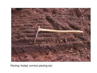
The week prior to the community planting, the township public works staff worked diligently to remove the multi-flora rose and other non-native trees and shrubs that had taken over the riparian buffer. They also removed debris in and around the creek.
Locations for the new trees were marked by the consultant for the public works staff to plant.
Large 3” caliper native trees – red bud and river birch , were planted at Bergey Road to get quick shade.
The Planting Day April 2003 Community volunteers- youth groups and adults from EnACT, Pennfield Middle School Chapter, Cub and Boy Scouts and Girl Scouts and the general public, were out in full force on the planting day, even on a dreary, rainy Saturday!
The area was monitored for the next year and photographed to demonstrate the growth and document the success of the project. Bergey Road - 1 month after planting
Bergey Road - 2 months after planting Herbaceous wildflowers and grasses start to fill in along the streambanks.
Tree growth Grasses and wildflowers become more dense August 2003
Late October 2003 Even though the frost has killed the vegetation, the roots and skeletal remains help slow the stormwater velocity and subsequent sediment erosion from breaking down the banks
Before planting: April 2003 Lower end of the 800 ft corridor
One month after planting: June 2003 Lower end of the 800 ft corridor
One year after planting: July 2004 Trees and shrubs begin to show significant growth Lower end of the 800 ft corridor
Even after heavy rains, the riparian buffer functions to slow down water and stop sediment and NPS pollution from flowing downstream causing more damage. (The flow line is the area of the matted-down grasses near the stake)
One year & three months after planting: August 2004 Area is not only functional but attractive! Midway along the 800 ft corridor.
One year & four months after planting:September 2004 Inlet off Denbeigh Drive at the end of the 800 ft corridor.
Challenges the Township faced with the project Thistle, a common invasive “weed” thrived in certain areas of the riparian buffer planting area, especially along Bergey Road. In order to keep it from spreading and taking over all the efforts gained, the township hired a licensed herbicide applicator to spray a very select herbicide – “rodeo” that does not harm anything except on what it has been sprayed. It will not stay in the soil or become airborne. It was effective in gradually killing the thistle, but it left brown areas along the buffer corridor. These areas will be replanted with other native vegetation.
SO WHY DID Hatfield Township take the challenge to replant the creek bank? Stormwater is regulated by the state, the PA DEP, who receives its regulations from the federal Environmental Protection Agency (EPA) The PA DEP offers assistance in the way of grants like the one that funded this project, to help municipalities and non-profits comply with the new stormwater regulations.
Phase II Stormwater Regulations The US EPA mandates that municipalities like Hatfield Township comply with the regulations for the Phase II Stormwater regulations. The goal of the Phase II Stormwater Regulations is to protect the environment from negative effects of runoff from human activities. Community Growth is a major cause of the watershed problems. Hatfield Township is responsible for the Quality and Quantity of stormwater it discharges into the watersheds within its boundaries.
The most important thing you can do to help Hatfield Township be in compliance with these regulations is to change some of your property management practices, especially if you live adjacent to a water body. Read on for more details on things you should do: • Maintain a buffer zone • Prevent erosion and sedimentation • Plan your landscape - use natives • Care for your lawn and garden properly • Use pesticides, herbicides and fertilizers responsibly • Dispose of chemicals and wastes from around your property with care • Conserve water
Maintain a Riparian Buffer Even the smallest amount of a riparian buffer makes a difference!
Prevent Erosion and Sedimentation The key to decreasing erosion and sedimentation on your property is to slow down the flow of water. The faster the water flows, the more soil and debris are carried away. • Keep the stockpiled soil covered with a tarp. Loose soil runs off. • Plant vegetation to hold the soil down. Plants protect the soil from the impact of raindrops. • Direct gutters into storage containers like rain barrels or even a bucket. Even if the bucket overflows, it will be slowed down. • Plant native groundcovers instead of grass. This will reduce impervious lawn space and runoff and provide wildlife habitat.