Download
1 / 13
130 likes | 163 Vues
Latitude vs Longitude. Longitude and Latitude. Objective: T o understand these terms and how they help us to find and describe different locations Think/Pair/Share What do you know about latitude and longitude?. Latitude and longitude. 1.

E N D
Longitude and Latitude • Objective: To understand these terms and how they help us to find and describe different locations • Think/Pair/Share • What do you know about latitude and longitude?
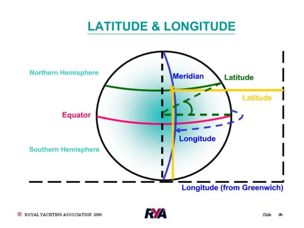
Latitude and longitude 1 A system of lines is used to find the location of any place on the surface of the Earth.
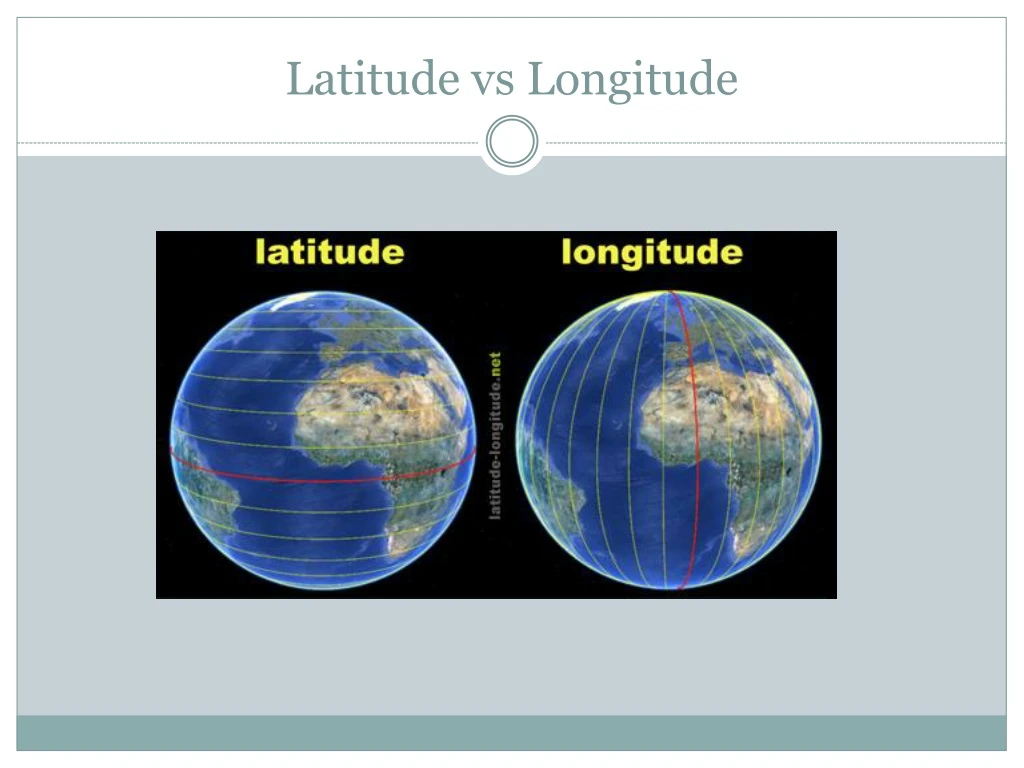
Latitude Arctic Circle (66° 30'' N) Tropic of Cancer (23° 30'' N) Tropic of Capricorn (23° 30'' S) Antarctic Circle (66° 30'' S) Latitude (shown as a horizontal line) is measured in degrees north or degrees south of the equator, which is the line around the exact middle of the earth. Lines of latitude are often referred to as parallels.
Latitude Equator North Pole South Pole
Longitude Lines of longitude are often referred to as meridians. Prime Meridian Longitude (shown as a vertical line) is measured in degrees east or west of something called the Prime Meridian.This is the line going from the North Pole to the South Pole and running through the middle of the Greenwich Observatory in London.
Why is the Prime Meridian in Greenwich? Britain was a world leader in exploration and map making. Therefore, navigators of other nations often used British maps. As a result, in 1884 the meridian of Greenwich was adopted throughout most of the world as the Prime Meridian.
Simple Rules • Latitude is shown by horizontal lines going around the earth from the North to the South Pole. • Longitude shows how far east or west something is from a line called the Greenwich Meridian. • Co-ordinates must have the latitude followed by the longitude. • Eg. (20˚S, 20˚W)
Practice • Cairo: (30°N, 31°E) • Beijing: (39°N, 116°E) • Sydney: (33°S, 151°E) • Berlin: (52°N, 13°E) • Mexico City: (19°N, 99°W) • London: (51°N, 0°W)
West Branch? • http://www.worldatlas.com/aatlas/latitude_and_longitude_finder.htm • Zip 44609 • Video