Download
1 / 44
440 likes | 658 Vues
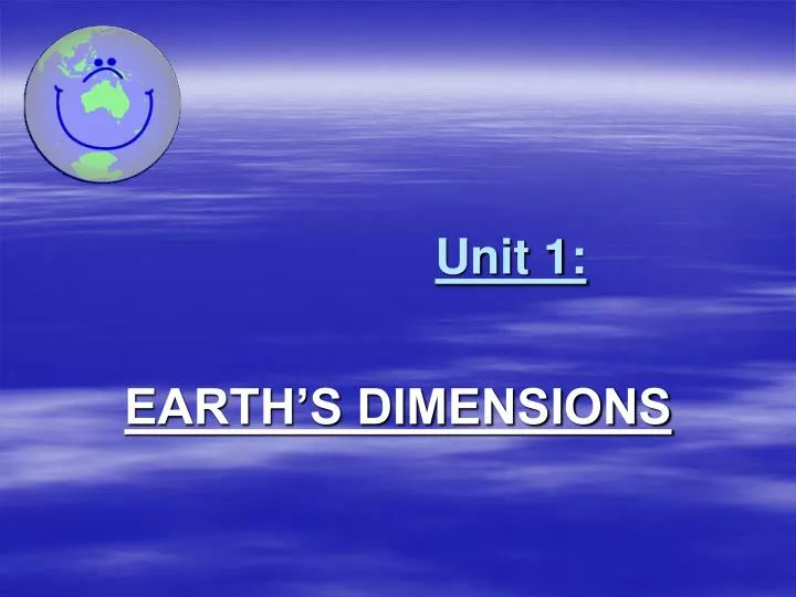
Unit 1:. EARTH’S DIMENSIONS. A. EARTH’S SHAPE. Earth appears a perfect sphere. Examples: Classroom Globe. Photographs of the Earth from space. Earth’s true shape = oblate spheroid . Larger circumference at equator (0 0 ). “Slightly” bulged at the equators.

E N D
Unit 1: EARTH’S DIMENSIONS
A. EARTH’S SHAPE • Earth appears a perfect sphere. • Examples: • Classroom Globe. • Photographs of the Earth from space.
Earth’s trueshape = oblate spheroid. • Larger circumference at equator (00). • “Slightly” bulged at the equators. • Flatter (smaller) circumference at poles (900 N/S). • “Slightly” flattened at the poles. • Example: Ping Pong Ball
http://www.mathwords.com/assets/quadric_movies/oblatespheroid.movhttp://www.mathwords.com/assets/quadric_movies/oblatespheroid.mov
Polaris as Evidence • Also known as the North Star • located directly above the North Pole • Only can be observed in the Northern Hemisphere • POLARIS GIVES ME MY LATITUDE • The latitude and Polaris are the same number. • Just add 0N at the end to represent the northern hemisphere (the North Star).
Example: An observer in New York State measures the altitude of Polaris at an angle of 440. What is the observer’s location? • ANSWER: 440N (NEW YORK STATE)Any latitude in the 40’s is always located in NYSALTITUDE : HEIGHTLATITUDE : USED TO LOCATE A POINT NORTH OR SOUTH OF THE EQUATOR
Earth Science Reference Tables Pg. 2 – New York State • http://www.ccsd.edu/South/Science/esci/RefTables/2bedrkcrnt.pdf
Lithosphere (LAND) • Includes: • Crust • Landmasses and landforms • Underwater features
Hydrosphere (WATER) • 71% (or 3/4) of Earth covered by a thin film of water • Very thin • Thickness of an apple skin • Includes All bodies of Water: • Marine (Oceans, Seas) • Fresh (Streams, Rivers, Lakes)
Anthrosphere (HUMANS) • Human activities affect the environment • OVER POPULATION • POLLUTION • DEFORESTATION- Diminishing natural resources
AtmosphereE.S.R.T. pg. 14 • Thin envelope of air • Held in place by gravity • Least dense sphere • Stratified(layers) into 4 zones
C. Earth’s Positions * WEST IS LESS! * EAST INCREASE! * Each longitude line equals 150 1 hr. = 150
Example of GMT Problem & Step-by-Step Procedure • QUESTION # 1 :If Polaris is seen at an angle of 41 degrees, with a GMT time of 1pm and a local sun time of 7pm, what is the observer’s latitude and longitude at this position? • Step 1: Find Latitude: Polaris = 410 Latitude = 410 N • Step 2: Find Time Difference: 6 hrs (DO NOT SUBTRACT – COUNT) • Step 3: Find Longitude: Multiply Time Difference by 150 6 hrs. X 15 = 900 • Step 4:East (Time Increases) or West (Time Decreases) 900E • Step 5:Location and/or Coordinates (410N, 900E) – Somewhere in Asia
QUESTION # 2 : If Polaris is seen at an angle of 58 degrees, with a GMT time of 3pm and a local sun time of 8pm, what is the observer’s approximate latitude and longitude? • Step 1: Find Latitude: Polaris = 580 Latitude: 580N • Step 2: Find Time Difference: 5 hrs. (DO NOT SUBTRACT _ COUNT) • Step 3: Find Longitude: Multiply Time Difference by 150 5 hrs. X 15 = 750 • Step 4: East (Time Increases) or West (Time Decreases) 750 E • Step 5:Location and/or Coordinates (580N, 750E) - Europe
D. POSITION CHARACTERISTICS • Isolines = lines that connect same field values • Examples of Isolines: • Isobars = isolines that connect equal air pressure • Isotherms = isolines that connect equal temperatures • Contour lines = isolines that connect equal elevations
DRAWING ISOLINE TIPS AND REMINDERS • 1. Use a pencil. • 2. Draw isolines at the specified intervals. • 3. Label isolines. • 4. Isolines start off and end off the page. • 5. Draw isolines in curved manner.
General Rules of Drawing Isolines • Isolines connect points of equal values. • Isolines are gentle, curving lines- no sharp corners. • Isolines are always closed curves even though the map might only show part of it. • Isolines NEVER cross- this would mean that one point has two different values. HOW TO DRAW ISOLINES
Gradient • Means “slope” • Steeper the “gradient”, closer the contour lines • Gradient can be used to measure: • Isolines (Diagrams) • Isobars (air pressure) • Isotherms (temperatures) • Contour Lines (elevations) • Gradient = change in field value distance
Gradient Practice Problems Example # 1: A stream in New York State begins at a location 350 meters above sea level and flows into a swamp 225 meters above sea level. The length of the stream is 25 kilometers. What is the gradient of the stream?
Gradient (slope) = change in field value distance Gradient = 350 meters – 225 meters 25 kilometers Gradient = 125 meters 25 kilometers Gradient = 5 meters/kilometers or5 m/km REMEMBER TO LABEL AND INCLUDE YOUR UNITS !!!
Water Features • Only line to touch or intersect contour lines • Forms a “V” or “arrow-shape.” • Arrrows or “V” point towards the source – where the stream began (upstream). • Opposite the arrows indicates the direction the water flows.
Practice Water Feature Question 1. Mill River generally flows toward the • Southeast • Southwest • Northeast • Northwest
Finding the Maximum Elevation on a Contour Map • MAXIMUM HEIGHT = ONE LESS THAN IS NEEDED TO CREATE ANOTHER CONTOUR LINE ON THE CONTOUR MAP
Maximum Height Example • If a contour map is displayed with the highest drawn contour line of 400 meters and the contour interval is 100 meters. What would be the maximum height (elevation) of this contour map? • ANSWER: 499 meters Maximum Height Example- June 2005 Regents Question
Topographic Maps – PROFILE • Side view of a landform based on a contour map.
How to make a profile from a topographic map? • Interactive Example
Examples Hill / Mountain Profile Valley Profile
“How to make a PROFILE from topographic map: Step-by-step Procedure” • Step 1: Place a blank piece of paper along the line you have drawn. • Step 2: On both the blank paper and the map, mark clearly the starting and ending points of your line of section.
Step 3: Below these marks, write down the elevation of the starting and ending points of your section. • Step 4: Once you are certain you have all of the appropriate marks and elevations, remove your paper from the map. • Step 5: Graph
Step 6: Connect the dots on the graph paper, and you have a topographic profile. • Make sure that when you connect the elevations (dots), the highest and lowest points do not receive a straight line across; create a “HUMP”. This represents that the elevation may increase or decrease slightly at these areas.