Download
1 / 5
80 likes | 324 Vues
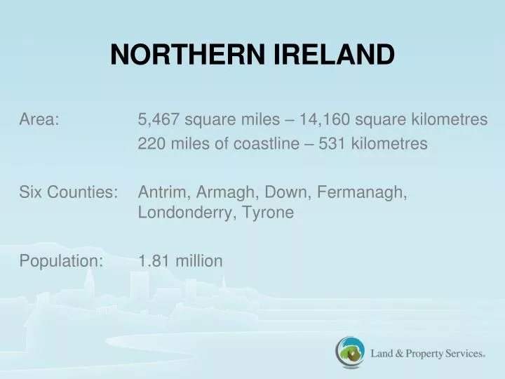
NORTHERN IRELAND. Area: 5,467 square miles – 14,160 square kilometres 220 miles of coastline – 531 kilometres Six Counties: Antrim , Armagh, Down, Fermanagh, Londonderry, Tyrone Population : 1.81 million. Land Registry operates three Registers:

E N D
NORTHERN IRELAND Area: 5,467 square miles – 14,160 square kilometres 220 miles of coastline – 531 kilometres Six Counties: Antrim, Armagh, Down, Fermanagh, Londonderry, Tyrone Population: 1.81 million
Land Registry operates three Registers: Registry of Deeds – paper based system, no map. Operational since 1708. No Government Guarantee of Title. Land Registry – map based system, operational since 1892. Carries Government Guarantee of Title. Statutory Charges Register – map based system, operational since 1970. Contains details of statutory charges which affect lands eg Listed Buildings/Tree Preservation Orders.
Land Registry is part of Land & Property Services (LPS), formed as an Agency in 2007 but deagentised in 2013. The other parts of LPS are: • Valuation & Mapping (formerly Ordnance Survey Northern Ireland); • Revenues & Benefits (dealing with payment of rates and rate reliefs); and • Business Services (dealing with Corporate Governance).
We operate under a private Finance Initiative Contract with British Telecom (BT) – contract for 15 years from 2004 to 2019. • Contract was to transform Land Registry from a paper based organisation to an IT based organisation – now almost all work done electronically. • Our in-house IT system is Landweb. • Our Direct Access Customer System is Landweb Direct – customers can view Folios and Maps on-line but must request copies of other documents.
FUTURE DEVELOPMENTS • Technical upgrade of Landweb System currently underway: • E-signatures. • E-payments. • E-discharges. • Review of Land Registration Act (NI) 1970 and Land Registration Rules (NI) 1994. • Commencement of two year Positional Improvement Programme to upgrade Land Registry Maps. • Accommodation move May/June 2014. • Digitisation of the Registry of Deeds Archive.