Download
1 / 21
210 likes | 646 Vues
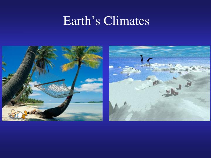
Earth ’ s Climates. Review of last lecture. The developmental stages and vertical structure of middle latitude cyclones (boundary between northern cold air and southern warm air, upper level low to the west of surface low)

E N D
Review of last lecture • The developmental stages and vertical structure of middle latitude cyclones (boundary between northern cold air and southern warm air, upper level low to the west of surface low) • How upper level longwaves and shortwaves may enhance cyclonic development at the surface (upper level low to the west of surface low) • The three regions of cyclogenesis and typical tracks • Lake effect • Anticyclones, heat waves and droughts • Climate change: move the tracks of the midlatitude cyclones towards the poles
Climate and Controlling Factors • Climate is the long-term statistical properties of the atmosphere for an area. • Climate analysis for an area includes many variables. • Climate classifications are based on properties such as temperature, precipitation, air mass types, and seasonal variations in water balance for an area.
The Koeppen System • The Koeppen climate classification system is based on natural vegetation types as indicators of average temperature and precipitation. • divides climates into five main groups, each having several types and subtypes. • Each particular climate type is represented by a 2 to 4 letter symbol
The Koeppen System: 5 main groups • A — Tropical. Climates in which the average temperature for all months is greater than 18°C (64°F). Almost entirely confined to the region between the equator and the tropics of Cancer and Capricorn. • B — Dry. Potential evaporation exceeds precipitation. • C — Mild Midlatitude. The coldest month of the year has an average temperature higher than –3°C (27°F) but below 18°C (64°F). Summers can be hot. • D — Severe Midlatitude. Winters have at least occasional snow cover, with the coldest month having a mean temperature below –3°C (27°F). Summers are typically mild. • E — Polar. All months have mean temperatures below 10°C (50°F).
Tropical Climates • Warm annual temperatures and with little temperature • variation. • Distinguished by precipitation variations.
Tropical Wet (Af) (rainforest) Even precipitation Tropical Monsoonal (Am) significant change of precipitation Tropical Wet and Dry (Aw) (Savanna) Boundary with dry climate
Dry Climates • Dry climates occur in areas where potential evapotranspiration is greater than precipitation. • 30% of Earth’s land surface is classified as a dry climate. • Semideserts are transitional zones that separate the true deserts from adjacent climates. • They are also called steppe climates, with reference to the associated vegetation type consisting of short grasses. • The two-tiered system of categorization yields four types of dry climates: subtropical desert, subtropical steppe, midlatitude desert, and midlatitude steppe.
Subtropical Deserts (BWh) Largest deserts with atmospheric subsidence and high pressure. Subtropical Steppe (BSh) High precipitation and temperature variability.
Midlatitude Deserts (BWk) Higher humidity and precipitation than subtropical deserts Midlatitude Steppe (BSk) Higher annual average precipitation than deserts
Mild Midlatitude Climates • The mild midlatitude climates are located in parts of the latitude range between 30° and 60° in either hemisphere. • Varying precipitation systems with mild winter temperatures. Summer temperatures may be high. • This climate group is subdivided into three climates. The mediterranean, humid subtropical, and the marine west coast climates.
Mediterranean (Csa, Csb) Distinct dry summer due to subtropical high, mild winter Humid Subtropical (Cfa, Cwa) Eastern continental areas. Long hot and muggy summers Marine West Coast (Cfb, Cfc) Cold ocean current mild summers and winters. Fogs, low clouds, drizzles
Severe Midlatitude Climates • Very cold winters. • Large continental areas. • Evenly distributed annual precipitation.
Subarctic (Dfc, Dfd, Dwc, Dwd) boreal forest . Warm, short summers and extremely cold winters Humid Continental (Dfa, Dfb, Dwa, Dwb) Eastern continents of 40°N–55°N. Abundant annual precipitation.
Polar Climates • Very high latitudes. • Very cold.
Tundra (ET) Permafrost(permanently frozen layer below the surface) Ice Cap (EF) Constant ice cover. Greenland and Antarctica.
Highland Climates (H) • Governed solely by topography, not geographic location. • Vertical zonation
Summary: The Koeppen System • A—Tropical. Climates in which the average temperature for all months is greater than 18°C (64°F). Almost entirely confined to the region between the equator and the tropics of Cancer and Capricorn. • B—Dry. Potential evaporation exceeds precipitation. • C—Mild Midlatitude. The coldest month of the year has an average temperature higher than –3°C (27°F) but below 18°C (64°F). Summers can be hot. • D—Severe Midlatitude. Winters have at least occasional snow cover, with the coldest month having a mean temperature below –3°C (27°F). Summers are typically mild. • E—Polar. All months have mean temperatures below 10°C (50°F).