Download
1 / 77
780 likes | 796 Vues
Environment & Ecology. 013 Geology, Minerals, and Mining Ch 11. Central Case: Mining for…cell phones?. Columbite. Congo. okapi. We use raw materials from the Earth. We take raw materials from the lithosphere and turn them into products.

E N D
Environment & Ecology 013 Geology, Minerals, and Mining Ch 11
Central Case: Mining for…cell phones? Columbite
Congo okapi
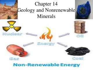
We use raw materials from the Earth • We take raw materials from the lithosphere and turn them into products. • The physical processes in the lithosphere shape Earth’s landforms. • Geology: the study of Earth’s physical features, processes. and history • Two processes are fundamentally important: the rock cycle and plate tectonics.
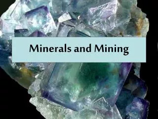
The rock cycle Rock cycle: heating, melting, cooling, breaking, and reassembling of rocks and minerals Important in the formation and conservation of soil, mineral resources, fossil fuels, and other resources Rock: any solid aggregation of minerals Affect soils and influence a region’s plant community Mineral: any naturally occurring solid element or inorganic compound A crystal structure A specific chemical composition Distinct physical properties
Igneous rock Magma: the molten, liquid state of rock Lava: magma released from the lithosphere Igneous rock: forms when magma cools Two classes, depending on how rock solidifies: Intrusiverock: magma that cools slowly below Earth’s surface (i.e., granite) Extrusiverock: magma ejected from a volcano (i.e., basalt) granite basalt
Sedimentary rock Sediments: particles of rock are blown by wind or washed away by water Sedimentary rock: sediments are pressed together (compaction) or dissolved minerals seep through sediment layers and bind sediment particles (cementation) Lithification: formation of rock through the processes of compaction and cementation
Formation of sedimentary rock Sedimentary rock is classified by the way it forms. Clastic sedimentary rock: forms from physically eroded material (sandstone, shale) Chemical sedimentary rock: formed as dissolved minerals precipitate from water or as calcite settles to ocean bottoms (Limestone and rock salt) Physical compaction and chemical transformation form: Fossils Fossil fuels Crude oil seeping from ground
Metamorphic rock Metamorphic rock: great heat or pressure on a rock changes its form Deep underground, high temperatures reshape crystals and change a rock’s appearance and physical properties. Foliated rock: heat and pressure causes layers (slate) Nonfoliated rock: not layered (marble) Gneiss (foliate) Quartzite (nonfoliate)
Earth consists of layers • Crust: a thin, brittle, low-density rock • Covers Earth’s surface • Mantle: thick layer of denser rock • Lithosphere: hard • Asthenosphere: molten • Mesosphere: hard • Core: dense, consists mostly of iron • Earth’s heat drives convection currents in the mantle • Pushes soft rock upward and downward… • Dragging large plates of lithosphere • Plate tectonics: the movement of lithospheric plates
Earth’s layers lithosphere asthenosphere mesosphere
Lithosphere (hard) Asthenosphere (soft) Mesosphere
The Earth has 15 major tectonic plates… …that move 2-15 cm (1-6 in.) per year. Movement of these plates influences climate and evolution.
Pangaea: the supercontinent At least twice in Earth’s history, all landmasses were joined in one supercontinent. Pangaea: the supercontinent that occurred 225 million years ago
The 3 types of plate boundaries • Divergent • Convergent • Transform
Divergent plate boundaries • The Mid-Atlantic Ridge is a divergent plate boundary where sea floor spreading occurs
Divergent plate boundaries • Iceland sits atop a divergent plate boundary where continental rifting occurs
Divergent plate boundaries • Formation of an ocean basin by rifting and sea floor spreading
Convergent plate boundaries a. Ocean-continent • Convergent plate boundaries vary depending on the type of crust c. Continent-continent b. Ocean-ocean
Convergent plate boundaries • An ocean-continent convergent plate boundary produces the Cascadia subduction zone and Cascade Mountains
Convergent plate boundaries • A continent-continent convergent plate boundary produces the Himalaya Mountains
Transform plate boundaries • Transform plate boundaries occur between segments of the mid-ocean ridge • Can also occur on land (ex: San Andreas Fault)
Earthquakes result from movement • Earthquakes: places in the Earth’s crust (faults) where built-up pressure is relieved • Most earthquakes are not felt, but some do enormous damage. • Cities built on landfills are very vulnerable. • To minimize damage: build strong buildings with built-in flexibility
Earthquakes in Hawaii Magnitude 6 or greater
Earthquakes in Hawaii 1946 Maui Hawaii’s largest: April 2, 1868 7.9 in magnitude 15-m tsunami 81 people died 1960
Volcanoes arise from rifts, subduction, or hot spots Meiji (3000 m deep) Over 100 volcanoes in a volcanic island arc system Big Island
Hawaiian Islands Niihau Kauai Oahu Molokai Lanai Maui Hawaii
J. Tuzo Wilson (1963), a Canadian geophysicist ,came up the "hotspot" theory. volcanoes of the Hawaiian chain should get progressively older and become more eroded the farther they travel beyond the hotspot. Pacific Plate Kauai (oldest) Oahu Maui Hawaii (youngest)
Movement of Hawaiian Islands Moves in a northwesterly direction Much of the Hawaiian island arc is underwater and extends toward Midway
WE’VE GOT HOT SPOTS ALL OVER THE PLACE Other examples of hot spots include: Cape Verde (off the coast of Senegal), Galapagos Islands (off the coast of Equator), Society Islands (French Polynesia), Tristan da Cunha (southern Atlantic), Yellowstone, Ethiopia Plateau, Lord How (near Sydney), Iceland, and many more.
Darwin’s Theory of Coral Atoll Formation: Subsidence Theory Fringing Reef- boarders coastline closely Island subsides Barrier Reef- separated from land by a lagoon Atoll- coral ring with central lagoon lagoon is a shallow area with a sandy floor, patch reefs, and patches of seagrass
Fringing Reef Shoreline Reef Flat Reef Front
Kaneohe Bay Barrier Reef Patch Reef Fringing Reef
Reef Flat of a barrier reef Lagoon Reef Flat of a Barrier Reef Coral Island (Cay or Motu) Reef Flat Reef Front Open Ocean
Belize- Blue Hole Atoll
Midway Atoll Kure Atoll (28° 25' N - 178° 20' W) Pearl & Hermes Atoll
Effects of volcanoes • Pyroclastic flow: a fast-moving cloud of toxic gas, ash, and rock • Mount Vesuvius erupted and buried Pompeii in 79 A.D. • Ash blocks sunlight. • Sulfuric emissions cause a haze that cools the atmosphere. • Cause crop failures Pompei 79 AD
Landslides are a form of mass wasting • Mass wasting: the downslope movement of soil and rock due to gravity • Landslide: A severe and often sudden instance of mass wasting, where large amounts of rock or soil collapse and flow downhill • Occurs naturally, but is also caused by human practices that expose or loosen soil • Mudslides: heavy rains saturate the soil and cause movement of soil, rock, and water • Lahars: mudslides caused when volcanic eruptions melt snow and sends volumes of mud downslope
Mass wasting can be devastating • In 1998, in Nicaragua and Honduras, over 11,000 people died from mudslides. • In 1985, over 21,000 people died from a lahar that buried the town of Armero, Colombia.