Download
1 / 23
230 likes | 397 Vues
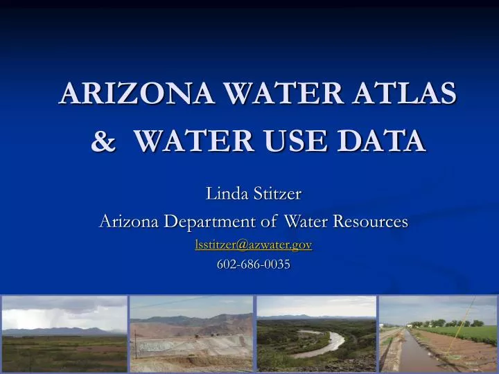
ARIZONA WATER ATLAS & WATER USE DATA. Linda Stitzer Arizona Department of Water Resources lsstitzer@azwater.gov 602-686-0035. Arizona Water Atlas Purpose. Assist local and regional planning efforts by providing water resource data and information

E N D
ARIZONA WATER ATLAS & WATER USE DATA Linda Stitzer Arizona Department of Water Resources lsstitzer@azwater.gov 602-686-0035
Arizona Water Atlas Purpose • Assist local and regional planning efforts by providing water resource data and information • Provide compiled information and data at one location from many data sources at the planning area, groundwater basin and community level • Provide general public information
Arizona Planning Areas • “Planning Area” • concept that provides a regional perspective on water resources and issues • Composed of 51 groundwater basins • Active Management Areas (AMAs) • Central Highlands • Eastern Plateau • Lower Colorado River • Southeastern Arizona • Upper Colorado River • Western Plateau
Atlas Organization & Status • Volumes 2-8 Planning Areas final and posted on web (web-format) • Volume 1 Executive Summary • Statewide overview, important summary information, background, data sources and methods • August 2010
Atlas Volume 9 • Resource Sustainability Assessment - 7/2011 • Interpret and evaluate Atlas findings to support water management decision processes • Evaluate supply vulnerability to determine resource sustainability e.g. • Limited physical supplies • Current or projected demand exceed supplies • Supply sensitivity to drought or other shortage • Competition with environmental demands or potential for impact • Legal issues
Volume 9 – Sustainability Assessment • Identify water supply vulnerability basin by basin and by demand centers (not individual communities) • Qualitative and quantitative metrics • Vulnerability ranking will be used to determine whether supplies are sustainable in the short-term and long-term 25, 50 and 100 years • 100 year population and demand projections by basin • Targeted stakeholder input • WIFA grant
Volume 9 – Sustainability Assessment • Integrate regional/local water planning studies • e.g. USBOR appraisal studies • North Central Arizona • Mogollon Highlands • Sierra Vista Subwatershed • Verde Highlands • Water Supply and demand projections; alternatives to meet “unmet demands” • e.g. Colorado River Basin Study • Complex water supply and demand projections to 2060 for areas either currently using or anticipated to need Colorado River water supplies
Colorado River Basin Water Supply and Demand Study • Comprehensive study to define current and future imbalances in water supply and demand; develop and analyze adaptation and mitigation strategies to resolve imbalances (1/2012) • Arizona Focus: M&I water demand 2010-2060 • CAP service area + on-River + North Central Arizona, Yavapai Highlands, Sierra Vista Subwatershed • Estimate magnitude of unmet Colorado River water demand (550,000-600,000 acre-feet) • Demand Study Tool (Ecosystem Economics)
Planning Area Volumes Content • Overview of entire planning area • Geography • Hydrology • Climate • Environmental Conditions • instream flow claims, ESA, WPF, protected areas • Population, Growth and Water Use • Water Supply • Cultural Water Demand • Sector/Community/Site • Water Resource Issues
Planning Area Volume Content • DetailedBasinwater resource characteristics: maps, tables • Geography • Land Ownership • Climate • Surface Water Conditions • Streamflow, reservoir data, etc. • Perennial/Intermittent Streams and Major Springs • Groundwater Conditions • Major aquifers, recharge, flow direction, well yields, water levels and water level changes, selected hydrographs
Planning Area Volume Content Basins (cont.) • Water Quality • Sites with Drinking Water Standards exceedences • Impaired lakes and streams and effluent dependent reaches • Contamination sites (WQARF, VRP, Superfund, RCRA, DOD) • Cultural Water Demands • Population (1980-2030) • Water use sector demand (1971-2005) • Effluent generation and disposal (Riparian/environmental demand unable to quantify) • Water Adequacy/Assured Water Supply Determinations • Subdivisions, # of lots, etc.
Arizona Water Atlas Data Sources • Over 60 data sources • Cultural demand data sources include: • USGS Water Use Contract • Annual municipal, industrial and agricultural use by basin • Hydrologic and Planning Studies • USGS, USBOR, ADWR, consultants • Arizona Drought Preparedness Plan (2004) • CWS annual water use reports and water resource plans (2007)
Arizona Water Atlas Data Sources(cont.) • AMA Assessments • Fourth Management Plan Precursor; Annual Reports and AWS Designations data • Wastewater Data • Clean Water Needs Survey – WIFA • ADEQ files • EPA
Industrial 0.4, 6% Municipal 1.5, 23% Groundwater 2.99 Agricultural 4.7, 71% Arizona Water Supply & DemandColorado River on-river diversions were 2.01 Maf of which 0.85 Maf was returned to the system for other use.Assumes all well pumpage is groundwater, except for accounting surface wells along the Colorado River.Demand does not include CAP long-term storage and system losses (approximately 0.3 Maf) or environmentaldemands on the Colorado River (approximately 0.02 Maf)
Supply/Demand v. Supply Availability • Colorado River entitlements, CAP contracts, decrees, settlements, groundwater rights, assured and adequate water supply determinations set legal limits on physically available water supplies • Available Groundwater • Limited water budgets; quantified deficits • Recharge, storage data • Effluent • Generation v. potential for reuse • Available v. Sustainable supplies
Water Providers in the Little Colorado River Plateau Basin serving 450 acre-feet or more water per year in 2006
Closing thoughts • Considerable existing current and projected population and demand data at the groundwater basin, local and regional level • Projection uncertainty; Volume 9 will project groundwater basin population and demand to 2110 (3-6 month deadline) • Water for the environment