Download
1 / 35
350 likes | 361 Vues
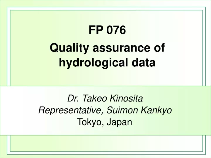
FP 076 Quality assurance of hydrological data. Dr. Takeo Kinosita Representative, Suimon Kankyo Tokyo, Japan. 1. Introduction.

E N D
FP 076Quality assurance of hydrological data Dr. Takeo Kinosita Representative, Suimon Kankyo Tokyo, Japan
1. Introduction The author already discussed about such problems2)3) particularly at the Steering Committee Meetings of Global Runoff Data Centre in Koblenz and International Association of Hydrological Sciences workshop at Sapporo in 2003.4)
2. Elements of hydrological observation The most important elements of hydrology, namely, precipitation, water level and discharge, are discussed in this report for water resources development and management.
Raingauge Photo 1 Raingauge in snowy area in Shirataki, Hokkaido
Photo 2 water gauge (Float type) in Gyotoku, Tottori
Photo 3Drift rod Photo 3 Drift rod
raingauge raingauge raingauge Fig.1 raingauge Various windshield
Photo 4 Field Calibration of the tipping bucket raingauge
not good signal telemeter raingauge logger good signal raingauge telemeter logger Fig.2 cable connection
Photo 5 Drained water frozen Raingauge, sensor frozen, Shimo-shiobara, Tochigi
Photo 6 Raingauge on the roof not preferable
(2) Staff gauge 2)Where a few staff gauges are set at the riverside, each staff should overlap 0.5m with both the upper staff and the lower staff like Photo 7. In many cases, this rule is forgotten.
Photo 7 Saff gauges, 0.5m overlapping,Kashima, Shizuoka
50cm 3) The highest staff must be set higher than the levee. Otherwise the extra-ordinary flood cannot be observed. If such a high water is observed, it will be perhaps selected as the design flood in the future.
reed switch magnet float Fig.3 Reed switch water gauge
(2) Low-water observation 2) In the coarse-grained riverbed, river water easily infiltrates into the ground. Contrarily, ground water naturally comes out if the water table is high. (3) High-water Observation
4. Data assurance Data processing is explained in the WMO Guide to Hydrological Practices.1) The Japanese hydrologists also decided data processing procedures by their own experiences.
4.1 Precipitation data Correlation A, B and C: names of stations good : high correlation bad: low correlation In this example, A maybe doubtful. Fig.4 Correlation detection
(2) The observed precipitation Ro, at the certain station must be compared with those at neighbouring stations, for the same period, which means a year, a month or a storm period. A two-dimensional linear estimation formula will be determined by these stations, where Re is the estimated precipitation, x and y are the coordinates and a, b and c are determined by precipitations observed at three neighbouring stations of which coordinates are known. If the difference between Ro and Re is less than the threshold, Ro is acceptable. The threshold is temporarily 30 of Ro.
(4) In order to discriminate an abnormal precipitation from the normals, it must be investigated whether the abnormal precipitation exceeds the sum of the average and three times of the standard deviation of the yearly maximum precipitation series. See Fig.5.
Occurrence of yearly maximum precipitation it seems abnormal average Precipitation 3×standard deviation Fig.5 criterion of “abnormal”
Fig.6 Left: Complicated precipitation contour lines, because including erroneous data. Right: Smooth precipitation contour lines, because erroneous data are removed.
4.2 Water level data (1) A sudden rise water level is suspicious. (2) A sudden fall is generally implausible. (3) A spike noise sometimes appears. (4) The value 0m must be distinguished from missing.
counter clockwise clockwise from the upstream from the downstream a flood a tidal wave H Q Q 4.3 Discharge data H Fig.7 Loops of the water-level discharge relation
H steady flow falling observed observed rising Q Fig.8 Surface gradient correction
(3) Outlier check based on uniform flow assumption A rating curve is formulated as Q=a (H+b)2 where Q is the discharge, H is the water level, a and b are determined by observed data. In the case of many observed data, the least square method can be applied to determine a and b. In the case of the outlier check, under the assumption of uniform flow and the steep river bank, a rating curve can be elongated within some range.11) a=V(1+p)2B2/(4A) H+b = 2R/(1+p) where V is the mean velocity over the observation section, p is the power of the uniform flow formula (p of Manning’s formula is 2/3), B is the width of the flow section, A is the flow area, R is the hydraulic radius.
H a rectangular channel a triangular channel Q Fig.9 Slight bent on H- Q relation
4.4. Discharge hydrograph (1) Correlation Qu(t)and Qd(t) respectively denote the upstream discharge and the downstream discharge at time t. Travel time of a flow between two stations is T. Supposing Qu(t-T) is measured on the abscissa and Qd(t) is on the ordinate, the plottings stand on a clear curve as shown in Fig.10. If any plotting is at a separate place, it perhaps is erroneous.
Fig.10 downstream discharge Qd(8) in the case of T=3 upstream discharge with the travel time. Discharge hydrograph correlation
(3)The peak of the downstream discharge C appears on the depletion curve of the upstream discharge, shown in Fig.11. If the peak C exists at the different place, the observation system must be carefully investigated.
discharge B C upstream E downstream F D A time Fig.11 Comparison of discharge hydrographs at the upstream and the downstream
Qu Qd Qu Qd Qu Qd Qd Qu discharge discharge good erroneous time time discharge discharge erroneous good time time Qu : upstream discharge Qd : downstream discharge
Assurance at observation sites is focused on a: a raingauge and circumstance, b:selection of water level station, a staff gauge and a recording gauge, and c:discharge observation reach, low-water observation and high-water observation. Data processing is also reviewed about precipitation, water level, a rating curve and comparison of hydrographs. 5. Conclusion
Acknowledgement The author would like to express hearty thanks to hydrological field observers who are working for accurate data acquisition both in hot sunshine season and in frozen winter.