Download
1 / 22
230 likes | 446 Vues
in 3D. Spatial & Terrain Analysis. Nigel Trodd Coventry University. Aim & objectives. To understand the application of 2D+ terrain analysis in GIS. to review methods of 2D spatial analysis to identify 1st and 2nd order derivatives of DEM data

E N D
in 3D Spatial & Terrain Analysis Nigel Trodd Coventry University
Aim & objectives • To understand the application of 2D+ terrain analysis in GIS • to review methods of 2D spatial analysis • to identify 1st and 2nd order derivatives of DEM data • to identify advanced methods of terrain analysis 3D … improves communication & interaction … is essential for environmental modelling … drives new methods of data capture & management
we should not rush these things without some basic spatialdatamodelling
dimensionality Entitation points, lines, areas volumes surfaces • 2D • 3D • 2.5D Data modelling geometry topology spatial concept not a problem 2D + above, below DEM, TIN, voxel
Measurement of inherent properties • simple geometric measurements associated with objects Point – none! Line - length, mid-point Area - perimeter, area, centroid, shape Surface – mean, min, max, range, variance Volume – volume, centroid
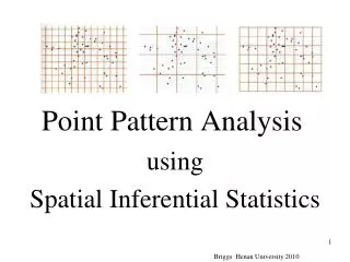
Spatial analysis in 2D
Definition of spatial analysis • A method of analysis is spatial if the results depend on the locations of the objects being analyzed e.g. • move the objects and the results change Or • the analysis modifies geometry or creates new geometry
Spatial operators Berry, J.K., 1987, Fundamental operations in computer-assisted map analysis, International Journal of GIS1 119-36. • Reclassifying maps • Overlaying maps • Proximity and connectivity • Characterizing neighbourhoods
Reclassify • Change or create a new entity using spatial properties Reclassify & then merge adjacent areas with the same attribute i.e. change geometry
Overlay analysis • Point in Polygon • Polygon on Polygon
Proximity analysis: buffering • Create a new area within a user-defined distance of an existing entity e.g., to determine areas impacted by a proposed highway
Contiguity analysis Which states share a border with Missouri?
Neighbourhood analysis • Local operators calculate an output value based on the values of nearby locations • Zonal operators • Focal operators • the area(s) of interest is defined by another data layer • the area of interest is defined by a user-specified moving window
Focal operators output at a location calculated from the values at locations in a window
Terrain analysis DEM visualisations DTM 1st order derivative 2nd order derivative in 2.5D
Terrain analysis watershed
Terrain analysis viewshed
Summary & Conclusion • 3D GIS is appealing - but rarely implemented • 2.5D is frequently implemented using a surface entity type • Terrain analysis in 2.5D exploits multiple visualisations of a DEM and its’ 1st and 2nd order derivatives • 2.5D products make useful inputs to environmental models • Much (most?) terrain analysis still relies on spatial operations in 2D