Download
1 / 18
180 likes | 335 Vues
Latin America. Unit 3. Physical Geography of Latin America Ch. 8. A Vast Region. Latin America is a vast region in the Western Hemisphere that covers almost 16 percent of the earth's surface and features varied landscapes

E N D
Latin America Unit 3
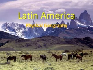
Physical Geography of Latin America Ch. 8
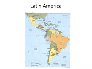
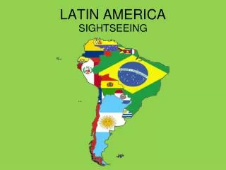
A Vast Region • Latin America is a vast region in the Western Hemisphere that covers almost 16 percent of the earth's surface and features varied landscapes • The name Latin America refers to the languages spoken in this region • Geographers divide the region in to 3 areas • Middle America • The Caribbean • South America
The Land The region's location along the Ring of Fire has had a tremendous influence on the landscape. Latin America's diverse physical geography features extensive mountain ranges, broad highlands, coastal lowlands, grassy plains, and volcanic islands • Mountains & Plateaus • Mountains of Mexico, Central America, & the Caribbean • Sierra Madre, & the Central Highlands, many of the Caribbean islands are part of the Central Highlands • Andes: Runs along the western edge of S. America. • Worlds longest mountain range. The parallel ranges in the Andes are called cordilleras • Highlands of Brazil • Much of Brazil consists of high plateaus (Mata Grosso & the Brazilian Highlands
The Land • Water Systems • The region's water systems, especially its huge rivers, are important for transportation, agriculture, and human settlement. • Rivers • Navigable rivers such as the Amazon serve as transportation routes and provide hydroelectric power • Lakes • Latin America has few large lakes • Lake Titicaca in the Andes is the worlds highest navigable river
Natural Resources • Minerals, forests, farmland, and water are major natural resources throughout the region • Not all countries, however, benefit equally due to geographic, political, or economic difficulties • Orinoco River (Venezuela) contains 11% of the worlds gold • Brazil is also rich in gold • Peru & Mexico are known for their silver • Chile is the worlds leader in copper exports
Climate & Vegetation Regions • Tropical Regions • Much of Latin America lies between the Tropic of Cancer and the Tropic of Capricorn, resulting in tropical rain forest, tropical savanna, and humid subtropical climates with hot temperatures and heavy rainfall • The Rain Forest • The Amazon Basin is the earth’s largest rain forest • Covers 1/3 of S. America • Desert & Steppe • Smaller areas of desert and steppe climates receive less rainfall • Atacama Desert: created by the rain shadow effect of the Andes
Elevation & Climate • The climates of Latin America are more affected by elevation than latitude. • Differences in elevation create three vertical climate zones that affect agriculture and settlement • The vertical zones are: • The tierra caliente (hot zone) extends to an upper limit of 3,300 feet. Most of this zone is in the coastal and eastern lowlands. • The tierra templada (temperate zone), ranging from 3,300 to 6,500 feet , extends over some inter-mountan basins, valleys, and slopes of the Andes. • The tierra fria (cool zone), from 6,500 to 10,000 feet, is a climatic zone of most of the basins and densely inhabited valleys of the mountain region • the temperate zone being the most heavily populated.
The End!