Download
1 / 25
250 likes | 653 Vues
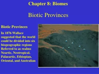
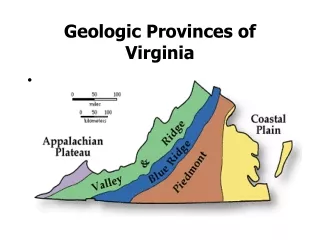
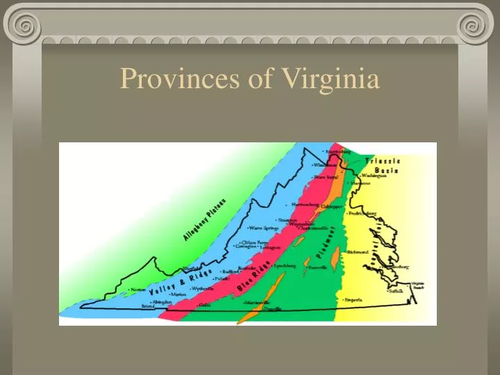
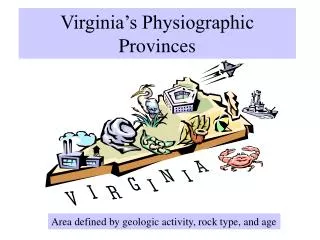
Provinces of Virginia. Differences Among Provinces. Physiography : landforms change and the countryside has a different appearance Rock Type : igneous, sedimentary and/or metamorphic Rock Structure : flat or folded & faulted Geologic Ages of the rocks. Coastal Plain. Location

E N D
Differences Among Provinces • Physiography: landforms change and the countryside has a different appearance • Rock Type: igneous, sedimentary and/or metamorphic • Rock Structure: flat or folded & faulted • Geologic Ages of the rocks
Coastal Plain • Location • from Atlantic Ocean on east to fall line at west • continues underwater to continental slope • Physiography • Flat & often marshy • Low slopes, barrier islands & salt marshes
Coastal Plain • Rock Type: Sedimentary • Layered by sediments left when area was flooded & by sediments eroded from Appalachian Mtns • transgression: when sea level rises & floods the land • regression: when sea level drops, exposing the land • All sedimentary rocks at surface • Many oceanic fossils Oblique aerial view of Passmore Creek and marsh, Jamestown Island, James City County
Structure Fairly low-relief, but dips slightly toward ocean Geologic Age Youngest of VA provinces Started forming when Atlantic Ocean opened in late Triassic Coastal Plain
Coastal Plain Fossils Whale fossil from MioceneEastover Fm., New Kent County Common seashell fossils
Coastal Plain – Chesapeake Bay • The Chesapeake Bay was created about 5000 to 6000 years ago when the area was flooded as meltwater from glaciers raised sea level. Continuing sea level rise and shoreline erosion caused the bay to grow further.
Piedmont • Location • from fall line at east to mountains (Blue Ridge province) on west • Physiography • Outer Piedmont (Eastern) • gently rolling upland • erosion flattened the surface of the folded bedrock beneath • Inner Piedmont (Western) • rugged terrain • erosion hasn’t smoothed the folded metamorphic rock • small broken belt of mountains
Piedmont • Rock Type: Metamorphic • Metamorphic rocks (from Precambrian) folded during the Paleozoic when North America and Africa hit • Igneous intrusions (granite & basalt) from rifting when Pangaea broke apart • Soil at surface is red & clayey from oxidation of rocks below Montpelier anorthosite exposed in the Virginia Piedmont
Structure Deeply weathered folded bedrock More resistant outcrops are seen nearer the Blue Ridge Scattered old volcanic arcs, faults & intrusions Geologic Age late Proterozoic through Paleozoic Piedmont
Piedmont Resources Virginia Slate(above) and Gold (below) Dinosaur footprint (left) found in Culpeper Basin sandstone quarry, above
Blue Ridge • Location • thin province • extending from Piedmont to east, Valley & Ridge to west • Physiography • Average height of area ~3000ft above sea level • VA’s two highest peaks in southwest corner of Blue Ridge
Blue Ridge • Rock Type: Igneous & Metamorphic • Complexly folded & faulted granite & metamorphic rock dating from Precambrian age – original North American basement rock (Grenville) • Thrust upward during collision between N Amer & Africa in late Paleozoic The northern Blue Ridge of Virginia, as seen from Shenandoah National Park
Structure Folded & faulted Steep mountains, high relief Geologic Age Mid-Proterozoic through Cambrian Blue Ridge
Blue Ridge Resources Beautiful views which draw tourists Catoctin Greenstone – Skyline Drive
Valley & Ridge • Location • Extends from Blue Ridge to east, Appalachian Plateau to west • Physiography • Folded mountains, which have been eroded leaving valleys & ridges
Valley & Ridge • Rock Type: Sedimentary • Thick folded sedimentary rock deposited during Paleozoic • Resistant sandstone caps the ridges; limestone is eroded to form valleys (differential erosion)
Structure Folded bedrock Steep mountains, high relief Geologic Age Paleozoic Valley & Ridge
Valley & Ridge Resources Well-developed Karst topography Luray Caverns
Appalachian Plateau • Location • Smallest, southwestern corner of Virginia • Continues into WV • Physiography • High plateau • Somewhat flat, but eroded by many rivers
Appalachian Plateau • Rock Type: Sedimentary • Thick folded sedimentary rock deposited during Paleozoic • Deeply cut by many rivers
Structure Similar rocks to Valley & Ridge, but weren’t folded – still horizontal Geologic Age Pennsylvanian (late Paleozoic) Appalachian Plateau
Appalachian Plateau Resources Coal seams exposed along Keen Mountain, Buchanan County. Each seam is approximately 0.5 m. Petroleum
Bibliography • http://www.wm.edu/geology/virginia/ • http://www.baydreaming.com/images/baymap.gif • http://www.cliffsnaturalstone.net/Wallston%20Template.htm • www.ldeo.columbia.edu • http://pubs.usgs.gov/of/2002/of02-437/image_files/photogallery/frd-s32_l.jpg • http://www.terragalleria.com/america/south-east/virginia/picture.usnc4107.html • http://www.pineyhillbandb.com/attractions.html • http://content.answers.com/main/content/wp/en-commons/thumb/9/9c/500px-Virginia_topographic.jpg • http://www.mme.state.va.us/Dmr/PUB/Brochures/gold.html


![The Provinces of Canada: [PROVINCE]](https://cdn3.slideserve.com/6922446/the-provinces-of-canada-province-dt.jpg)