Download
1 / 26
280 likes | 441 Vues
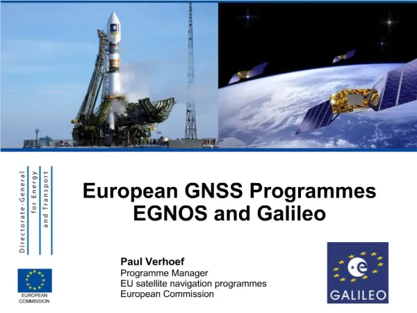
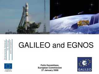
Galileo and EGNOS for the road Transport. November 2008 European Commission – TREN G4. Galileo satellite navigation. EGNOS and Galileo Status and services Road Applications. GALILEO and EGNOS. GPS is well known

E N D
Galileo and EGNOS for the road Transport November 2008 European Commission – TREN G4
Galileo satellite navigation • EGNOS and Galileo • Status and services • Road Applications
GALILEO and EGNOS • GPS is well known • EGNOS : GPS signal + corrections computed by ground stations and broadcasted by two satellites • Already OPERATIONAL • GALILEO : 30 new satellites independent from GPS
Positioning accuracy GPS GPS + EGNOS GPS + EGNOS + GALILEO Note: single frequency user, error in meters.
EGNOS coverage Accuracy : depending on the conditions, 1 to 5m standard performance Most ranges of receivers have currently EGNOS enabled products
Open Service Free to air; Mass market; Simple positioning; free of charge Commercial High accuracy; Encrypted;Professional guaranteed service Navigation Safety of Life (Aviation) Open Service + Integrity and Authentication of signal EGNOS : 3 services
EGNOS : Key messages for road clients • It is operational • Better accuracy than GPS • Covers all Europe • Free of charge for ever • Receivers available
Galileo a set of services • Open Access • Free of charge; free to air; Mass market; Simple positioning • Commercial • Encrypted; High accuracy; Guaranteed service • Safety of Life • Integrity; Authentication of signal (Aviation) • Search and Rescue • Near real-time; Precise; Return link feasible • (Maritime) • Public Regulated • Encrypted; Integrity; Continuous availability • (Administrations, security, military)
Galileo Status • Experimental Sat. • 2 satellites launched , frequencies and clocks • In Orbit Validation (IOV) • 4 satellites, expected 2010 • Full Operational Capacity (FOC) • 30 satellites • Expected 2013 • cost 3.4 b€ - funded by the 27 Member states of the European Union • Management by EC and ESA • Programme relaunched end November 2007
Galileo status • Decision of the Council and the Parliament to relaunch the programme in November 2007 • Budget of 3.4 b€ formally allocated by the Council decision of July 2008 • Procurement process for the system segments currently running : • Satellites • Ground stations • system
A universe of services and applications Road transport Recreation Location based services (LBS) Agriculture, fisheries etc… . Aviation Rail transport Public services Maritime transport
GNSS Market • 236 B€ foreseen as world wide market for equipment and services in 2025 • 75 % for LBS • 20 % for Road ITS • 5 % for all the other domains together…
Mobile Phone and LBS Market • In 2006, worldwide market • 2 billion subscribers • 500 million units sold • applications foreseen : • Leisure and entertainment • Traveler information • E-health • Disabilities • Emergency calls • Surveillance • …
Agriculture • Land Parcels Monitoring • Cadaster • In EU: 3 millions km2 • 3.5 million farmers • 50 million agricultural parcels • 5% field inspection with • sat. nav. receivers
Justice & home affairs • Offenders & Asylum seekers • Electronicdevices attached to offenders • Alerts when allowed perimeters are broken • Cut prison overcrowding • Emergency Services • Help emergency team operations • Provide route guidance in difficult terrains • Civil protection • Define and apply keep-away zones • Identify location to drop material • Police forces • Police fleet monitoring • Fight against piracy • Vehicule and individual traking and tracing
Road Market 1. Road Tolling 2004: 650 millions vehicles worldwide 160 millions vehicles in Europe 2004: in Europe 2 millions car navigation devices Vehicles in the EU : Cars 73% Light Commercial Vehicles 23% Trucks 3% National tolling system currently working with GPS in Germany since 2003
Road Market 1. Road Tolling • Currently Toll Collect in Germany • France soon for trucks ? • The Netherlands for all vehicles ? • Road Tolling EU Directive • 2004/52/CE, April 2004 • recommends use of satellite • navigation technologies • eCall initiative, based on E112
Road Market 1. Road Tolling • Galileo / Egnos can bring : • Better accuracy • Better availability of the signal • Authentication to avoid spoofing • Service guarantee • ALL receivers will use two or more constellations : • Galileo + GPS • Galileo + Compass • Galileo + Glonass thus improving their performance
Road Transport2. Navigation and fleet management • Applications already operational • Same improvement as for road tolling
Road Transport 3. Animal Transport • 1 million animals are brought to slaughterhouses every day • Regulation 1/2005 of 22/12/2004 • imposes the use of satellite navigation receivers • Very ambitious: • all new transporters by January 2007 • all transporters by January 2009 • For the protection of animals during transport and related operations
Road Transport 4. Dangerous Goods • Nine classes • Set of Safety requirements (+security) • Legal framework • Nuclear material • Main goal: protection • Methods: containment, prevention, storage, etc. Satellite navigation tracking: position, date and time, speed, course, respect of pre-defined path, excluded zones, faster emergency operations, etc.
Road Transport 5. Monitoring of coaches • To avoid this : • Monitoring of the itinerary • Real time Access control • Monitoring the driving conditions • Real time info service + automatic eCall for emergency situations
6. ADAS(advanced driver assistance systems) • Safety critical application • Needs total reliability and very high accuracy (up to 10 cm) • Galileo required with service guarantee • First elements start on implementation • To be on the market around 2020
Construction & Engineering • Structural monitoring • Road construction • compactors, • pavers • Bulldozers, • etc. • Substantial savings • in raw material (5-10%) • in construction time • in safety of operations
Galileo http://europa.eu.int/comm/dgs/energy_transport/galileo/index_en.htm