Download

1 / 18
180 likes | 296 Vues
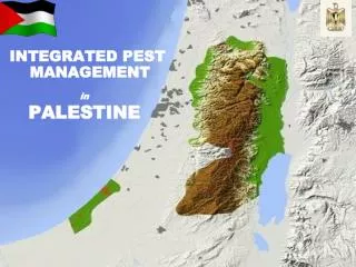
Integrated Data Management. Desert Activities. Desert Tortoise Line Distance Sampling Open Dump database USFWS Wetlands/Riparian area inventory Regional firefighting data Alternative Futures studies Decision Support System/Architecture development

E N D
Integrated Data Management
Desert Activities • Desert Tortoise Line Distance Sampling • Open Dump database • USFWS Wetlands/Riparian area inventory • Regional firefighting data • Alternative Futures studies • Decision Support System/Architecture • development • NPS Desert Park Cluster monitoring • BLM rangeland health monitoring • Regional water resource studies • BLM, DOD, NPS, state planning activities
Why Data Management • Maximize use of existing data • Synthesize data to get proper perspective • Reduce conflict/disagreement • Promote more consistent decisions
MDEP Data Management Vision Share scientific data to facilitate data driven land management decision making by managers throughout the ecoregion.
Goal The goal is to develop and implement an Internet - accessible database, of land management information, that would facilitate data collection, storage, transfer, and analysis by all entities with natural and cultural resource management responsibilities.
Objectives • Develop collaboration among all agencies • Focus limited resources and eliminate duplication • of effort among all participants • Design and develop a spatial data • clearinghouse accessible via the Internet
Functionality • Data Access • Data distribution • Data repository
Functionality • Data Access • Data distribution • Data repository • Online Data Interaction • Data visualization at multiple scales • Dynamically add or subtract data
Functionality • Data Access • Data distribution • Data repository • Online Data Interaction • Data visualization at multiple scales • Dynamically add or subtract data • Spatial Bibliography
Functionality • Data Access • Data distribution • Data repository • Online Data Interaction • Data visualization at multiple scales • Dynamically add or subtract data • Spatial Bibliography • Other Databases
Basic cartographic data Boundaries (ownership, special use areas, tng areas, rec. areas) Roads Trails Streams Imagery Flight routes Camp grounds Visitor centers Mines Railroads Airports Landing strips Utilitiy lines DEM Slope Aspect • Weather data • Water quality data • Geologic data • Soils data MDEP Data Needs • Vegetation data • Species lists and distribution data for vertebrates and vascular plants • Water body location and classification • Air quality data (include location of monitoring stations)
Integrated Data Management