Download
1 / 29
300 likes | 481 Vues
ENSO Prediction and Policy. Why Predict ENSO? How do we predict ENSO? Why is it possible ? What information do predictions offer? What to do with this information? An on-the-ground policy application…. Why does ENSO State tend to Oscillate?. Equatorial ocean dynamics

E N D
ENSO Prediction and Policy • Why Predict ENSO? • How do we predict ENSO? • Why is it possible ? • What information do predictions offer? • What to do with this information? • An on-the-ground policy application…
Why does ENSO State tend to Oscillate? Equatorial ocean dynamics Key observations by Klaus Wyrtki in 1970’s El Nino is preceded by a transfer of warm water from west to east This transfer is thought to trigger a warm event What triggers the movement of water? • In cold phase, waters cold (and low) in east, warm (and high) in west • Warm water from west sloshes back and overshoots equilibrium- positive feedbacks mentioned before set of El Niño conditions
Why does ENSO State tend to Oscillate? Shortest Answer: Equatorial ocean dynamics Short answer: Differing timescales of Kelvin and Rossby Wave propagation Longer answer: The oscillation is made possible due to the asymmetry between eastward and westward oceanic motions (see 2-D Animation in notes). Along the equator there is a relatively fast eastward motion called an equatorial Kelvin wave. Peaking somewhat off the equator are westward motions called Rossby waves. Time scale: <1 yr for the Kelvin waves to shift the warm pool eastward [once trades relax]; 2 yrs for the Rossby waves to return the warm pool to the west, to await another wind relax. Kelvin Rossby
Here is a 3-D animation the tropical Pacific as it cycles through an El Niño then La Niña event. The surface shown is sea-level (in cm) and the surface is colored according to the SST anomalies associated with each event.
Normal Conditions in the tropical Pacific Sea level pressure Sea surface temperatures Trade winds Walker circulation Equatorial upwelling Thermocline depth Sea surface height Tropical rainfall patterns
El Niño Conditions Sea level pressure Sea surface temperatures Trade winds Walker circulation Equatorial upwelling Thermocline depth Sea surface height Tropical rainfall patterns
La Niña Conditions Sea level pressure Sea surface temperatures Trade winds Walker circulation Equatorial upwelling Thermocline depth Sea surface height Tropical rainfall patterns
What’s going to happen? Forecasts courtesy of IRI (Lamont-Doherty)
Societal impact of ENSO in the news Indonesia Flooding Hawaii Drought 2010 news…
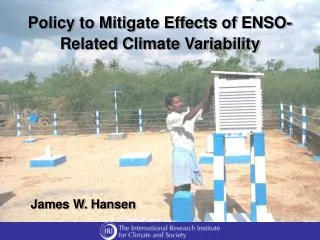
How ENSO impacts people Effective management of climate related risks (opportunities) for improved: • Agricultural production • Stocking, cropping calendar, crop selection, irrigation, insurance, livestock/trade • Water resource management • Dynamic reservoir operation, power generation, pricing/insurance • Food security • Local, provincial, regional scales • Public health • Warning, vaccine supply/distribution, surveillance measures,… • Natural resource management • Forests/fire, fisheries, water/air quality • Infrastructure development
Malaria and Rainfall The disease is highly seasonal and follows the rainy season with a lag of about 2 months
ENSO and Zimbabwe corn yield - ENSO +
Predictions and Policy Snapshots of current conditions are not very useful. People need advance warning, and for their region. Today: 1) how predictions are made 2) what we can do with them
ENSO Prediction Methods • Skillful 6-9 months into the future • This ability has saved many millions of lives • Two methods: Dynamical vs. Statistical
El Niño Forecasting Stephen E. Zebiak Senior Research Scientist International Research Institute for Climate Prediction Mark Cane DEES Vetlesen Professor
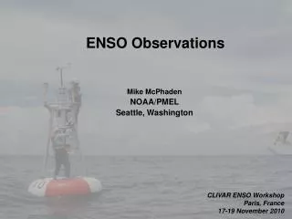
ARGO floats XBT (eXpandable BathiThermograph) Moorings Satellite SST Sea Level Real Time Ocean Observations M.A. Balmaseda ( ECMWF)
TOGA TAO mooring array M.A. Balmaseda ( ECMWF)
Tropopause SSTA Simplified Ocean and Atmosphere Models 50 m 150 m Active layer Deep ocean; u=v=w=0 Surface layer Simplified form of equations for conservation of mass, momentum, energy
Forecast Initialization Procedures Ocean simulation Atmos. simulation Winds, Heat fluxes Ocean obs. Atmos. obs. SST forcing Data assimilation Ocean analysis Atmos. analysis t t + t t t + t Initial Conditions, t=t0 Ocean model Atmosphere model FORECAST
Modeling gives you skill at forecasting: Better skill after 3-4 months than “persistence” Skillful up to 9 months into future
How to predict? Forecasts courtesy of IRI (Lamont-Doherty)
How is forecasting possible? The tropical ocean-atmosphere system is coupled. Models are initialized with real observations The system has persistence (“memory”)