Download
1 / 50
510 likes | 637 Vues
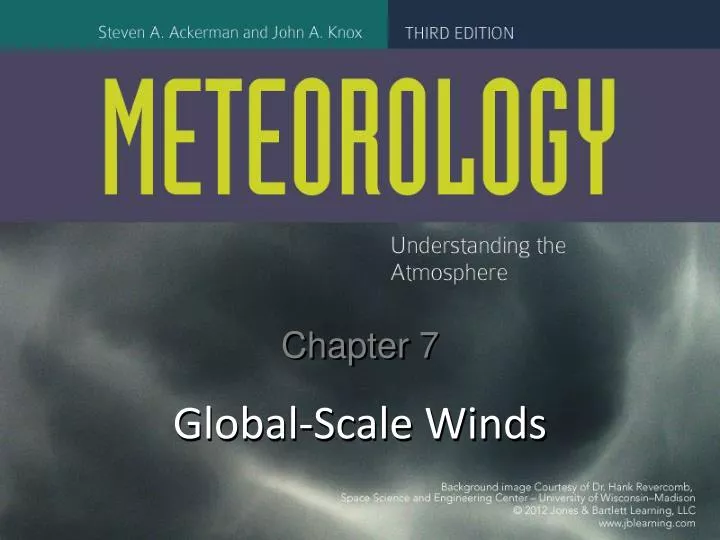
Chapter 7. Global-Scale Winds. Figure CO: Chapter 7, Global-Scale Winds--Jet stream from space. Image courtesy of the Image Science & Analysis Laboratory, NASA Johnson Space Center. Sailors Understood Global Winds.

E N D
Chapter 7 Global-Scale Winds
Figure CO: Chapter 7, Global-Scale Winds--Jet stream from space Image courtesy of the Image Science & Analysis Laboratory, NASA Johnson Space Center.
Sailors Understood Global Winds • Trade winds off the Atlantic coast of North Africa blow steadily from the northeast • Farther north along the coast of Europe the winds typically blow from west to east • At about 20°S the trade winds blow steadily from the southeast • Winds in the horse latitudes (near 30°N and 30°S) are usually light or calm
What a description of global winds should explain • Steady and calm winds observed by mariners • Seasonal patterns of precipitation around the world • Seasonal patterns of cloudiness around the world • The relationships between average wind patterns and pressure patterns and upward and downward air motions • The jet streams
Figure 05A: Climatology of precipitation (January). Source: MATLAB
Figure 05B: Climatology of precipitation (July). Source: MATLAB
Are very complicated because of the changing seasons, differences between land and water, and differences in latitude. Can be simplified using a conceptual model. Have been described using a 3-cell model with no land and no seasons. Only temperature differences from equator to pole are included. The surface winds over Earth
The Conceptual Model • Begins with cloud band that nearly encircles the tropics • These convective clouds are nearly always present and require upward motion • Rising air explains cloudiness and precipitation in the tropics • Aloft, the rising air spreads out to the north and south, and the Coriolis force deflects it towards the east
Figure 09: Satellite image of subtropical jet stream clouds. Courtesy of CIMSS, University of Wisconsin-Madison
The Conceptual Model Continues Aloft • The air aloft accelerates as it approaches 30° latitude and forms the west-to-east subtropical jet stream • Converging air near latitude 30° sinks toward the surface where there is a region of high pressure, light winds, and a minimum of cloudiness and precipitation • The subsiding air spreads out to the north and south
The Conceptual Model Continues at the Surface • Air flowing towards the equator near the surface away from the region of high pressure and light winds is deflected by the Coriolis Force • This air becomes the trade winds • The trade winds of the NH and SH come together in the Intertropical Convergence Zone (ITCZ) • This circulation is called the Hadley cell • The ITCZ is also known as the doldrums, for the light winds often observed there
Figure B01A: Full-disk satellite image with labels Courtesy of SSEC and CIMSS, University of Wisconsin-Madison
Figure 10: Satellite image of clouds in equatorial Pacific Courtesy of Earth Observatory/NASA
The Conceptual Model near the Poles • At the poles more energy is lost to space than gained from the sun • The air there cools and sinks, warming adiabatically and creating an inversion that inhibits cloudiness and precipitation • At the ground, the sinking air moves outward from the poles, is deflected by the Coriolis force, and becomes the polar easterlies • Eventually the air rises to complete the circulation of the polar cell
The Conceptual Model in Mid Latitudes • On the poleward sides of the descending branches of the Hadley cells, surface air moves poleward • The Coriolis forces deflects this air to form the midlatitudewesterlies • The midlatitudewesterlies encounter the polar easterlies at about latitude 60°, a clash of air masses called the polar front • The temperature gradient causes the westerly polar front jet
Figure 7.11ab: Sea-level pressure maps for a typical January and July
Figure 7.13: The approximate positions of the polar front jet stream and the subtropical jet stream over the Northern Hemisphere during winter. Modified from S. Lee and H.-K. Kim, J. Atmos. Sci 60 [2003]: 1490–1503.
Upper-Air Midlatitude Westerlies • The jet streams meander like rivers, producing a wave-like pattern of troughs and ridges • The air flow through these waves results in storms that move warm air poleward and cold air toward the equator. • Each trough-ridge pattern is called a Rossby wave • Rossby waves drift slowly eastward, with rising air near the troughs and sinking air near the ridges
Waves • Waves are described by their wavelength (distance between successive troughs or ridges) and amplitude (north-south extent) • Amplitude and wavelength determine the type of weather associated with the waves
When the waves are small, and the ridges and troughs are weak, the pattern is called zonal, or high index, meaning roughly west to east at constant latitude. When the waves have greater amplitude (north-south dimension), the pattern is called meridional, or low index, meaning that there is a lot of north/south motion. Names for Upper-level Wind Patterns
Sometimes there is zonal flow at high latitudes and meridional flow at low latitudes. This is a split-flow pattern. Sometimes persistent closed highs and lows form in a split-flow pattern when the meridional pattern is extremely meridional. This is called a blocking pattern, because it can be extremely persistent. More about upper-level patterns
Figure 7.16: Normal (a) and “blocking” (b) wind patterns above North America in summer Modified from “Written in the Winds: The Great Drought of ’88.” J. Namias, Weatherwise, Jan. 4 1989, vol. 42, pp. 85–87. Reprinted by permission of the publisher [Taylor & Francis Group, http://www.informaworld.com]
Blocking highs can lead to drought conditions and prolonged heat waves. Meridional flow accomplishes poleward energy transport that helps balance the energy balance of the Earth and atmosphere. Implications of Upper-level Winds
Figure 17a: (a) Anomalies in 500-mb heights in the vicinity of North America during December 2009 to February 2010. Courtesy of ESRL Physical Science Division/NOAA.
Figure 17b: Actual 500-mb heights in the vicinity of North America during December 2009 to February 2010. Courtesy of ESRL Physical Science Division/NOAA.
Shorter waves move eastward faster than the longer Rossby waves. Waves of different length can add and subtract to/from one another’s amplitude. Forecasting waves in the westerlies aloft is vital for everyday weather forecasting. El Niño/La Niña affect the westerlies aloft. More about Waves in the Westerlies Aloft
The Poleward Transport of Energy • The poleward transport of energy is a feature of the conceptual model • Without this transport of energy the poles would be much colder and the tropics much warmer • Poleward energy transport is accomplished by both the atmosphere and the oceans • The region of maximum energy transport lies between latitudes 30° and 60°
The ITCZ, the subtropical highs, and the polar front all shift southward in NH winter and northward in NH summer. Seasonal shifts are most intense over Asia, which has the largest continental air mass. The summer monsoon is wet, with low pressure over land; the winter monsoon is dry, with high pressure over land. Seasonal Shifts and Monsoons
More Seasonal Shifts • The polar jet stream is displaced further poleward in summer than in winter • During summer the positions of the subtropical highs shift poleward • The polar jet stream is weaker in summer • The subtropical jet stream is weaker in summer • Lows associated with the ITCZ shift seasonally as do the lows associated with the polar front
Thermal Lows • Lows associated with deserts are called heat lows or thermal lows • They develop because of intense surface heating • They develop at about the same latitude as the subtropical highs • They occur in the southwest U.S. in summer, and the vicinity of Iraq
Monsoons • Monsoons are weather features driven by seasonal differences in the heating of land and ocean along with seasonal shifts in global-scale circulations. • Monsoons are not present in the three-cell model • Indian summer monsoon has cooler air over water, heated air over land, upslope onshore wind and generation of clouds and precipitation—wet season • Indian summer monsoon has return flow aloft from land to water and sinking air over the Arabian Sea and the Bay of Bengal
The Winter Monsoon • During autumn and winter, air above land cools faster than over the water, establishing a PGF from land to water. • The winds are reversed from the summer monsoon flow—at the surface from land to sea • Sinking air above the land suppresses cloud development and precipitation. • Winter monsoon is a dry season
Unsolved Problems for Research • What determines the location of the ITCZ? • The ITCZ has been moving northward at a rate of about 1.4 km per year. • What controls the poleward extent of the Hadley cell? • What causes the summertime subtropical highs in the Northern Hemisphere? • Why is it that the subtropical highs of the Northern Hemisphere are strongest when the sinking branch of the Hadley cell is at its weakest? • What controls the locations of the jet streams?
Figure 23: Computer simulations of the location of the polar and subtropical jet streams for varying amounts of tropical convection. Modified from S. Lee and H.-K. Kim, J. Atmos. Sci. 60 [2003]: 1490–1503.