Download
1 / 10
110 likes | 265 Vues
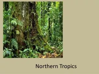
Northern Shoshone. By: Meera Sundar, Niyati Shah, Kaity Fairbanks, and Julie Sun. Location. “The Great Basin includes parts of: Idaho Oregon Wyoming Colorado California Arizona Nevada Utah. Climate. The average annual temperature of the Great Basin is 64.4 degrees F (18 degrees C).

E N D
Northern Shoshone By: Meera Sundar, Niyati Shah, Kaity Fairbanks, and Julie Sun
Location • “The Great Basin includes parts of: • Idaho • Oregon • Wyoming • Colorado • California • Arizona • Nevada • Utah
Climate • The average annual temperature of the Great Basin is 64.4 degrees F (18 degrees C). • The Great Basin National Park has various temperatures throughout the year. • For example, these are some of the temperatures: • July, which has the highest average temperatures: • Average Maximum: 86 degrees F (30 degrees C). • Average Minimum: 57 degrees F (14 degrees C). • January, which has the lowest average temperatures: • Average Maximum: 41 degrees F (5 degrees C) • Average Minimum: 18 degrees F (-8 degrees C) • The Great Basin is semi – arid.
There is no water surplus because of the climate. • There is more evaporation than precipitation in the Great Basin, which means that there is not much water there. • In the Great Basin National Park, precipitation is very low. • The average amount of precipitation out the 12 month: • The most is 1.4 inches during March • The least is 0.9 inches, and that is during the months of January, June, July , and September.
Beadwork • Beadwork is the best-known form of art from the Wind Rivers • The materials, colors, symbolism, and etc reflects the environment of the person who beaded it • The purpose of beadwork was to decorate • Traditional beadwork includes buckskin dresses, moccasins, traditional pouches and teepee storage bags, leggings, and etc • Earliest examples are found on clothing and moccasins
Bibliography • “Great Basin.” Utah History to Go. State of Utah, n.d. Web. 18 Aug. 2012. (http://historytogo.utah.gov/utah_chapters/the_land/greatbasin.html) • “Weather” National Park Service. National Park Service, U.S. Department of the Interior, 15 Jul. 2012. Web. 19 Aug. 2012. (http://www.nps.gov/grba/planyourvisit/weather.htm) • Jose Arredondo. “The Great Basin Culture Area.” Map. Chicano Studies 125. Jose Arredondo, n.d. Web. 18 Aug. 2012. (http://www.sscnet.ucla.edu/chavez/hinojosa/chicano125/map_15.html)