Download
1 / 13
130 likes | 260 Vues
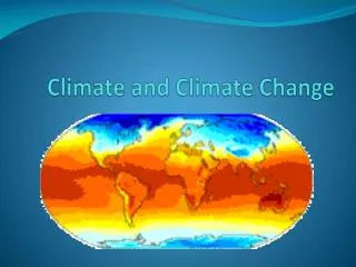
Climate, Change and Flood Planning. CCTAG April 2013. Talk Overview. Flood Planning Overview Atmospheric Rivers Past, Present, and Future The Climate Change Design Storm Framework. Flood Planning. Plan to designated threshold stage or flow

E N D
Climate, Change and Flood Planning CCTAG April 2013
Talk Overview • Flood Planning Overview • Atmospheric Rivers Past, Present, and Future • The Climate Change Design Storm Framework
Flood Planning • Plan to designated threshold stage or flow • Designation linked to return period (e.g. 100-year flood) • Bulletin 17-B Guidelines provide means to statistically estimate peak stream flow and volume associated with a given duration (e.g. 3-day volume) • Methods only consider historical data
Year to Year Precipitation Variability California precipitation is uniquely variable Std Dev of Annual Precipitation Mean Annual Precipitation Dettinger et al, 2011
Determining Flood Adaptation Capacity • Top-down approaches not workable for flood management at this time Source: Dessai and Hulme, 2003
The Storm of 4-5 Jan 2008 6-10 ft snow ~500 miles 32 ft waves 7-13 in rain Atmospheric river Note that major impacts were focused >500 miles south of the Low pressure center in this storm. This differs significantly from hurricanes, but the impacts are enormous and spread over a large area L Many major impacts are associated with the landfall of the “atmospheric river” element of the storm, the precise characteristics of which are not operationally monitored offshore or onshore. • GOES IR image of major West Coast storm • Time = 0030 UTC 5 January 2008 • Low pressure center is off WA coast Adapted from M. Ralph
Flux Magnitude and Duration are Key Adapted from M. Ralph
Flooding & water supply Cyclogensis Storm Track changes L Atmospheric River MJO/Tropical Convection ENSO Easterly Wave Key Phenomena Affecting California Water Supply/Flooding: The most extreme CA storm would result from a rare alignment of key processes acting on different space and time scales Adapted from M. Ralph
Building a Framework for Climate Change and Design Floods • Central Valley Hydrology Study (USACE) • Climate Variability Sensitivity Study (USACE) • Atmospheric River Characteristics Study (Scripps) • Watershed Controls on Extreme Precipitation Study (UC Davis) • 21st Century Extreme Precipitation Monitoring Network (DWR/NOAA ESRL/Scripps)
Goal: Design storm that can accommodate climate change Existing USACE Methods Present and Future Conditions Atmospheric River Event (ARE) - moisture flux - duration - freezing elevation - direction Flood Hydrograph -peak -volume -critical duration Design Rainfall Event -volume and peak -duration -spatial distribution Sierra Barrier Jet Characteristics • Watershed Controls • orographic enhancement distribution • antecedent conditions • snow line • basin wetness Flood Management Infrastructure Evaluation