Download
1 / 32
320 likes | 541 Vues
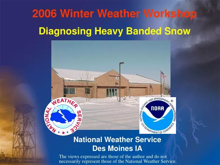
2006 Winter Weather Workshop. Diagnosing Heavy Banded Snow. National Weather Service Des Moines IA. The views expressed are those of the author and do not necessarily represent those of the National Weather Service.

E N D
2006 Winter Weather Workshop Diagnosing Heavy Banded Snow National Weather Service Des Moines IA The views expressed are those of the author and do not necessarily represent those of the National Weather Service.
Precipitation Band Definition--an elongated region of accumulated banded precipitation-an instantaneous radar feature which may or may not result in a banded accumulation • Banding results from mechanisms that organize lift or moisture into narrow regions(Comet,2005) • Ingredients for Mesoscale banded snow (Banacos, 2003)
Frontogenesis defined • (in general terms) refers to the change in the magnitude and orientation of the temperature gradient at a level or in a layer (e.g., 850-700 mb) due to directional and speed changes in the wind field. • (in specific terms) refers to an increase in the • horizontal thermal gradient with time. F > 0 frontogenesis, F < 0 frontolysis (Funk, 2004)
Vector Frontogenesis Function The F vector is the full wind version of the quasigeostrophic Q vector. It can be broken down into 2 components (natural coordinates): Fn and Fs. Fn: -Frontogenetical (dominant) component of F -Directed perpendicular to temperature lines -Refers to changes in magnitude of thermal gradient -Corresponds to vertical motion on the frontal scale (mesoscale bands) Fs: -Rotational component of F -Directed parallel to isotherms/thicknesses -Refers to changes in direction (orientation) of thermal gradient with no magnitude change -Corresponds to synoptic-scale vertical motion on the scale of the baroclinic wave itself (Funk, 2004)
Common Synoptic Patterns for F to act Strong Surface Cyclone Conceptual Model (Moore, 2003)
Weak Surface Cyclone / Stationary Front Conceptual Model (Moore, 2003)
Forecast premise for mesoscale banding: • Does NOT require a strong surface cyclone, only a low-mid tropospheric baroclinic zone • Requires a strengthening baroclinic zone in the presence of sufficient moisture for precipitation (AND – for snow, the proper thermal stratification). • Large-scale deformation zones are BY FAR AND AWAY the most common means of manifesting areas of frontogenesis within the 850-500mb layer. (Banacos, 2003)
Use of Frontogenesis in Forecasting • Presence of F in 850-500mb layer can help diagnose and predict areas of heavy banded precipitation. • Potential for banding can be assessed using F field in numerical models, with placement of banding refined in <12 hour period. • New graphic forecast tools allow location of banded precipitation to be conveyed to the user. (Banacos, 2003)
Horizontal Convergence • Convergence (Divergence) acts frontogenetically (frontolytically), always, irrespective of isotherm orientation. F<0 (Banacos, 2003)
Horizontal Deformation Flow fields involving deformation acting frontogenetically are prominent in the majority of banded precipitation cases. F>0 (Banacos, 2003)
Dynamics of Frontogenesis (vertical circulation) Flow field dominated by deformation. (Banacos, 2003)
Dynamics of Frontogenesis (cont.) Ageostrophic circulation develops as a response to increasing temperature gradient. (Banacos, 2003)
Dynamics of Frontogenesis (cont.) • When we talk about frontogenetical forcing, it’s the resulting ageostrophic circulation we are most interested in for precipitation forecasting (Banacos, 2003)
Sloping Continuity of F 600 mb 600mb 700 mb 700mb 850 mb 850mb • Presence of parallel axes of positive frontogenesis sloping upward toward colder air is a common aspect of heavy banded precipitation areas. (Banacos, 2003)
Role of Deep-Layer Shear Profile (Banacos, 2003)
Using CSI/EPVto Measure Stability CSI = Conditional Symmetric Instability • Symmetric instability is a special combination of unbalanced forces in which parcels may be stable to solely horizontal or vertical displacements but still be unstable. • The release of CSI can result in Slantwise Convection (McCann, 1999) • EPV = Equivalent Potential Vorticity • A relatively simple, quick, and effective way to evaluate CSI. Gravitational instability may also be present. • The closer EPV is to zero, the more responsive the atmosphere will be to a given amount of forcing. • IF EPV<0 , then CSI is present. Overlaying EPV with theta-e is an effective way to determine if convective (gravitational) instability also exists. • (Moore,2003)
Modulation of Band Intensity by Instability for a constant value of F As gravitational or symmetric stability decreases, the horizontal scale of the band decreases while the intensity of the band increases. Multiple bands become established in an unstable regime (Banacos, 2003)
Conceptual Model of Frontogenesis / EPV Regions (Moore,2003)
Enhanced vertical motion as Symmetric Stability decreases (Comet, 2005)
Using Soundings to Identify Instability 700-500mb lapse rate: 6.7 C/km • Near neutral or unstable lapse rates (with respect to a moist adiabat) implies multiple narrow and intense (maybe 5-10 km or so in width), bands. (Banacos, 2003)
TROWAL: • Trough of warm air aloft resulting from cyclonically turning warm conveyor belt • Heavy banded snow is favored along and north of TROWAL axis (Comet, 2005)
Model Diagnostics of TROWAL, COL, Deformation Zone ETA 12z / March 15, 2004 • COL point aloft-- relative minimum in wind speed within 850-700 mb region • should be a cue to investigate frontogenesis and banding potential, and COL location may approximate the area of heavy snow (Banacos, 2003)
Snow Band Checklist • Presence of (1”/hr): • Sloped region of mid-level 2-D Frontogenesis / Deformation axis in 850-500mb range / TROWAL • Relative minimum in wind speed (<20kt) within 850-700mb region (Col point aloft) and/or uniform deep-layer shear profile with absence of substantial hodograph curvature • limited dry air advection in near surface. • near saturated / high low-mid level RH present (east CONUS, 1000-500mb >85%) • Favorable thermodynamic profile for snow (i.e. cloud top temp <-9C, no melting layers) • (Banacos, 2003)
Snow Band Checklist (cont.) • Enhancement of (1-3”/hr, 5”/hr in extreme cases): • Presence of negative EPV, elevated potential or slantwise instability-CSI (convective snow potential, band multiplicity) • Saturation through dendrite growth layer (-12 to –18C) coincident with strong UVV (high precipitation efficiency) • Isothermal layer just colder than 0 C above surface: • suggests higher atmospheric moisture content and • enhances aggregation • (Banacos, 2003)
Heavy banded snow is favored… • To the southeast of the zone of mid-level frontogenesis • To the northwest of the zone of mid-level negative EPV (near CSI region) • Along and to the north of the TROWAL axis • In a region of substantial isentropic lift and high RH (Moore, 2003) (Moore, 2003)
L L L L L Quick Event Review March 15-16 2004 heavy snow Frontogenesis DOES NOT require a strong surface cyclone, only a baroclinic zone (this fact can lull the forecaster into neglecting heavy snow potential). Surface Low Track 1012 mb 1013 mb 12Z/15 1013 mb 1006 mb 1012 mb 18Z/15 00Z/16 06Z/16 12Z/16 (Banacos, 2003)
10-12 12-14 14-16 16-18 18+ Snow to Liquid Ratios for March 15-16, 2004 17 25 10 14 10 14 17 8 14 20 11 14 10 16 16 13 9 8 14 11 10 11 10 24 15 13 13 14 15 14 17 14 22 22 25 20 13 20 25 12 19 10 24 19 12 27 9 13 17 11 10 8 16 20 12 13 15 17 NWS and Cooperative Observer Obs • SLR’s in red • outliers in blue
Winter Forecasting Resources • SPC Winter SREF • Bufkit • Canadian EPV
2006 Winter Weather Workshop The End National Weather Service Des Moines IA The views expressed are those of the author and do not necessarily represent those of the National Weather Service.
References Banacos, P., 2003: Prediction of Frontogenetically Forced Precipitation Bands,presentation at WDTB Winter Weather Workshop IV, [http://www.wdtb.noaa.gov/workshop/WinterWxIV/index.html] Comet, 2005: Mesoscale Banded Precipitation Web Module. Comet’s Winter Weather page, [http://www.meted.ucar.edu/mesoprim/bandedprecip/index.htm]. Funk, T., 2004: Understanding Frontogenesis and its Application to Winter Weather Forecasting. [http://www.crh.noaa.gov/lmk/soo/presentations/frontogenesis_lmk2.pdf] McCann, D., 1999: Comments on “Evaluation and Application of Conditional Symmetric Instability, Equivalent Potential Vorticity, and Frontogenetic Forcing in an Operational Forecast Environment”, Wea. Forecasting, 3, 470. Moore, J.T., 2003: Heavy Banded Snow Web cast. COMET’s Winter Weather page, [http://meted.ucar.edu/norlat/bandedsnow/].