Download
1 / 33
330 likes | 407 Vues
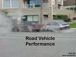
On Road Vehicle Activity GPS Data and Privacy. Vetri Venthan Elango Dr. Randall Guensler School of Civil and Environmental Engineering Georgia Institute of Technology. Overview. Introduction Background Data Methodology Case Study Conclusions and Future Work. Introduction.

E N D
On Road Vehicle Activity GPS Data and Privacy Vetri Venthan Elango Dr. Randall Guensler School of Civil and Environmental Engineering Georgia Institute of Technology
Overview • Introduction • Background • Data • Methodology • Case Study • Conclusions and Future Work
Introduction • The use of GPS devices in travel behavior studies continues to increase in frequency and depth • GPS devices can provide accurate and detailed spatial and temporal data • High resolution GPS data are useful in studying • Travel behavior • Driver behavior • Safety • Emissions • Etc.
Objective • High resolution GPS data have a significant potential to compromise privacy • Aggressive driving (speed/acceleration) - lawsuits • Home departure and arrival - home security • Locations visited • Methodological goal • Post-process high resolution GPS data and ensure privacy of participants • Retain enough detailed data to be useful to various research communities
GPS-based Travel Study Examples • Lexington travel data demonstration 1997 • GPS for personal travel surveys • Georgia Tech comprehensive electronic travel monitoring system 1999-2000 • The Rätt-Fart Borlänge GPS study 1999-2001 • California Statewide Household Travel Survey GPS study, 2001 • Commute Atlanta Study, 2004-2006 • University of Minnesota, I-35 Bridge use study, 2008-2009 • Cobb County School District, GPS-based anti-idling study 2010 - ongoing
Travel Survey Methods using GPS • Active handheld systems replicating traditional travel-diaries • GT comprehensive electronic travel monitoring system study • Longitudinal studies with vehicle-based GPS systems installed in participant vehicles • Commute Atlanta Study • A hybrid of longitudinal passive GPS data collection coupled with intermittent online travel surveys • University of Minnesota, I-35 Bridge Crossings Study
Commute Atlanta Study • Instrumented vehicle research collecting high-resolution GPS (2004-2006) • Assess the effects of converting operating costs into variable per-mile driving costs • Approximately 500 vehicles in 270 households • More than 1.8 million vehicle trips • Baseline data from 270 households • Approximately 100 households in the pricing study
Proposed Commute Atlanta Dataset for Public access • Travel Diary Data (trip-level travel data) • 95 households that had complete data for the study period • Summary of trips including origin/destination TAZs, distance, duration, date, time etc. • Second-by-second data withheld • Onroad Vehicle Activity Data (second-by-second) • Approximately 175 households that did not have complete data for study period • Trip summary data (distance, duration, etc.) withheld
On Road Vehicle Activity Data • Characteristics • Second by second vehicle speed and position data • Data are tied to specific roadways • FHWA highway functional classification, number of lanes, lane width, etc. • Uses • Safety studies • Driver behavior • Emissions analysis
Attributes • GPS data • Latitude and Longitude, speed, heading, date and time • Number of satellites, position quality information, etc. • Roadway Characteristics • HPMS attributes • Georgia Tech Household Classification Group (income, vehicle ownership, and household size) • Vehicle Characteristics • Fuel Type, Engine Type, Body Type and Model Year Group • Driver Characteristics • Age group and Gender
Privacy Concerns • High resolution GPS data can identify participant’s • Home, and work locations • Shopping, recreational and social preferences • Driver risk parameters • High resolution GPS data + Vehicle Characteristics + Driver Characteristics, will yield the identity of individual participants • Recent news about public access to location data • Iphone location tracking • TomTom selling GPS data to Police
Identifying Home Locations • Characteristics • Most frequent trip end • Usually the last trip end of the day • Methodology • Pool the data based on vehicle/driver characteristics, location, and date-time from vehicle activity datasets • Identify frequent trip ends by time of day • Spatially analyze the most frequent trip ends and the last trips in each day
Data Filtering Techniques I • Filter using buffer around the home location • Center of the buffer is the home location • Filter using a polygon around the home location • Polygon centroid is the home location
Data Filtering Techniques II • Filter using a random polygon with its centroid away from home • Define random centroid from household • Random distance (minimum 500 ft and maximum 750 ft) from the household in a random direction • Generate a random six sided polygon • Vertices at a minimum distance of 0.5 miles and maximum distance of 0.75 miles from the centroid • All GPS data that are within this polygon are trimmed
Case Study • One month of activity data for 2 households • Onroad vehicle activity data were filtered using a randomly generated polygon for each household • Post-analysis of the filtered dataset (detective work) • Identify home location using filtered data with a trip ends algorithm • Spatially identify clipped trip endpoints • Find the centroid of these last known points • Do a Network Analysis of clipped trip endpoints
Household 1Actual Filter Polygon More than 1000 parcel centroids within filter Polygon
Household 1Home Location Estimate from Dataset Estimated Home Location
Household 1Home Location from Spatial Analysis Estimated Home Location
Household 1Network Analysis 137 parcel centroids within Intersect Area
Household 2Actual Filter Polygon More than 300 parcel centroids within filter Polygon
Household 2Home Location Estimate Estimated Home Location
Household 2Home Location from Spatial Analysis Estimated Home Location
Household 2Network Analyst 22 parcel centroids within Intersect Area
Access to Vehicle Registration DataImproves Matching • Household zip code = 30306 • Household has exactly 2 vehicles registered • Both vehicles are SUVs • One vehicle is 1995-1999 model year • One vehicle is 2000-2004 model year
Query Statistics • Registered Vehicles: 16,071 • SUVs: 3,718 • HH with 2 SUVs: 418 • HH with 2 SUVs and specified model year groups: 19
19 Potential Household Locationsamong 16,000 residences Zip Code30306
Conclusions • High-resolution GPS data need to be filtered before data are shared to prevent loss of privacy • A filtering method that uses a random polygon around the home location was applied • However, using network and available on-road vehicle activity data, home locations can be identified • Using vehicle registration data and other data sources make it even easier to identify households • Liability associated with participant privacy protection lies with data collector
Ongoing Activities • Continue work to develop post-processing methods that ensure travel diary data and high resolution GPS data do not compromise participant privacy • Unfiltered data remain available for research only at Georgia Tech through 2011 • Other researchers can visit Tech and do their research in partnership
Questions? VetriVenthanElango vetri@gatech.edu Randall Guensler randall.guensler@ce.gatech.edu