Download
1 / 60
600 likes | 677 Vues
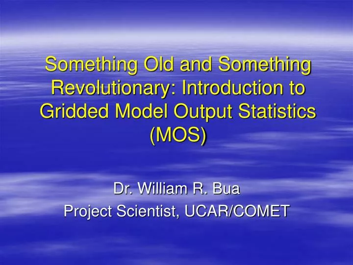
Something Old and Something Revolutionary: Introduction to Gridded Model Output Statistics (MOS). Dr. William R. Bua Project Scientist, UCAR/COMET. Acknowledgements. Paul Dallavalle, Mark Antolik, and Bob Glahn for powerpoints and publications

E N D
Something Old and Something Revolutionary: Introduction to Gridded Model Output Statistics (MOS) Dr. William R. Bua Project Scientist, UCAR/COMET
Acknowledgements • Paul Dallavalle, Mark Antolik, and Bob Glahn for powerpoints and publications • IFPS Science Steering Team and others for participation in beta testing of teletraining session
Outline • Review of traditional MOS • Why was MOS developed? • How is MOS developed? • Advantages and limitations of traditional MOS? • Gridded MOS • Why gridded MOS? • How is gridded MOS developed? • Where can I get the data? • How well did Gridded MOS do in the Western CONUS? • What’s next for Gridded MOS?
Why was MOS developed? • To add value to direct NWP model output • Objectively interpret model • Remove some systematic biases • Account for uncertainty at increasing forecast times (i.e. regress toward mean at long lead times) • Predict what the model does not…or what the model does not predict as well as statistical guidance (e.g. 2-m temperature in areas of rugged terrain) • Produce site-specific forecasts (i.e. a “downscaling” technique) • Assist forecasters • “First Guess” for expected local conditions • “Built-in” model/climo memory for new staff
MODEL OUTPUT STATISTICS (MOS) • Relates observed weather elements at individual stations (PREDICTANDS) to appropriate variables (PREDICTORS) via a statistical approach. • For relatively rare observed weather elements (e.g. thunderstorms), stations with similar climatologies are grouped to produce a sufficiently large sample. • Predictors are obtained from: • NWP Model forecasts • Prior surface observations • Geoclimatic information • Statistical model used • Multiple Linear Regression with forward selection
Medium-range GFS vs. MOS: AK warm season max temperatures Direct model output “Climatology” MOS
DevelopmentalConsiderations • Selection and Quality Control of observational databases • ASOS and precipitation? Which mesonet? What about remote sensor data? • Predictand definition must be PRECISE! • E.g. Nighttime Minimum Temperature • “Nighttime” is 0700 PM - 0800 AM LST • Choice of Predictors (physically meaningful formulation) • PoPs would consider PW, VVEL, model QPF; NOT 1000-500 thickness or tropopause height • Predictor or predictand data may require binary or other transform of data
DEVELOPMENTAL CONSIDERATIONS (cont.) • Terms in Equations; Selection Criteria • Dependent Data • Sample Size, Stability, Representativeness • AVOID OVERFIT !! • Stratification - Seasons • Pooling – Regions • Categorical Forecasts?
“REAL” REGRESSION EQUATIONS MULTIVARIATE MOS regression equations are , of form: Y = a + a X + a X + ... + a X 0 1 1 2 2 N N Where, the "a's" represent COEFFICIENTS the "X's" represent PREDICTORvariables QUITE The maximum number of terms, N, can be large: For NGM QPF, N = 15 For NGM VIS, N = 20 The FORWARD SELECTION procedure determines the predictors and the order in which they appear.
MOS LINEAR REGRESSION JANUARY 1 - JANUARY 30, 1994 0000 UTCKCMH 60 50 40 10°F residual error 30 TODAY'S MAX (°F) 20 10 Reduction of Variance=93.1% 0 -10 1150 1200 1250 1300 1350 18-H NGM 850-1000 MB THICKNESS (M)
Regional Equations • Pooling of data from stations to get stable statistical relationships for relatively rare events • Pooling done by regions with similar climate characteristics • Weather elements using pooled station data (list not necessarily exhaustive) • Precipitation • Precip type • QPF • Prob of Precip • Thunderstorms • Aviation • Visibility • Ceiling height
GFS Cool Season PoP/QPF Regions With GFS MOS forecast sites (1406)
KDCA 12-Hour QPF Probabilities 48-Hour Projection valid 1200 UTC 10/31/93 MOS BEST CATEGORY SELECTION TO MOS GUIDANCE MESSAGES 0 1 2 3 4 5 6 YES THRESHOLD YES NO EXCEEDED? PROBABILITY (%) NO NO NO
MOS Advantages and Limitations • Advantages • Recognizes skill of NWP • Removes some systematic NWP model bias • Uses best predictors for forecast • Produces reliable probabilities • Allows specific site forecasts of weather elements • Limitations • MOS is a synoptic scale method (consider resolution of MOS forecasts) • Performance degrades for: • Extreme events, especially if event did not occur during the MOS development period, and … • With longer lead times, since MOS regresses toward the mean with increasing lead time • Developmental data limitations • Changing NWP models change predictor/predictand relationships • Extreme events • No flow regime dependence; warm, cold, wet, dry regimes all combined to come up with MOS relationships
The Gridded MOS Project • Why? • Produce MOS guidance on native high-resolution grid (2.5 to 5 km spacing) • Generate guidance with sufficient detail for forecast initialization at WFOs • Generate guidance with a level of accuracy comparable to that of the station-oriented guidance • Provides smoother guidance • Removes WFO discontinuities • However…regional discontinuities may still exist from use of regional equations for first guess
National Digital Forecast Database (NDFD) • A database that is a 4-dimensional representation of the weather from the current time to several days into the future • Vertical dimension not yet well developed • Currently, the representation is on a 5-km grid (2.5 at some WFOs) • Built from local digital forecast databases that are updated as often as meteorological conditions warrant
High-res geophysical data grids • Currently using elevation from 30 arc-second USGS topography data interpolated to 5-km • Under development • GIS-defined slope and aspect derived from USGS topography • 1-km land use data from NASA • 4-km monthly climo of max/min T from PRISM (Oregon State Univ.) • 4-km monthly precip from PRISM • Note – PRISM data mostly adjusts for topography. It has no adjustment for urban areas – for instance urban heat islands do not show up
Surface Data • Currently in use: • METAR • Buoys/C-MAN locations • Mesonet sites • NOAA cooperative observer network • RFC-supplied sites • Co-op data • Used for 24 hour snow, not shorter time intervals. • Co-op max/min data are problematic due to different obs times by different observers. • Under development: • Precip obs also from NPVU (http://www.hpc.ncep.noaa.gov/npvu/)
Western CONUS (used for GMOS test) • 300 METAR sites • 1175 MesoWest sites • 80 RFC sites
CONUS Gridded MOS Sites MOS Sites: ~1,500 Coop Sites: ~5,500 RFC + MesoWest: ~1,500
Remote Sensing Data • These are already on a grid that can be used for direct Gridded MOS development • Currently used: • Lightning detection data • Under development • Radar data for precipitation • Satellite data for clouds • Development still usually needs to be done on a regional basis
Remotely-sensed Precipitation Data Still under development; currently using gauge data as with traditional MOS
Satellite-based Effective Cloud Amount Still under development; currently using traditional MOS-type equations
Gridded MOS Methods • There are two basic methods used to produce Gridded MOS • Develop regression equations that apply to observation sites (single station equations), and grid them (interpolate from quasi-random points to a regular grid) • Develop regression equations that can be applied at gridpoints, and directly make forecasts there
Single Station Operators 8,500 stations! • For the CONUS points … • Use GFS model and traditional MOS methodology to develop sensible weather values for each station
Developing the “First Guess” Field • Observations for most predictands do not exist at gridpoints, so Regional Operator approach has to be used • Pool regional observations and develop equations for each weather element and forecast projection • Apply equation at all grid points within region • Useful as a first guess, but not yet accurate enough for product • Can also opt for the average value of the field for all stations, a specified constant, or data from a forecast model interpolated to the 2.5 or 5-km grid
BCDG Analysis • Method of successive corrections • Bergthorssen and Doos (1955) • Cressman (1959) • Glahn (1985); application to Local AFOS MOS Program (LAMP) • Elevation (“lapse rate”) adjustment • Inferred from surface observations at different elevations • Since calculation is done “on the fly” from the data, can vary with weather element, time of day, season, and synoptic situation • Land/water gridpoints treated separately • Different analysis parameters over land and water • Land (water) data points affect only land (water) gridpoints
Lapse Rate Calculated For Each Station • Pre-processing step determines 60-100 neighbors for each station • Lapse Rate = Sum of (temp differences of higher elevation station and lower elevation station) • Divided by Sum of absolute difference of elevation of the two stations • Normally the lapse rate is negative, but is sometimes positive, especially along the west coast
74° 75° 75° 1000 76° 81° 80° 77° 500 79° = 0.01°F/m
Land/Water Distinction • Radius of influence over water 3.5 times that over land to accommodate the sparse buoy data points • Small lakes cannot be dealt with unless there is a water datapoint close enough to influence a grid box • Interpolation considers land/water distinction
20 pts No influence here from the land point here… 30 pts … 5 pts 40 10 pts 3 pts Ocean versus land: Land points cannot influence ocean and vice versa
70 pts No influence here from the ocean point here… 105 pts … 17.5 pts 40 35 pts 10.5 pts Ocean versus land: Land points cannot influence ocean and vice versa
BCDG Analysis Options • Smoothing can vary by pass and first guess option used • Special “terrain-following” smoother • Smoothes over a 5- or 9-point stencil when the terrain is relatively flat. • Does not smooth a gridpoint that is at a high or low point in elevation. • Smoothes along contours when a series of three in any of 8 directions are at somewhat the same elevation
74° 75° 75° 1000 76° 80° 77° 500 79° NO smoothing at low points. Smoothing along contours.
BCDG Analysis Options (Cont.) • After last pass, closest gridpoint to a datum can be set to, or nudged toward, that datum • Nudging allows a slightly closer fit to the data without creating bulls eyes when a graphic is produced • Setting to the value allows an application using the grid to almost always recover the datum
MOS Temperature Analysis (no terrain or land v. water distinction)
MOS Temperature Analysis (w. terrain and land/water distinction)
National Digital Guidance Database (NDGD) v. National Digital Forecast Database (NDFD)
http://www.weather.gov/mdl/synop/gridded/sectors/conus.php 3-hourly Clickable links
Marine layer Elevated areas “poking up above the marine inversion “Observed” Tsfc
Elevated areas “poking up above the marine inversion Gridded MOS Tsfc