Download
1 / 28
280 likes | 427 Vues
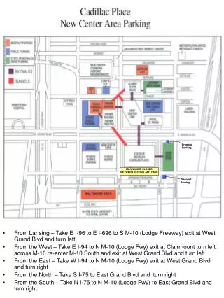
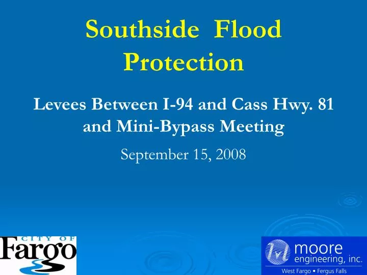
Southside Flood Protection Levees Between I-94 and Cass Hwy. 81 and Mini-Bypass Meeting September 15, 2008. 25 th Street South. St. Benedict. Cass Co Hwy 16. Wild Rice River. Interstate 29. 1997 Spring Flood – South of Fargo. Fargo. Moorhead. Interstate 29. Rose Coulee. Frontier.

E N D
Southside Flood Protection Levees Between I-94 and Cass Hwy. 81 and Mini-Bypass Meeting September 15, 2008
25th Street South St. Benedict Cass Co Hwy 16 Wild Rice River Interstate 29 1997 Spring Flood – South of Fargo
Fargo Moorhead Interstate 29 Rose Coulee Frontier 25th Street South Red River Cass Co Hwy 81 Wild Rice River 1997 Spring Flood – South of Fargo
Interstate Hwy 94 Fargo West Fargo Southside Flood Control Moorhead Preliminary 100 & 500 Year Floodplains Horace Interstate Hwy 29 Oxbow
Provide Protection from overland flooding that threatens the majority of properties south of I-94. Prevent extensive expansion of South Fargo Floodplain and mandatory flood insurance requirement. Provide growth area for Fargo, helping to keep our region’s economy healthy Southside Flood Control
Fargo Moorhead Interstate 29 Rose Coulee Frontier 25th Street South Red River Cass Co Hwy 81 Wild Rice River 1997 Spring Flood – South of Fargo
Southside Flood Control North Dakota State Climate Office
Southside Flood Control Wild Rice River Levee Alternative Base Project
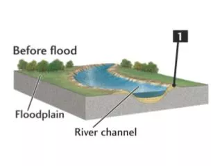
Issues Raised With Base Alternatives • Red River & Wild Rice River impacts (Higher flood levels) • Lost storage (Concern storage impact will simply move impacts upstream) • Properties east of Hwy 81 and upstream receive no protection
Southside Flood Control STORAGE SUMMARY Existing effective storage 6,000 Acre-Ft Base project 0 Acre-Ft Channel extension/storage 2,000 Acre-Ft Supplemental storage 4,000 Acre-Ft Upstream dams 75,000 Acre-Ft (External storage)
SOUTHSIDE FLOOD CONTROL Wild Rice River Levees Alternative – Red River Impacts
Fargo Moorhead Interstate 29 Rose Coulee Frontier 25th Street South Red River Cass Co Hwy 81 Wild Rice River 1997 Spring Flood – South of Fargo
Wild Rice River Area Options Option 1 – No Wild Rice River Crossing Option 1: No Wild Rice River Crossing ($5.5 Million) Option 2 (Base): Wild Rice River Crossing ($15.5 Million) Option 3: Mini-Bypass ($29.4 Million) Option 2 – Wild Rice River Crossing Option 3 – Mini-Bypass
Southside Flood Control Technical Committee Preferred Option “Mini-Bypass”
Southside Flood Control Wild Rice “Mini-Bypass” Fly-Through
Southside Flood Control Wild Rice Levee Option With Red River Channel Extension Options
Southside Flood Control SE Cass Preliminary Assessment District Boundary
Preliminary Assessment Analysis Completed by Southeast Cass WRD • Agricultural Property • Total cost per acre – $89.00 • Total cost per quarter – $14,240.00 • Average annual cost per acre – $7.30 • Total cost per quarter – $1,168.00 • Assumed a 25 year payment schedule at 6.50% interest
Water Resource District Assessment District Process • Send ballots to all property owners on assessment list. • (One ballot per parcel owned) • Conduct a project hearing • Ballots returned by mail • Count all ballots returned • (Weighted by amount you pay) • If more than 50% of ballots returned vote yes • Project proceeds
Preliminary Assessment Analysis Completed by Southeast Cass WRD Reassessment of Benefits As the undeveloped properties in the assessment district get developed, the WRD can reassess the benefits so all properties pay for similar benefits.
88th Avenue Wild Rice River Highway 81 1997 Spring Flood – South of Fargo
Southside Flood Control Questions / Discussion