Download
1 / 28
291 likes | 653 Vues
The Four Regions of West Virginia. Human and Environmental Interaction. HEI – The way we use, affect, and are affected by our environment. Animals eliminated from WV because of human interaction wolf, bison, elk Railroad helped the industries in WV boom.

E N D
Human and Environmental Interaction HEI – The way we use, affect, and are affected by our environment. Animals eliminated from WV because of human interaction wolf, bison, elk Railroad helped the industries in WV boom
Human and Environmental Interaction 3 major industries that are examples of human/environmental interaction Mining Lumber Chemical Surface mining=strip mining Chemical industry great site in WV because of the available elements Kanawha Valley “the Chemical Valley of the World”
Human and Environmental Interaction Lumbering Early settlers saw that the entire state was covered with forest. They cut down the trees and used them for two purposes: To provide building materials for houses Fuel (later used to build boats) Lumbering brought other jobs, such as: Sawmills Pulp mills-converts wood chips or other plant fiber source into a thick fiber board which can be shipped to a paper mill for further processing Tanneries-workplace where skins and hides are tanned
Movement Movement-the way we are linked through exploration, trade routes, settlement, migration, and invasion WV was first settled in the Potomac region Early settlers searched for food, water, and safety. Settlers traveled the least restrictive way, by valleys and following rivers.
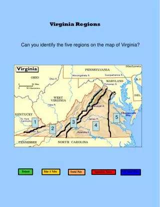
Regions(an area that is bound by common characteristics) Geographic regions are defined by: Common Climate Common Landform Economic Recreational activities West Virginia has 4 Regions: Potomac Section Allegheny Highlands Allegheny Plateau Ohio River Valley
The Potomac Section Geography: In the Eastern Panhandle Gently rolling farmland (Rural) Potomac River is its northern border (the river gives the region its name) Contains lowest point in WV (Harpers Ferry 247 feet above sea level) A place where urban(city or town)workers flock to the region from Washington D.C.
The Potomac Section • History: • It was the first region settled by Europeans • In 1912 US Supreme Court ruled that the Fairfax Stone would be the starting point of the boundary between WV and MD • Industries • Livestock (sheep and cattle) because of excellent grass • Peach & Apple orchards because of great soil • Apple Butter Festival • Mountain State Apple Harvest Festival
The Potomac Section • Natural Features • (Warm springs) Berkeley Springs • Spa(health resort) • Whitewater rafting on the Shenandoah River • Potomac Eagle (The Trough) • State Parks- Cacapon and Berkeley Springs • Harper’s Ferry (picture on front of text)
The Allegheny Highlands • Geography: • Mountainous Region - Forms the dividing line between eastern and western WV • Contains Highest Point in WV - Spruce Knob 4862 feet above sea level • The Allegheny Highlands is the region that gave WV its nickname the “Mountain State”
The Allegheny Highlands • History • Immigrants(ones who moves into a new country to settle) • Swiss and Germans settled much of the region in the 1740s and early 1800s • Helvetia (Latin for “Switzerland”) settled in 1869 • Southern and Eastern Europeans came into the region in the late 1800’s and earl 1900’s (due to coal and timber industries) • Industries • Tourism! • Sparsely populated (largest city: Beckley)
The Allegheny Highlands • Natural Features • Premier Skiing Facilities – Snowshoe, Winterplace, Silver Creek Ski Area and others • Hiking, rock climbing, spelunking, mountain bicycling • Peter’s Mountain • Seneca Rocks • Smoke Hole • Seneca, and Lost World Caverns • Dolly Sods
The Allegheny Plateau Geography Plateau(an elevated tract of more or less level land) Rivers cut gorges and canyons across the plateau New River Gorge New River – second oldest river in the world The largest city is located in this region: Charleston(State Capital)
The Allegheny Plateau History The influence of Native Americans is evident in the region Kanawha (river of evil spirits) Logan County was named after a Mingo chief whose family was killed by a band of white men Mingo County named after tribe of Indians The Region is rich in ethnic diversity Italians, Belgians, Czechs, Greeks, Irish, and Spaniards. Mining Industry attracted many immigrants to the region
The Allegheny Plateau Natural Features Contains a variety of natural resources Limestone, sandstone, shale, coal, oil, natural gas and salt Whitewater rafting (Gauley River and New River) Windsurfing, boating, scuba diving, water skiing, fishing (Summersville Lake) New River Gorge Bridge (Construction completed in October of 1977) Bridge Day (3rd Saturday of Oct)
The Ohio River Valley Geography Lies next to Ohio River, the river dominates this region Many cities located in this area- Huntington, Parkersburg, Point Pleasant, Wheeling Islands are found in the Ohio river with unique flora and fauna (Ohio River Island National Wildlife Refuge) Blennerhassett Island
The Ohio River Valley • History • Area was inhabited for thousands of years by Indians • First settled by French in mid 1700s. French called the Ohio La Belle Riviere “The Beautiful River” • 1763 French surrendered Ohio Valley to Britain after French and Indian War • The historic Blennerhassett Island • West Virginia’s “floating capitol”
The Ohio River Valley(Blennerhasset Island) Aaron Burr Conspiracy (1805 – 1807) Aaron Burr - Former Vice President under Thomas Jefferson; orchestrated a plot to create a new government opposed to America in the Southwest Harman Blennerhasset – Wealthy Irish born lawyer that owned an island on the Ohio River where Burr and his conspirators plotted; also financed Burr’s conspiracy Edward Tiffin, governor of Ohio, brought militia to Blennerhasset Island, raided it and stopped the conspiracy Burr and Blennerhasset were accused of treason(the crime of trying to overthrow the government of one’s state or country)
The Ohio River Valley(West Virginia's “Floating Capitol”) • When West Virginia became a state in 1863, the Capitol building was at the Linsly Institute in Wheeling. • In 1870, the State Legislature designated Charleston as the Capital city. • In 1875, the Legislature voted to return the Capital to Wheeling. This was appealed by the citizens of Charleston and finally settled by the West Virginia Supreme Court of Appeals on September 13 in favor of Wheeling. • The Legislature struck once more in 1877 and ordered an election to be held on August 7 for the citizens of West Virginia to select a permanent location for the Capital. The vote was between Charleston, Martinsburg and Clarksburg. Thirty days after the election, Henry M. Mathews proclaimed that after eight years, Charleston would be the government's permanent seat VS
The Ohio River Valley The new Capitol opened on May 1, 1885, and served for 36 years until its destruction by fire on January 3, 1921 Luckily, the Legislature had authorized the construction of the present Capitol on the north bank of the Kanawha River in 1921. This building was completed in 1932 at a cost of $10 million
The Ohio River Valley Major manufacturing: Steel Glass Textiles
Review 7 River Basins in WV The climate of WV is Humid Continental The New river has 4 tributaries The Kanawha river has the greatest number of tributaries The county that is often referred to as the birthplace of rivers is Pocahontas WV has one natural lake WV location can be described as relative and absolute WV boundaries- natural and man-made Fairfax Stone- WV and Maryland Mason-Dixon Line- WV and Pennsylvania
Refernces http://commons.wikimedia.org/wiki/Image:Helvetia_WV-Shield_Sign.jpg http://www.geocities.com/Heartland/Valley/6192/ http://www.freebase.com/view/wikipedia/images/commons_id/556019 http://www.newriverwv.com/ http://www.wvbridgeday.com/ http://en.wikipedia.org/wiki/Charleston,_West_Virginia http://www.blennerhassettislandstatepark.com/ http://www.electricearl.com/parkersburg/island.html http://www.blenkoglass.com/ http://www.wvtourism.com/spec.aspx?pgID=80