Download
1 / 45
450 likes | 796 Vues
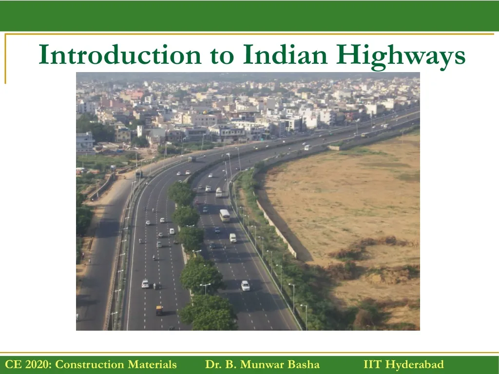
Introduction to Indian Highways. History of Road Development in the World. Mountain Trails. Roman Roads. Roman Road Construction. Ancient Greek Roads – grooves and large stone blocks. Macadam Road. India Grand Trunk Road 2,500 kilometres (1,600 mi).

E N D
Plank Road – Western US Early 20th Century Plank roads were typically constructed of wood planks two inches thick and eight feet long, which were nailed to four-inch-square stringers at a 90-degree angle.
History of Road Development in India • Ancient Period (3500 BC) • Mughul Period (15th Century) • British Period (17th & 18th Century) • Free India (1950 onwards)
Types of Ancient Indian Roads • Indus Valley Civilization (Harrapa and Mohenjedaro): • Roads with brick drains on both sides. • Mauryan rule in the 4th century constructed • Rajpath (high roads) • Banikpaths (merchant roads). • Ashoka Regime: • Road networks with horticulture and rest houses at 4.8 – 6.4km along the roads. • Mughul Period • Trunk roads between Northwest to Eastern part and also linking coastal and central part of India • British Period • Trunk roads, bridges, PWD was formed, construction of Grand Trunk Road
Indian Roads • India has a large road network of over 3.314 million kilometers of roadways (2.1 million miles). • It is 3rd largest road network in the world. • At 0.66 km of highway per square kilometer of land the density of India’s highway network is higher than that of the United States (0.65) and far higher than that of China's (0.16) or Brazil's (0.20).
Golden Quadrilateral • It connects India's four largest metropolises: Delhi, Mumbai, Chennai and Kolkata. • Four other top ten metropolises: Bangalore, Pune, Ahmedabad, and Surat, are also served by the network. • The largest highway project in India, initiated by AtalBihari Vajpayee, it is the first phase of the National Highways Development Project (NHDP), • It consists of building 5,846 km (3,633 mi) of four/six lane express highways. • Cost : 60,000 crore
Impact of Transportation • Economic Development • Social Development • Spatial Development • Cultural Development • Political Development
Classification of Highways • Depending on weather • All weather roads • Fair weather roads • Depending on the type of Carriage way • Paved roads • Unpaved roads • Depending upon the pavement surface • Surfaced roads • Un surfaced roads National highway act ( 1956 )
Classification of Highways Based on the Traffic Volume • Heavy • Medium • Light Based on Load or Tonnage • Class 1 or Class 2 etc or Class A , B etcTonnes per day Based on location and function ( Nagpur road plan ) • National Highway (NH) • State Highway (SH) • Major District Road (MDR) • Other District Road (ODR) • Village Roads (VR)
Based on modified system of Highways classification • Primary • Expressways • National Highways • Secondary • SH • MDR • Tertiary • ODR • VR
Classification of Roadways • Expressways 200 Km • National Highways 78,651 Km • State Highways 1,56,181 Km • Major District Roads & Rural and Other Roads 44,55,510 Km Total = 46,90,542 Kms
Expressways • Heavy traffic at high speed (120km/hr) • Land Width (90m) • Full access control • Connects major points of traffic generation • No slow moving traffic allowed • No loading, unloading, parking.
National Highways • India has a huge network of national highways. • The national highways have a total length of 78,651 kms. Indian highways cover 2% of the total road network of India and carry 40% of the total traffic. • The entire highway network of India is managed by the National Highway Authority of India which is responsible for development and maintenance of highways. • Longest highway in India is NH7 (2,369 km), which stretches from Varansi in Uttar Pradesh to Kanyakumari in the southern most point of Indian mainland. • Shortest National Highway is the NH 47A (5.9 km (3.7 mi)), which connects Kundanoor Junction in Kochi city to the Kochi port at Willingdon Island.
State Highways • They are the arterial roads of a state, connecting up with the national highways of adjacent states, district head quarters and important cities within the state. • Total length of all SH in the country is 1,56,181 Kms.
Major District Roads • Important roads with in a district serving areas of production and markets , connecting those with each other or with the major highways.
Other district roads • Roads serving rural areas of production and providing them with outlet to market centers or other important roads like MDR or SH.
Village roads • They are roads connecting villages or group of villages with each other or to the nearest road of a higher category like ODR or MDR. • India has 44,55,510 Km of MDR+ODR+VR out of the total 46,90,542 Kms of all type of roads.
Urban Road Classification • ARTERIAL ROADS • SUB ARTERIAL • COLLECTOR • LOCAL STREET • CUL-DE-SAC • PATHWAY • DRIVEWAY
Water Bound Macadam (WBM) roads • The British engineer John Macadam introduced what can be considered as the first scientific road construction method. • WBM stands for Water Bound Macadam, and the term WBM road was derived in the memory of an engineer by name Macadam who designed and formulated this road section. • This road is laid by binding the in-situ layers of boulders, stones, fine aggregates and fillers. • The filler is made from the mixture of sand combined with either moorumquarry dust, or soil that is available in that locality. • The filler is mixed with water and is used to fix stone boulders and the layers of coarse stones of varying sizes by compacting with a road roller to form the base of a road. The road can be used in this form itself. • As an improvement, you can apply concreting or black topping above the WBM to make it better.
Base courses Emulsion treated gravel Foamed bitumen gravel Waterbound Macadam Hysen Cells
Alternative cost effective low-cost sealing options Scarce wearing course material, requires innovative approaches to reducing the maintenance cost of Gravel roads
Modern roads The modern roads by and large follow Macadam's construction method. Use of bituminous concrete and cement concrete are the most important developments. Various advanced and cost effective construction technologies are used. Development of new equipment's help in the faster construction of roads. Many easily and locally available materials are tested in the laboratories and then implemented on roads for making economical and durable pavements. Scope of transportation system has developed very largely. Population of the country is increasing day by day. The life style of people began to change. The need for travel to various places at faster speeds also increased.
Modern roads This increasing demand led to the emergence of other modes of transportation like railways and travel by air. While the above development in public transport sector was taking place, the development in private transport was at a much faster rate mainly because of its advantages like accessibility, privacy, flexibility, convenience and comfort. This led to the increase in vehicular traffic especially in private transport network. Thus road space available was becoming insufficient to meet the growing demand of traffic and congestion started. In addition, chances for accidents also increased.