Download
1 / 25
250 likes | 406 Vues
Robert Jones, Associate Professor Skidmore College rjones@skidmore.edu Spring NEARC 2013. Creating ArcReader Projects for Local History. ArcMap projects created for local use by ArcReader on a hard drive, CD, DVD or flash drive ArcMap and ArcReader 10.0 were used for this presentation

E N D
Robert Jones, Associate Professor Skidmore College rjones@skidmore.edu Spring NEARC 2013 Creating ArcReader Projectsfor Local History
ArcMap projects created for local use by ArcReader • on a hard drive, CD, DVD or flash drive • ArcMap and ArcReader 10.0 were used for this presentation • What is NOT covered in this presentation • ArcGlobe package What this Presentation Covers
Expensive for many potential users • Especially non-profit organizations • Independent map users • Difficult for many users to learn • Not intuitive • Many up-front concepts to understand • Especially for occasional users • Easy to forget how to do things if not used often ArcMAP is . . .
Free • Can be downloaded or distributed to any user • A Simplified version of ArcMap • Brings interactive mapping to anyone with Windows • Has the look and feel of ArcMap • ArcReader can only read, not create, maps • Easy to learn • Uses tools common to many other applications • Zoom in and out • Pan • Print ArcReader is . . .
License required for this ArcGIS Extension • Creates ArcReader projects • Based on “.mxd” files • Creates two folders • A “PMF” folder for the project and hot linked files • A “DATA” folder containing features and rasters ArcPublisher
Get frequent geographic requests such as • “What is there now?” • “What was there before _______?” • “Where are old cemeteries in ______ ?” • Have difficulty finding same locations from paper maps • Some of which are stored in vaults and are only copies • Many of which are different sizes • Many of which have different features noted on them • Need easy access to geographic layers • Need to print portions of larger maps • Often for different time periods for the same extent Historians’ Geographic Needs
Turn layers (and/or groups of layers) on and off • Zoom in and out • Pan • Print • Export maps (as .bmp files only!) • Use the Identify tool • Change transparency of layers • Swipe Layers • Use hyperlinks • Measure distances • Mark up a map (using penor highlighter) • Query (limited) • Switch between data and layout view Some things ArcReaderCan Do
Toolbars ArcMap Toolbar ArcReader Toolbar
Add new data layers Create new layers from existing layers Change colors of features Turn labels off or on Change the order of layers in the table of contents View an entire attribute table Save changes to a .pmf file ArcReaderCannot
The ArcReader package can be saved in one of three formats • Existing format (shape files and rasters) • File geodatabase • Compressed file geodatabase • Compressed GDB (not using existing format) takes up about half the space of the other ArcReader formats • ArcReader packages take up 5 times the space of a map package (.mpk) • 2.5 times the space for a Compressed GDB Saving the ArcReader Package
ArcMap (using the Publisher extension) • Can create .pmf files • Cannot open .pmf files ArcMap and .pmf Files
ArcMap can modify the contents of files within the package • depending on the data package format chosen • ArcMap • Can open and edit files saved as • “Existing format” • File geodatabase • Can open, but not edit, files in Compressed GDB • Cannot open files in Compressed and Locked GDB Opening and Editing Filesin the ArcReader Data Package
Each .pmf file is created from a .mxd file • .pmf files cannot be edited once created • Changing the pmf file • Must change and save the .mxd file • Then republish a new .pmf file • Presumably if the files in the DATA folder are the same • Only the pmf file needs to be changed Changing the .pmf File
A new .pmf file for a given DATA folder can be can be created • Files within the DATA folder can be edited • unless they are compressed • Not possible to add new files to a DATA folder without creating a new package Modifying ArcReader Packages
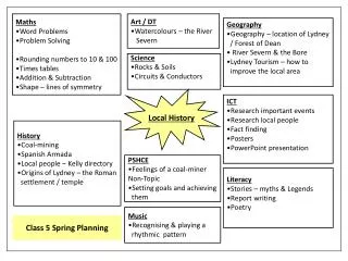
Project Contents • Most recent aerial photos as a group layer • Streets layer • Parcels layer • Cemeteries as points with hyperlinked documents • Word documents contain links to web pages for each cemetery • Word documents contain directions and sketch of each cemetery • Several cemeteries are hidden in what are now forestlands • Word documents provide a photograph, parking and access information for each cemetery • Some are on private property A Sample ArcReader ProjectCemeteries in Town of Greenfield, NY
Town Historian reports that much time is saved looking the history of a given place • Enables Town Clerk to include previously unknown cemeteries on deeds • Some property owner did not know that their parcel contained a cemetery! • Greenfield is largely rural • Was once heavily farmed in 1700’s • Most farming ceased by late 1800’s Some Benefits to Greenfield
Historic Places of Interest in ArcReader • Pictures, short videos and other information about selected historic sites Next Steps in the Greenfield Project
Requested (suggested) by other Saratoga Town Historians • Assigned GIS Class students to create a town map • Each student was assigned one of the towns/cities in Saratoga County • Created an ArcReader projects for their assigned town/ city containing • Streets layer • Town/city Boundary • All available historic maps georeferenced and clipped to boundary • All available topographic maps georeferenced clipped • Environmental layers clipped to town/city boundaries • Bedrock, soils, surficial geology, wetlands, watersheds, land cover, fault lines • Most recent aerial photography for the town or city • Provides a civic engagement project for students • And to their portfolio for future GIS job applications • Perform a needed public service beyond the expertise of the end users Other History Projects:ArcReader for Other Towns
The City has hundreds of historic maps • Different historic maps are stored in various major locations • Many are 200 year old originals in vaults for their own protection • Not easily available to the public • Saratoga Springs mapping project • Using ArcReader to make historic map layers available • In ArcReader • And in .kml formats for Google Earth • See temporary web site: http://www.skidmore.edu/~rjones/SSHIST/index_sshist.htm Special Project for Saratoga Springs
The layers can be created as accessible outside of ArcReader • If accessable • ArcMap can modify the layers • ArcMap can add or delete layers and republish a new .pmf file for the Data folder files • Creating a new map package can be time consuming • 30 minutes is not unusual • Republishing a new .pmf file takes only seconds • similar to saving an ArcMap (.mxd) project file Things to Consider when Creating ArcReader Projects
Work with the end user when creating the package • Unless you are extremely familiar with their uses and needs • Have end-users explain how they use ArcReader projects to other similar end-users • Many end-users are not experienced technical people • Have a process for updating their ArcReader project as needed by them • Try to make end-user into independent users More Things to Consider
Not all capabilities of Publisher and ArcReader were contained nor tested for this presentation • For more information see: • http://help.arcgis.com/en/arcgisdesktop/10.0/help/index.html#/Welcome_to_the_ArcGIS_Help_Library/ Closing Comments