Download
1 / 19
190 likes | 382 Vues
Lake Ontario Riparian Alliance (LORA). Grassroots Public Advocacy For The Protection, Restoration And Conservation Of Great Lakes Beaches And Riparian Property.

E N D
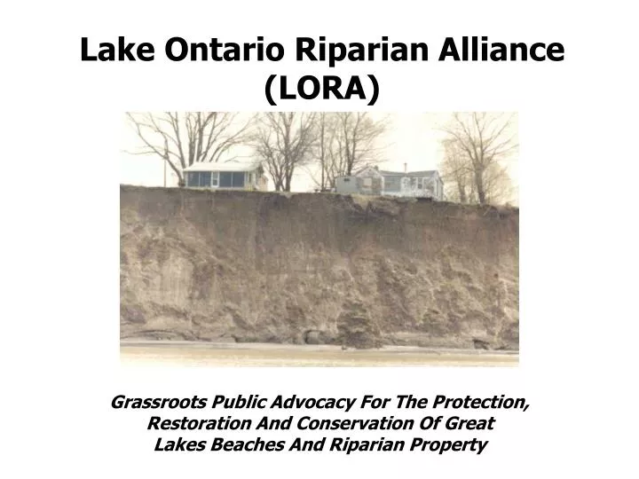
Lake Ontario Riparian Alliance (LORA) Grassroots Public Advocacy For The Protection, Restoration And Conservation Of Great Lakes Beaches And Riparian Property
Founded In 1993, LORA sought alternatives to failing shore protection efforts, and erosion damage caused by beach loss and poorly designed protection structures. LORA sought shore protection practices that workedwithnature to protect the shoreline and actually build back the lost protective beaches. LORA Wanted This Not This
Very Quickly LORA Learned Several Things • There was no financial assistance at any level • It was incredibly expensive to repair shoreline damages • Local contractors had very limited expertise • There was “ALMOST” No Engineering Or Design Assistance Available • NYS DEC & USACE applied arbitrary & inconsistent regulatory roadblocks • Almost all of the private property shore protection was failing Hundreds Of Thousands Of Dollars Were Being Paid To Build Protection Structures That Didn’t Work
One determined shoreline property owner put it in to perspective with his tongue in cheek comment….. “That’s Why It’s Called The Bank Of The Lake, All Of Your Money Ends Up In It!” He was fixing his property for the third time in 15 years, had spent over $75,000 and showed me a DEC/USACE Permit that only allowed him to build the Same Structure Again!
In 1993 most shoreline groups & associations believed that the solution was totally about levels. LORA looked at the problem in a different way. We Believed That The Best Shore Protection Was A Healthy Stable Beach. Butfor 10 Years in a row levels were allowed to peak in the higher end of the range. Most of the protective beaches were gone. This caused the water to move closer to the banks, bluffs and homes while changing the location of mean high water of 247.3 ft. Often This Was An Uncompensated Taking Of Land
We Decided that if the government could not (Or Would Not) manage lake levels to protect the shoreline…. • Then we needed to find an affordable shore protection design that…. • Was Able To Be Permitted • Was designed to the expected • range of 243.3 to 247.3 • Was environmentally friendly • Could Restore Protective Beaches • Would Last INDEFINETLY When Properly Maintained.
The NYSDEC & USACE routinely permit structures that conflict with existing regulations & have little engineering behind them. Even so, the promised mean high level of 247.3 is used as a regulatory guideline, for anything built on the shore and in many deeds to determine property boundaries. We found that the NYS DEC & USACE goal of keeping protection structures too small, too steep and in the wrong spot guaranteedfailure. They offered little or no protection and caused protective beaches to disappear. A catch 22 where the protection structure often caused it’s own failure.
LORA Sought The Advice Of Experts To See If There Was A Design That Not Only Protected The Shore But Also Worked With The Water And Waves To Protect Itself By Building Rather Than Destroying Beaches • Our goal meant the design had to meet certain criteria: • It had to have a functional life of 30 years or more • It had to be environmentally friendly and offer the best chance of restoring beach • It had to be affordable and easily maintained • It had to reduce or eliminate beach scour and return site to original condition • Most Importantly, • It Had To Be Designed To Work Over The Promised 4ft Range Of Levels 243.3 to 247.3 We were told by regulators & habitat/biologists that there was no such design. We were wasting our time. All shore protection caused beaches to be lost. All shore protection interfered with the lake’s natural processes.
After we got past the DEC & USACE gatekeepers (Regulatory & Habitat), we learned that both groups had engineering departments. We Met With Them For Advice. • The engineers said that in order to accomplish our goals, (affordability, beach restoration, environmental friendliness, permitability, ease of maintenance) the most suitable design was an old one…. • Rubble Mound Revetment • Layman’s Terms…A Strategically Placed Pile Of Rocks • The DEC & USACE engineers explained that the key to this successful design were. • Slope - the ratio of rise to run needed to be as gradual as possible to provide as much energy dissipation as possible. • Proper Design Height - the rise (Expected Range Of Levels 243.3 to 247.3) needed to be accurate to avoid undermining AND over-topping. • Mass - the amount off material in the revetment was more important than stone size especially when considering maintenance • Compound Angles - at either end to reduce flanking and down stream effects
The design the engineers suggested is remarkably simple. It was a slight modification of a “public domain” solution first offered in the 1970’S by the USACE as part of a “Help Yourself” Shore Protection Manual. Add lake level range of 4 feet (243.3 to max of 247.3) to localized wind and wave set up to determine the rise or design height. Apply the 1:3 slope and you have the run and the size of the revetment According to engineers this design was likely to accomplish all of our goals
In general, the most common dimensions for most sites was a 7ft. High (Rise), 1:3 Slope And a 21 Ft Long (Run) And 3 tons Per Lineal Ft Mass Basically On Paper It Looked Like This And It Took Over Two Years To Get Approved LORA then created the Affordable Shoreline Assistance Program or (A.S.A.P) and offered the design, permit application assistance, free shoreline evaluation and brokered reduced prices on materials, material transportation and equipment operation to anyone that needed it…. for no charge!
When actually built, it looked like this and was built over 120 times…. Huron NY
Westage Condominiums Rochester NY
Where is the property boundary if the deed ties it to the high water mark?
To The Questions The IJC Asked Us To Comment On….. What specific impacts do you expect would result from the proposed regulation plan? We believe that the greater range of levels (above 247.3) with Plan 2014 and the duration and timing of these highs and lows will…. 1) Increase demand for shore protection and lead to even more hardening of the shore 2) Damage hundreds of protection structures designed to protect to the level of 247.3 3) Totally destroy poorly designed structures (of which there are many) and severely damage unprotected parcels like pubic parks 4) Increase the cost shore protection due to structures needing to be larger and contain more material (Possibly 50% Higher) 5) Place the cost of shore protection out of the reach of many & make it harder to permit 6) Could be an uncompensated taking of land 7) Result In shore protection damages that far exceed dollar amounts estimated 8) Eventually devalue waterfront private, public and commercial property
How would the IJC’s proposal affect existing efforts to plan, prepare for and respond to coastal hazards? Right now there is no plan that responds to or prepares for wind driven wave action and erosion on the open lake. There is no plan that prepares for or responds to low water problems. Words in abrochure? Updated NYDEC maps? 24 hour advance warning from weather reports or USCG? That’s about it! The problems caused by higher or lower level fluctuations are so big and so expensive that they continue to defy normal solutions. There is a difference between preparing and responding to a condition that slowly develops . Responding to slowly rising waters that cause flooding in low areas is quite different from preparing and responding to a flash flood. On The Open Lake We Have “FLASH EROSION” Plan 2014 puts the shoreline at greater risk and it is important for the commission to understand that NOTHING is in place to respond to MOST of the coastal hazards 2014 will cause.
What outcomes from a regional adaptive management pilot study would have the most value? Many of us feel that Plan 2014 actually dilutes the adaptive management that is place with the current plan. 2014 Requires permission to act. Trigger levels that are too high or too low for the time of year, no actions that reduce or increase water levels. Adaptive management needs to think and act on a much, much larger scale. Funding for wide scale government dredging. Construction Of Protective inner harbors. Communication and co-operation with NY State. Regulatory relief for property and business owners. Shoreline property owners, businesses and recreational users of all types need to be at the table and have an equal say in the adaptive management.
One Last Comment…… In talking with hundreds of shoreline property owners, boaters, fisherman, swimmers and tourists, the vast majority are confused (and disappointed) that the focus of the IJC is on QUANTITY rather than QUALITY. While QUANTITY of water has negative effects on several interests, focusing on the QUALITY of the water has no negative effect anybody. Granted, not a scientific poll but, nearly everyone we talk to would rather have cleaner water, than more (or less) polluted water. Nearly everyone we talk to believes cleaner water would be better for the environment , than more (or less) polluted water. There has been a tremendous amount of time and money spent trying to fix something that not everyone agrees is broken. Many of us would rather see the effort and money spent to clean the water so our beaches stay open, so we can eat fish again, the foul smell due to alage blooms is gone and we are able to enjoy life in a hazard free environment.


![[PDF] Free Download Cross Breed By Lora Leigh](https://cdn4.slideserve.com/8023271/slide1-dt.jpg)