Download
1 / 14
150 likes | 343 Vues
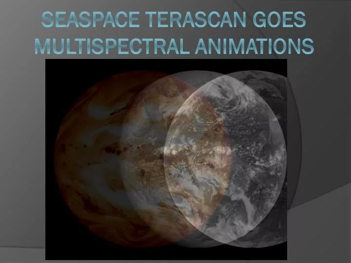
SeaSpace Terascan GOES Multispectral Animations. GOES System Talent Team. Micheal Cobb Elizabeth City State University. Kathryne Burton Elizabeth City State University. Andrew Brumfield Technical Mentor Elizabeth City State University. James Headen Elizabeth City State University.

E N D
GOES System Talent Team Micheal Cobb Elizabeth City State University Kathryne Burton Elizabeth City State University Andrew Brumfield Technical Mentor Elizabeth City State University James Headen Elizabeth City State University Khaliq Satchell Elizabeth City State University Dr. Malcolm LeCompte Team Mentor Elizabeth City State University
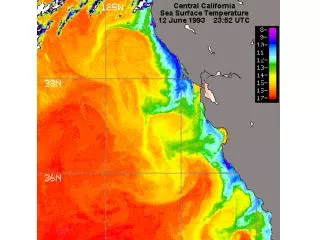
Abstract • Installation of the two SeaSpaceTerascan Geostationary Operational Environmental Satellite (GOES) receivers in July, 2013 provides ECSU’s CERSER laboratory with a capability to capture and generate the most current image data available of the Earth’s Western Hemisphere environment. The data is provided in an operational mode defined by the limitations of the GOES scanning imaging system. The GOES system operations are scheduled by the National Oceanic and Atmospheric Administration (NOAA) to provide various obligated environmental products, primarily to support numerical meteorological prediction services to different regions of the Western Hemisphere. A principal advantage of any remote sensing system located in Geostationary orbit lies in the ability to create ‘loops’ or animations that reveal changes that occur in the Earth’s environment.
What is TeraScan? • TeraScan is a software designed to process data from satellites and turning it into images. • Environmental satellites • Meteorological satellites
TeraScan Data Format (TDF) • Unique to TeraScan • Allows data to be viewed in TeraScan • Ability to convert into picture products of various styles • Easy to share through network
TeraScan System Compatibility • Geostationary Satellites • L-Band Transmittance • Polar-Orbiting Satellites • L/S Band Transmittance • X-Band Transmittance
What can TeraScan do with received data? • Creates Images • Produces Data Products • Mathematical Data Interpretations • Survey Particular Areas
What is GOES? • Geostationary SatelliteSystem • Operated by the United States National Environmental Satellite, Data and Information Service (NESDIS)
Future Work We will combine a GOES east and Goes West data to produce a composite image between the two.