Download
1 / 33
330 likes | 464 Vues
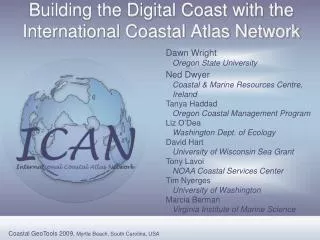
Building the Digital Coast. Priority Coastal Issues. Land use planning (growth management) Coastal conservation Hazards (flooding/inundation/storm surge) Water quality Marine planning and ocean governance Erosion and shoreline change management Protected areas management

E N D
Priority Coastal Issues • Land use planning (growth management) • Coastal conservation • Hazards (flooding/inundation/storm surge) • Water quality • Marine planning and ocean governance • Erosion and shoreline change management • Protected areas management • Climate adaptation
Common Geospatial Needs • High resolution imagery • Land cover and land use • Integrated Topo/Bathy • Climate data and forecasts • Shoreline and change rates • Flood maps and prediction • Data Standards and access
Common Geospatial Needs • Training • Scenario prediction tools • Techie tools and non-techie tools • Awareness of existing data, tools, and training • Improved intergovernmental coordination • $$$$$$
Vision • Enabling platform providing easy access to data, tools, and information • Coastal organizations come together to address coastal issues • Evolves to a community resource
The Digital Coast is not • the end all, be all system for NOAA • But the Digital Coast does provide • a common delivery platform for organizations • a common information platform for coastal decision makers
Digital Coast PACKAGING • Data • Tools • Training • In Action Profiles
Sample Data • Land cover & land use • Imagery • Lidar • Benthic habitat • Shoreline • Bathymetry
Tools • Data Access and Visualization • Hurricane Evacuation Zones Mapping Tool • Legislative Atlas • Historical Hurricane Tracks IMS • Hazard Assessment Tool • Data Handling Tools • Lidar Data Handler • Chart Reprojector • Electronic Navigational Chart Handler • Nautical Chart Viewer • Decision Support • Habitat Priority Planner • Nonpoint-Source Pollution and Erosion Comparison Tool • Impervious Surface Analysis Tool • CanVis Visual Simulation Tool • Multipurpose Marine Cadastre • Informational • Storm Mapping Tutorial • Storm Data Resource Guide
Digital Coast in Action • Visualize sea level rise impacts • Gather regional governance data • Develop conservation plans • Get public involved in planning • Educate public about hazard risks • Create runoff scenarios
Digital Coast and USACE • USACE Products: • Coastal Mapping Data (2005) • Tools (2009) • Digital Coast in Action (2009) • Data downloads: • >5,300 downloads • 475 GB • ~170B points
Digital Coast PARTNERSHIP GROUP • Association of State Floodplain Managers • Coastal States Organization • National Association of Counties • National States Geographic Information Council • The Nature Conservancy
What does the Digital Coast mean for the partnership group? • Coastal data, tools, training, case studies • National exposure • Leadership opportunity • Opportunity to leverage resources • Ability to promote best practices
Additional Digital Coast Participants • Collaborators • MS Coordinating Council for GIS and Remote Sensing • Integrated Ocean and Coastal Mapping (IOCM) • Content Providers • Various State Partners • National Geodetic Survey • U.S. Army Corps of Engineers • U.S. Geological Survey • Private Sector
What does this mean for IOCM? • Efficient product and service delivery • A customer driven portfolio • A means of reaching strategic priorities • An opportunity to leverage resources • A way to demonstrate outcomes • Increased exposure for geospatial activities
Future Plans for the Digital Coast • Build content • Build partnership group • Build additional success stories • Build the user community
Miki Schmidt • Nicholas.Schmidt@noaa.gov • (843) 740-1237 www.csc.noaa.gov/digitalcoast
Coastal Challenges • 53% of population living in coastal areas, only 17% of nation’s land area • 57% of U.S. GDP from coastal watershed counties • $6-30 billion per year from beach recreation • $10-26 billion per year from recreational fishing • $4.9-$49 billion per year generated from coastal wildlife viewing • $15 billion spent yearly by local government on Great Lakes restoration
NOAA Coastal Services Center • Mission – linking people, information, and technology in the coastal zone • Constituents–organizations impacting coastal communities • Role–bring new skills, data, and information • Result–decision makers have the tools they need
Comprehensive Hurricane Preparedness Study Tool View horizontal extent of storm surge zones for each hurricaen category View Street level Impacts to determine evacuation zones
Hazard Assessment Tool Report Generator The tool automatically generates a report for any area (parcel, part of a parcel, multiple parcels, etc.) that indicates floodplain zones, base flood elevations, CZM special management areas, tsunami evacuation zones and a map of the area
Multipurpose Marine Cadastre A marine information system for the outer continental shelf and state waters that provides a data framework to support decision making.
Priority Issues • Land use planning • Hazards and community resilience • Water quality • Habitat conservation • Marine spatial planning and ocean governance • Climate change