Download
1 / 72
730 likes | 1.36k Vues
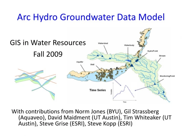
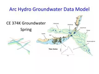
Arc Hydro and Time Series. Presented by David R. Maidment At ESRI, Redlands CA 15 January 2004. Hydrologic Information System. Analysis, Modeling, Decision Making. Arc Hydro Geodatabase. Drainage System. Hydro Network. Flow. Time. Time Series. Hydrography. Channel System.

E N D
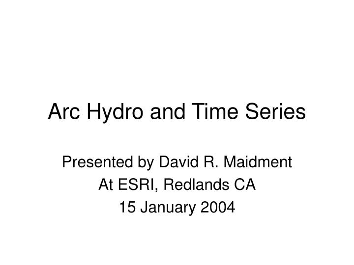
Arc Hydro and Time Series Presented by David R. Maidment At ESRI, Redlands CA 15 January 2004
Hydrologic Information System Analysis, Modeling, Decision Making Arc Hydro Geodatabase
Drainage System Hydro Network Flow Time Time Series Hydrography Channel System Arc Hydro Components
Flow Time Time SeriesData indexed by time • A time series is a sequence of (time, value) pairs • Represents a single type of information e.g. streamflow • Many existing time series databases are not linked to GIS
Variable Time Time and Space in GIS Time Series Feature Series t3 t2 Value t1 Time Attribute Series Raster Series Value t3 t2 t1 t1 t2 t3 y x
Variable Time t1 t2 t3 Time Series and Temporal Geoprocessing DHI Time Series Manager Time Series Feature Series t3 t2 Value t1 Time Attribute Series Raster Series Value t3 t2 t1 y x ArcGIS Temporal Geoprocessing
Variable Time Time Series • A sequence of {time, value} pairs • Exists independently of GIS • May be associated with 0, 1 or many spatial features • Displayed using graphs • Measured at gages • Generated by simulation models Time Series Value Time
Attribute Series t1 t2 t3 Attribute Series • A sequence of {featureID, time, value} triplets • Features have time series • Feature classes have attribute series • Attribute series is a feature attribute that varies through time • Features have fixed shape Time Series Feature Attributes
Arc Hydro Attribute Series Object TSDateTime TSValue FeatureID TSType
Arc Hydro Attribute Series Feature Class (HydroID) Attribute Series Table (FeatureID)
Attribute Series Typing TSType Attribute Series • Map time series e.g. Nexrad • Collections of values recorded at various locations and times e.g. water quality samples • This is current Arc Hydro time series structure 1 * Type Units Regular …. Type Time FeatureID Value
Raster Series • A sequence of {time, raster} pairs • Stored in a time-indexed raster catalog • Shares same time series type classification as other forms of time series • Produced by time-indexed geoprocessing operations Raster Series Value t3 t2 t1 y x
Feature Series • A sequence of {shape, time, value} triplets • Feature geometry varies through time • Features may vary in shape and location in space • Produced by observation or by classification of phenomena in raster series Feature Series t3 t2 t1
Time Series Types • Need to classify time series into Types so that functions can be applied appropriately • All series should share the same typing system • Many aspects of typing numerical data from physical time series • GIS data have categorical, ordinal, interval and ratio types
Arc Hydro Case Studies • GoldSim linked to Arc Hydro • Tracking Analyst for displaying Arc Hydro attribute series data • MaptoMap: From Nexrad rain map to a flood plain map using Model Builder, Arc Hydro and the HEC models • Temporal Geoprocessing for Hydroperiod at the South Florida Water Management District Then Michael Blongewicz will present the DHI Time Series Manager
Arc Hydro Attribute Series Feature Class (HydroID) Attribute Series Table (FeatureID)
Arc Hydro TSType Table Units of measure Regular or Irregular Time interval Type Of Time Series Info Recorded or Generated Type Index Variable Name • Arc Hydro has 6 Time Series DataTypes • Instantaneous • Cumulative • Incremental • Average • Maximum • Minimum
Type of Time Series Gold Sim Types Arc Hydro Type 1. Instantaneous
Arc Hydro Case Studies • GoldSim linked to Arc Hydro • Tracking Analyst for displaying Arc Hydro attribute series data • MaptoMap: From Nexrad rain map to a flood plain map using Model Builder, Arc Hydro and the HEC models • Temporal Geoprocessing for Hydroperiod at the South Florida Water Management District Then Michael Blongewicz will present the DHI Time Series Manager
Tracking Analyst Data Structures • Simple Event • One table • Contains at least date/time of observation • Complex Event • Two tables • Object can be stationary or dynamic (depending on whether geometry and time are on same table)
Simple Events (1 Table) Unique Identifier for objects being tracked through time Observation Time of observation (in order) Geometry of observation
Complex Event (static version) This is an Attribute Series The object maintains its geometry (i.e. it is stationary and has fixed shape)
Complex Event (dynamic version) This is a Feature Series The object’s geometry can vary with time (i.e. shape can change or relocate)
Concept of Temporal Layer • Take the attribute series table, and join the feature class to that table • Shape is then attached to all attribute series records (one shape for many records) • This is a “Time Centric” view. Bring space to time rather than time to space
Irregularly recorded water quality data form an Attribute Series • A point feature class defines the spatial framework • Many variables defined at each point • Time of measurement is irregular • May be derived from a Laboratory Information Management System Field samples Laboratory Database
Fecal Coliform in Galveston Bay(Irregularly measured data, 1995-2001) Coliform Units per 100 ml Tracking Analyst Demo
Nexrad over South Florida • Real-time radar rainfall data calibrated to raingages • Received each 15 minutes • 2 km grid • Stored by SFWMD in Arc Hydro time series format
Nexrad data as Attribute Series Attribute series Display as a temporal layer in Tracking Analyst
Nexrad Animation (produced with Tracking Analyst) • Tracking Analyst animations need a time stamp displayed on them • Tracking Analyst needs to be able to display Raster Series • It would be nice to have a “animate raster series” tool in Spatial Analyst
Arc Hydro Case Studies • GoldSim linked to Arc Hydro • Tracking Analyst for displaying Arc Hydro attribute series data • MaptoMap: From Nexrad rain map to a flood plain map using Model Builder, Arc Hydro and the HEC models • Temporal Geoprocessing for Hydroperiod at the South Florida Water Management District Then Michael Blongewicz will present the DHI Time Series Manager
GIS Preprocessors for Hydrologic Models GIS Interface Model 1 Database Model 2 Model 3
Connecting Arc Hydro and Hydrologic Models GIS Interfacedata models HMS Geo Database Arc Hydro data model RAS WRAP
Regional Storm Water Modeling Program and Master Plan for San Antonio City of San Antonio
San Antonio Regional Watershed Modeling System Geospatial Data: City, County SARA, other “Bring the models together” Modeling System Rainfall Data: Rain gages Nexrad Calibration Data: Flows Water Quality Floodplain Management Capital Improvement Planning Water quality planning Integrated Regional Water Resources planning Flood Forecasting
Regional Watershed Modeling System Case Study Salado Creek watershed Components: • Arc HydroGeodatabase • for whole watershed • HEC-HMShydrology model • for whole watershed • HEC-RAShydraulic model • for Rosillo Creek Bexar County Rosillo Creekwatershed
Arc Hydro and HEC-HMS HEC-HMS Hydrologic Model Arc Hydro Schematic Network Calculates Flows
Arc Hydro and HEC-RAS HEC-RAS Hydraulic Model Calculates Water Surface Elevations Arc Hydro Channel Cross Sections
HEC Data Storage System (DSS)(binary data file system shared by HEC models) • Model features define the spatial framework • One or a few variables modeled • Values for each time interval • One time series may be associated with many features • Many modeling scenarios Time series catalog Many time series
Flow Change Points Models communicate with one another through Arc Hydro at designated points
FLOODPLAIN MAP Nexrad Map to Flood Map in Arc 9 Model Builder Flood map as output Model for flood flow HMS Model for flood depth Nexrad rainfall map as input
Arc Hydro Case Studies • GoldSim linked to Arc Hydro • Tracking Analyst for displaying Arc Hydro attribute series data • MaptoMap: From Nexrad rain map to a flood plain map using Model Builder, Arc Hydro and the HEC models • Temporal Geoprocessing for Hydroperiod at the South Florida Water Management District Then Michael Blongewicz will present the DHI Time Series Manager
Enhanced Arc Hydro Framework for South Florida Existing Arc Hydro Framework Arc Hydro for South Florida Water Management District (SFWMD) Hydroperiod Estimation Operations Decision Support System Regional Simulation Model Flood Hydrology & Hydraulics