Download
1 / 29
290 likes | 417 Vues
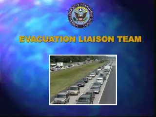
EVACUATION LIAISON PROGRAM. BACKGROUND. Born out of Floyd 3.5 million evacuees Multi state/region event No coordination across borders Florida GA SC NC all requested traffic evacuation coordination assistance. THE STARTING POINT. Designed an ELT based on HLT concept Only in FEMA RIV

E N D
BACKGROUND • Born out of Floyd • 3.5 million evacuees • Multi state/region event • No coordination across borders • Florida GA SC NC all requested traffic evacuation coordination assistance
THE STARTING POINT • Designed an ELT based on HLT concept • Only in FEMA RIV • Created a Traffic Model – Evacuation Traffic Information System (ETIS) • Operational conference Calls & Briefings
Where We Are Today • Current USDOT Traffic Management Capability: • ELP Extends To Three FEMA Regions III,IV,VI • Continuing To Enhance Web-Based ETIS System • 2 Activations – Lili/Isidore & Isabel • Post Assessments Inclusion • Moving Towards Real Time Intelligent Traffic Systems (ITS) Incorporation (SC) & (FL)
PARTNERSHIP • USDOT - Team Lead • FHWA • Contractor Support • FEMA – EM Specialist • ESF-1 National Response Plan Function • Information Technology –GIS • STATE DOT & EMA’s - Not Just Coastal States
ELT MISSION: To facilitate communication and coordination among states impacted by a multi-state hurricane evacuation response.
Region III, IV, VI, Evacuation Liaison Team Information Flow TX DOT EMA SC DOT EMA NC DOT EMA LA DOT EMA GA DOT EMA FEMA REGIONS RIII, RIV & RVI USDOT FEMA HLT AL DOT EMA FL DOT EMA MS DOT EMA FEMA Region III States Other Agencies
ELT Responsibilites: • Provide a centralized communication link between the States, Regions, FEMA HQ, FEMA EST, DOT HQ, and other appropriate agencies • Receive, compile and analyze vital information • Disseminate updated information to impacted areas • Provide necessary data, analysis, & intelligence to facilitate evacuation, pre-positioning, staging, reentry planning, decision making and problem solving
How does the ELT help you? • Traffic Congestion Information • Road Closures • Shelter Location • Contra-Flow/Reverse Lane Information • Traffic Accidents • Type of Evacuation Occurring
REPORTING TIME TABLES • Formal Written situation reports twice a day • 3 hour updates (once evacuation begins) • Periodic status reports for video/teleconferencing • Immediate updates to potentially impacted States as information is received. • STATES will update the ETIS with information every 3 hours.
Evacuation Traffic Information System www.fhwaetis.com
ETIS - Emergency Traffic Information System • Server Funded by Federal Highway Administration • Associated with the Evacuation Liaison Team at Federal Emergency Management Agency’s (FEMA) Regional Operations Center in Atlanta • For Cat 3 and above/multi-state impacts • Primarily for state to state coordination.
ETIS - Emergency Traffic Information System • On Internet • www.fhwaetis.com • State Emergency Response Team and the Emergency Operations Center have read and write access • Counties have read access
ISABEL LESSON LEARNED • Confusing/Conflicting Information • Population Apathy • Light Evacuation Response • 16 total storm deaths – • Need Updated & Current POC Information
ETIS Post Storm Improvements • Verification of Existing Population Data. • Verification of Existing Roadways and new construction. • Full Functionality of FEMA Region III states. • Full Functionality for Inland coastal counties.
Improvements Cont. • Create delay timing functions • Create historical storm data base • Include Partial/Full Evacuation Status • SC One Way Plans Included • Upgrade ArcIMS Mapping Software
Improvements Cont. Mapping Application Enhancements FEMA 100 Year Floodplain Surge Inundation Zones Evacuation Zones Shelter Points HAZUS/Satellite Imagery
CONTACT INFORMATION Michael (Mike) Foran- USDOT Manager, Emergency Preparedness Operations Staff ESF-1 SE United States michael.foran@faa.gov 404-305-5471
CONTACT INFORMATION BROCK LONG- FEMA RIV HURRICANE PROGRAM SPECIALIST brock.long@dhs.gov 770-220-5668