Download
1 / 30
330 likes | 603 Vues
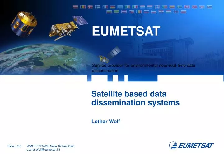
EUMETSAT. Satellite based data dissemination systems Lothar Wolf. Overview. Today: Description of existing operational satellite based dissemination system - EUMETCast The Future: An interoperable satellite based dissemination system with global coverage - GEONETCast. EUMETSAT Objectives.

E N D
EUMETSAT Satellite based data dissemination systems Lothar Wolf
Overview • Today: Description of existing operational satellite based dissemination system - EUMETCast • The Future: An interoperable satellite based dissemination system with global coverage - GEONETCast
EUMETSAT Objectives • ... The primary objective is to establish, maintain and exploit European systems of operational meteorological satellites. • A further objective is to contribute to the operational monitoring of the climate and the environment as well as the detection of global climatic changes.
EUMETSAT’s Mission is…. • ... to deliver operational satellite data and products that • satisfy the meteorological and climate data requirements • of its Member States - 24 hours a day, 365 days a year. • This is carried out according to the recommendations of • the World Meteorological Organization (WMO).
EUMETSAT Dissemination Services • Dissemination of EUMETSAT Meteosat and METOP data • Dissemination of Foreign Satellite Data (e.g. GOES, MTSAT) • Meteorological Products and Forecast Data (ECMWF, DWD, MetOffice) • DWDSAT • DCP • MDD (WMO Region 1) (including PUMA/AMESD) • BMD (WMO Region 6) • EARS (EUMETSAT Advanced Re-transmission System) • GEONETCast trial service • All those services make use of the EUMETCast framework
EUMETCast • Generic (open and flexible), multi-missiondissemination system based on the standard DVB multicast technology and acombinationof communication infrastructure • Independentof local (network) infrastructure at the reception side • Simultaneousproduct availability across the broadcast footprint • Closed-loopproduct and performancemonitoring • High SLA of 99.50% with very rigid, guarantied and mission relatedtimeliness(e.g. 3m50sec MET8 image timeliness across EUMETCast footprint) • Scalableby usage of commercial telecommunication satellites (using a set of broadcast forward channels) • Allowing the usage of off-the shelf, commercial, inexpensive equipment for reception • File levelencryptionincluding the ability of “Denial of Service” toendorse data policy
EUMETSAT’s role as EUMETCast Service Management Provider Data Service Management Others… DVB Broadcast Other Sources DWD EARS EUMETSAT SAFs EUMETSAT DVB Uplink Users
EUMETCast Communication System Integration • Networks used for Data Acquisition and Dissemination • WMO and regional networks (GTS, RMDCN) • Private networks • IP-VPN networks • Internet • Broadcast (including encryption and mission oriented guarantied timeliness) • EUMETSAT is involved in all WMO related activities (WIS, VGISC/SIMDAT, IGDDS etc.)
EARS Project as example of combined communication infrastructure Upgraded bandwidth 128 kbs > 512 kbs Upgraded bandwidth 128 kbs > 512 kbs EUMETCastBroadcast Up-link ProductProcessing Node Tromsø IP VPN Network ASCAT Level 2 KNMI Product Processing Node EARSControl Maspalomas Improved redundancy Product Processing Node EUMETSAT Site N
EARS Project as example for near-real time product availability Global DataDump Global 3-6 hours Global DataDump Global 3-6 hours HRPT Reception Local Immediate HRPT Reception Local Immediate EUMETSATAdvancedRetransmissionService Regional 30 min.
BMD as example for a non-imagery mission • From 1 September 2005 the RA VI Basic Meteorological Data (BMD) became operational for a two year pilot phase. • Service contains: • SYNOP, TEMP, PILOT, Warnings and Tropical Cyclone data: • Forecast data in GRIB format from ECMWF and DWD: • Charts of WAFS, Aerological Diagrams, basic meteorological field parameters and observations in graphical form. • Access to BMD is restricted to the WMO members (National Meteorological Services and partner organisations) of the WMO Regional Association VI.
Procedure to become a EUMETCast Data Provider • - Specification to EUMETSAT: • Data (files) to be transmitted, with attributes • Size • Frequency (per hour, day, week, month …) • Time (hh:mm) of transmission • Timeliness requirements - Discussion/clarification with EUMETSAT of technical issues (like need for a segmentation of files for very large file sizes) - Test Phase: File transfers from Data Provider to Uplink Service Provider, transmissions via satellite, Reception Station handling - Request to the STG OPSWG for inclusion of this data into the EUMETCast services, subsequent endorsement by STG/Council - Inclusion into the operational EUMETCast schedule
EUMETCast Europe Coverage HB-6, Ku-Band Coverage
EUMETCast Africa Coverage AB-3, C-Band Coverage
EUMETCast South America Coverage NSS 806, C-Band Coverage Begins Q2 2006
The Future • EUMETCast as service framework for current and pre-operational mission data delivery with guarantied timeliness • EUMETCast as technology core for the implementation of a satellite multicast based dissemination system for environmental data with global coverage: GEONETCast
GEONETCast Background • Ministers agreed at the third Earth Observation Summit in February 2005 to develop the GEOSS to meet the need for timely, quality, long-term global environmental information as a basis for sound decision making and to enhance delivery of the benefits to society. • GEONETCast is a dissemination system under development by which GEOSS environmental satellite and in situ data and products from participating Data Providers will be transmitted to users using a multicast, access controlled, broadband capability. • Especially useful for less developed or low infrastructure areas • Participation in GEONETCast as a data provider, end user, or dissemination infrastructure provider is voluntary. • The intergovernmental Group on Earth Observations (GEO) has defined the GEONETCast task as Capacity Building Task #CB-06-04 with oversight by the GEO Architecture and Data Committee
GEONETCast Benefits • A key feature in increasing the use of environmental data globally is to make it accessible to all nations in a cost-effective and efficient manner. • Given the rapidly increasing volume and diversity of data and products, particularly from earth observation and environmental satellites, this presents a real challenge. Adding to the complexity of the situation is the diversity of organisations and national entities involved in earth observation satellite systems, in-situ observations and production activities. • The introduction of a coordinated, coherent, global dissemination scheme that addresses the existing problems of data dissemination is to be welcomed, and GEONETCast has the potential to achieve these goals in coordination with other data dissemination methods. • GEONETCast promises to facilitate and enhance access, particularly for developing countries, to key environmental data in the nine societal benefit areas of GEO.
GEONETCast Status • EUMETCast, operated by EUMETSAT, currently provides the operational dissemination infrastructure that hosts GEONETCast. This provides geographic coverage of Europe, the Middle East, Africa, and South, Central and most of North America. • Discussions have started with the Chinese Meteorological Administration (CMA) to integrate FengYungCast into GEONETCast. This would provide geographic coverage of the Asia/Pacific region. A first data exchange trial has been started and is demonstrated at CGMS in Shanghai. • NOAA has a stated initial intention to establish a dissemination system providing comprehensive coverage of the Americas known as GEONETCast Americas. Users in the region will be provided with a long-term perspective for access to GEONETCast. A data exchange trial was established during summer including a local American beam demonstrated in Seattle. • The GEONETCast concept was also presented during various GEO conferences and during this years EUMETSAT African User Conference (Maputo)
GEONETCast Status AsiaSat-4 GEONETCast Evolution to global coverage • Together, these three regional systems (EUMETCast, FengYunCast and GEONETCast Americas) form GEONETCast, and have the capability to provide global coverage.
GEONETCast Status • The added value that GEONETCast brings is to facilitate and enhance access, particularly for developing countries, to key environmental data in the nine societal benefit areas of GEO by applying standards across, and encouraging the development of, regional systems. • These three regional systems are seen as the minimum required to establish global geographic coverage. Should additional regional systems be made available the GEONETCast concept can easily accommodate them.
GEONETCast System Design Overview • GEONETCast Regional Network Centre - GNC • Re-use of EUMETCast framework • Re-use of technical standards • High level design of GEONETCast implementation via interconnected GNC • Re-use of existing networks for data acquisition • Re-use of service standards • Central point of entry for users (one stop shop)
GEONETCast System Design Overview • GEONETCast Regional Network Centre - GNC • Re-use of EUMETCast framework • Re-use of technical standards
GEONETCast System Design Overview • High level design of GEONETCast implementation via interconnected GNC • Re-use of existing networks for data acquisition • Re-use of service standards • Central point of entry for users (one stop shop)
GEONETCast Current and Planned coverage AsiaSat-4 GEONETCast Evolution to global coverage
GEONETCast • GEONETCast further information: • http://www.geonetcast.org • GEONETCast Implementation Team collaboration: • http://wiki.geonetcast.org
EUMETSAT Satellite based data dissemination systems For more information on EUMETCast please visit our web site: http://www.eumetsat.int