Download
1 / 36
360 likes | 546 Vues
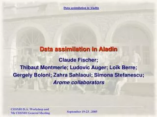
Use of radar data in ALADIN. Mari án Jurašek marian.jurasek @shmu.sk Slovak Hydrometeorological Institute. Use of radar data in ALADIN EWGLAM/SRNWP/COST717, Lisbon 2003. Contents of presentation. current work with radar and ALADIN data in ALADIN’s countries

E N D
Use of radar data in ALADIN Marián Jurašek marian.jurasek@shmu.sk Slovak Hydrometeorological Institute
Use of radar data in ALADIN EWGLAM/SRNWP/COST717, Lisbon 2003 Contents of presentation • current work with radar and ALADIN data in ALADIN’s countries • future: “Research plan for radar data assimilation in ALADIN”
Current status Use of radar data in ALADIN EWGLAM/SRNWP/COST717, Lisbon 2003 • assimilation of radar data not yet developed for ALADIN • usage of radar data: • for ALADIN verification • together with ALADIN in hydrological models • together with ALADIN in nowcasting application • all work is done only on national level
AUSTRIA • archiving 1h cumulated precipitation from 10 minutes radar data in lat-lon grid • archiving precipitation fields based on surface observations in the same grid • mainly used for ALADIN convective rainfall forecast visual verification Use of radar data in ALADIN EWGLAM/SRNWP/COST717, Lisbon 2003
AUSTRIA (2) • first study made for eastern alpine domain • period: summer 2003 • first results: • ALADIN precipitation forecast is not selective enough in space • early bias with regard to the onset of precipitation • in some areas model generates convective precipitation on almost every day during the summer season Use of radar data in ALADIN EWGLAM/SRNWP/COST717, Lisbon 2003
Hourly precipitation rate estimated by radar measurement Hourly precipitation rate interpolated from the local obs. network AUSTRIA (3) Use of radar data in ALADIN EWGLAM/SRNWP/COST717, Lisbon 2003
AUSTRIA (4) 17th August 2003, 17 UTC Convective cloudiness and precipitation prognosed by ALADIN Convective precipitation (hourly rate) prognosed by ALADIN Use of radar data in ALADIN EWGLAM/SRNWP/COST717, Lisbon 2003
AUSTRIA (5) • results leaded to the experiments with modified trigger functions in the ALADIN deep convection scheme. • larger project connected with integrated flood forecasting system will probably start next year • combination surface precipitation observations, radar and ALADIN Use of radar data in ALADIN EWGLAM/SRNWP/COST717, Lisbon 2003
CZECH REPUBLIC • ALADIN data used for generating radar image forecast • wind field data - crucial point of the radar echo prediction • tested 3 different methods for wind field calculation • COTREC • Wavelet Transform Decomposition • ALADIN geopotential field at 700 hPa Use of radar data in ALADIN EWGLAM/SRNWP/COST717, Lisbon 2003
CZECH REPUBLIC (2) COTREC • comparison of two consecutive radar images using some similarity criteria • smoothing of final field WAVELET • similar to COTREC, but radar image is decomposed to subspaces using the wavelet transformation • calculation of decomposition similarity criteria at several different detail levels • smoothing of final field like in COTREC Use of radar data in ALADIN EWGLAM/SRNWP/COST717, Lisbon 2003
CZECH REPUBLIC (3) ALADIN • cloud motion is controlled by air mass flow at approx. 3-5 km above sea level • it corresponds with geopotential at 700 hPA (cca 3 km) • ALADIN data interpolated to the image size and to the resolution of radar data • motion field calculated from geostrophical approximation Use of radar data in ALADIN EWGLAM/SRNWP/COST717, Lisbon 2003
CZECH REPUBLIC (4) COTREC Wind field calculated by COTREC method Forecasted radar image by COTREC method Use of radar data in ALADIN EWGLAM/SRNWP/COST717, Lisbon 2003
CZECH REPUBLIC (5) WAVELET Wind field calculated by WAVELET method Forecasted radar image by WAVELET method Use of radar data in ALADIN EWGLAM/SRNWP/COST717, Lisbon 2003
CZECH REPUBLIC (6) ALADIN Forecasted radar image by ALADIN method Wind field calculated by ALADIN method Use of radar data in ALADIN EWGLAM/SRNWP/COST717, Lisbon 2003
CZECH REPUBLIC (7) Results of comparison: • all methods improve radar information • for all methods, similar decrease in forecast quality with forecast time • in most cases, the ALADIN method is slightly worse • ALADIN method needs only one radar image • ALADIN method has the smallest hardware requirements Use of radar data in ALADIN EWGLAM/SRNWP/COST717, Lisbon 2003
CZECH REPUBLIC (8) Conclusion: • in operational use only COTREC and ALADIN methods • forecasted radar image generated every 10 minutes • forecasted for +10 min +20 min ... +90 min Use of radar data in ALADIN EWGLAM/SRNWP/COST717, Lisbon 2003
FRANCE • study of flood event in southern France from 8th to 10th September 2002 • visual verification (comparison) of cumulative radar rain with cumulative ALADIN rain forecast • main goal: to see the general evolution of the precipitation Use of radar data in ALADIN EWGLAM/SRNWP/COST717, Lisbon 2003
FRANCE (2) 48 h cumulated precipitation measured by radar 48 h cumulated precipitation forecasted by ALADIN Use of radar data in ALADIN EWGLAM/SRNWP/COST717, Lisbon 2003
FRANCE (3) • space-time interpolation of precipitation fields • pattern matching applied on radar data • attempt to prepare radar data for non-visual verification • radar data space filtered to ALADIN resolution (cca 10 km) • spectral study of radar and ALADIN precipitation Use of radar data in ALADIN EWGLAM/SRNWP/COST717, Lisbon 2003
FRANCE (4) • result of spectral study: forecast error is like white noise, no difference between frontal and convective precipitation • spectral filtering used for separating large- from small scale precipitation • discrepancy between radar and model data separated to: • large scale scaling error • large scale geometrical deformation error • small scale residual Use of radar data in ALADIN EWGLAM/SRNWP/COST717, Lisbon 2003
FRANCE (5) • Computation of optimal deformation operator: • correlation method - numerically too expensive, already for 200 x 200 points field • incremental variational technique • highly non-quadratic pattern matching cost function • problem with optimisation if good first guess not available Use of radar data in ALADIN EWGLAM/SRNWP/COST717, Lisbon 2003
HUNGARY • radar and ALADIN data as input for hydrological model DIWA (DIstributed WAtershed) running outside of Hungarian Meteorological Service • input for model: • ALADIN precipitation forecast • ALADIN min/max temperature • ECMWF forecasts ( as ALADIN + ensemble) • calibrated 12 h cumulated precipitation from radar measurements Use of radar data in ALADIN EWGLAM/SRNWP/COST717, Lisbon 2003
HUNGARY (2) Example of calibrated 12h radar precipitation Use of radar data in ALADIN EWGLAM/SRNWP/COST717, Lisbon 2003
HUNGARY (3) Verification of 72 h hydrological model forecast over 110 days period Use of radar data in ALADIN EWGLAM/SRNWP/COST717, Lisbon 2003
Conclusion of first part • none radar data assimilation to ALADIN • usage of radar data together with ALADIN data is not coordinated • only some applications on national level Use of radar data in ALADIN EWGLAM/SRNWP/COST717, Lisbon 2003
Research Plan • in June 2003 prepared proposal of workplan for research of radar data assimilation for ALADIN • radar data - essential for mesoscale assimilation • available radar data: • reflectivity • instantaneous rainrate • cumulated rainfall • doppler wind , wind shear, turbulence • vertical wind profile • quantities from multiple polarisation measurements Use of radar data in ALADIN EWGLAM/SRNWP/COST717, Lisbon 2003
Which radar data? • each has advantages and disadvantages • not all available on all radar sites • reflectivity seems to be available on most European sites • not common form of data: • “PPI” images • volume data Use of radar data in ALADIN EWGLAM/SRNWP/COST717, Lisbon 2003
The philosophy • learning from satellites • remote sensing process is complex and nonlinear • we should assimilate quantity close to measured (reflectivity instead of rainrate) • derived quantities contain hardly correctable errors • observation operator for simulation of reflectivity for each radar • development of system for radar data against model data monitoring Use of radar data in ALADIN EWGLAM/SRNWP/COST717, Lisbon 2003
The philosophy (2) • biases and big errors cannot be handled by 3D/4D-Var • software for detection and removal of corrupted data • study of space- and time structure of biases between simulated and observed data for bias correction • each radar processed independently • thinning of too dense data consistently with the resolution of the analyses Use of radar data in ALADIN EWGLAM/SRNWP/COST717, Lisbon 2003
The philosophy (3) • very accurate modelling of physical process of observation • precisely interpolating / averaging model variables along the radar beam path • physical part of observation operator should be prepared by radar specialists • observation operator should relatively independent from model Use of radar data in ALADIN EWGLAM/SRNWP/COST717, Lisbon 2003
Things To Do • get samples of very good quality radar reflectivity data • get idea of fields needed to simulate reflectivity • get simple (to start with) reflectivity simulation formulae • specify obs. operator by list of necessary model fields, information about observation Use of radar data in ALADIN EWGLAM/SRNWP/COST717, Lisbon 2003
Things To Do (2) • carefully specify the technical implementation of previous things • implement radar data into the ODB processing • implement direct interpolation of model fields • convert model field to the reflectivity, compute and store difference with observation • study monitoring statistics Use of radar data in ALADIN EWGLAM/SRNWP/COST717, Lisbon 2003
Things To Do (3) • code tangent linear and adjoint of obs. operator • simulate one radar pixel • study the impact of reflectivity assimilation to forecast • run several cycles of data assimilation to see the cumulative effect • retune preprocessing and analysis parameters Use of radar data in ALADIN EWGLAM/SRNWP/COST717, Lisbon 2003
Thank You for your attention! marian.jurasek@shmu.sk Use of radar data in ALADIN EWGLAM/SRNWP/COST717, Lisbon 2003