Download
1 / 29
300 likes | 693 Vues
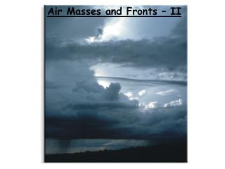
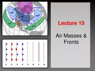
Chapter 8: Air Masses and Fronts. Introduction. Air masses have uniform temperature and humidity characteristics They affect vast areas Fronts are boundaries between unlike air masses Fronts are spatially limited They are inherently linked to mid-latitude cyclones. Formation of Air Masses.

E N D
Introduction • Air masses have uniform temperature and humidity characteristics • They affect vast areas • Fronts are boundaries between unlike air masses • Fronts are spatially limited • They are inherently linked to mid-latitude cyclones
Formation of Air Masses • Source regions: The areas of globe where air masses form are called source regions. Surface conditions transfer to overlying air to form air mass.
(1) air gains temperature and humidity characteristics of the surface. (2) Topographically uniform areas. It will take a few days for an air mass to take on the characteristics of the underlying surface. So, air masses are usually formed in low and high latitude, since middle latitude is too variable. It requires large regions and uniform topography to form air masses.
(3) It requires days for temp/moisture imprinting to form air masses. (4) air masses classified by temp/moisture characteristics of source region • moisture: continental (dry) v. maritime(marine) – c or m • temp: tropical (warm), polar (cold), arctic (very cold) – T, P or A
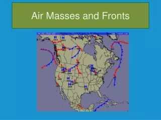
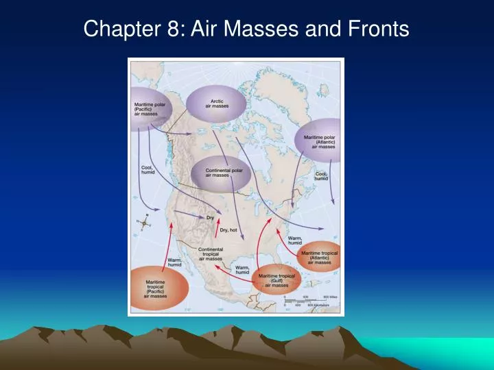
Once formed, air masses migrate within the general circulation • Upon movement, air masses displace residual air over locations thus changing temperature and humidity characteristics • Further, the air masses themselves moderate from surface influences North American air masses and air mass source regions
Continental Polar (cP) and Continental Arctic (cA) Air Masses Continental Polar (cP) • Winter: originate over high-latitude land masses (northern Canada, Siberia) • Low solar angle, short days, high albedo cooling of over-lying air inversions and highly stable conditions • very cold and dry limited cloud formation, bright and sunny • Summer: warmer with higher moisture content fair weather cumulus develop Continental Arctic(cA) • extremely cold and dry conditions: low temperature limited vapor content • boundary between cA and cP Arctic Front
Migrations of cP air induce colder, drier • conditions over affected areas • As air migrates heat and moisture capacity • increases stability decreases
Maritime Polar (mP) Air Masses • ~ to cP but warmer and higher moisture content • forms over N. Pacific/Atlantic • e.g. cP flowing out of Asia, over warm Japan current adds heat/moisture • west coast of the US mP air affects regions during winter • process is different along east Coast cyclonic flow: winds approach coast from the northeast (nor’easters) cold, heavy snowfall
Continental Tropical (cT) Air Masses • Summer phenomena – hot, low-latitude areas SW US, northern Mexico • little available moisture, high temp hot, dry air masses • steep lapse rates, unstable conditions due to intense surface heating • limited cloud formation • thunderstorms may occur: • advection • orographic lifting
Maritime Tropical (mT) Air Masses • Form over low latitude oceans: Gulf of Mexico, tropical Atlantic • very warm, humid unstable • affects southeastern US • Migration inland heating of air mass from ground surface increases lapse rates increases instability intense ppt (thundershowers) . • moisture content: reduced in northward direction Miami v. Chicago
Fronts • separate air masses leads to changes in temperature and humidity • as one air mass is replaced by another • changes in temp lead to uplift and ppt • four types of fronts: • cold cold advancing on warm • warm warm advancing on cold • stationary air masses not advancing • occluded does not separate tropical • from polar/arctic, boundary btw two • polar air masses
Cold Fronts • cold air displaces warm air • results in heavy precipitation events and rapid temperature drops • Extreme precipitation extensive vertical lifting • warm air ahead of the front forced aloft cumulonimbus clouds Frontal development about a low pressure system The vertical displacement of air along a cold front boundary
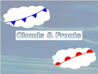
Types of fronts Identification of fronts 1. Sharp temperature changes 2. Change in the air’s moisture 3. Shifts in wind direction 4. Pressure and pressure change 5. Clouds and precipitation patterns Course: Introduction to Atmospheric sciences(ATOC210) by GyuWon LEE
Consequence: cloud and precipitation patterns Cold front • Showers with gusty winds are prevalent when the warmer air is moist and • unstable • - Anvil with Ci (Cirrus), Cs (Cirrostratus). • Move faster (15 ~25knots) and are steeply sloped (~ 1: 50) • -Ac: Altocumulus (mid-clouds); Cb: Cumulonimbus.
The sharp cold front boundary is evident on both satellite pictures and radar composites
Consequence: cloud and precipitation patterns Cold front: frontogenesis (frontolysis)
Warm Front • occurs when warm air displaces colder air • overrunning – warm air gently rides over cold, dense air • leads to gradual progression of cloud types stratus, nimbostratus, altostratus, cirrostratus, cirrus • cirrus is seen first, clouds continue to thicken and lower • zone of contact is less steep than cold fronts greater horizontal extent • longer, less intense periods of rain (uplift not as dramatic) • ppt falls through cold air mass frontal fog, or sleet/freezing rain
Identification of fronts Warm front 1. Sharp temperature changes 2. Change in the air’s moisture 3. Shifts in wind direction 4. Pressure and pressure change 5. Clouds and precipitation patterns • Advancing warm, moist, subtropical (mT) air replaces the retreating cold maritime polar air. • - Precipitation well in advance of the front’s surface boundary.
Consequence: cloud and precipitation patterns Warm front • - Wide spread rain ahead of the sfc front (“overrunning”) • - Ci, Cs, As, Ns - The wind veers with altitude • Frontal inversion in the region of the upper level front • - Move slower (10knots) and are gently sloped (~ 1: 200)
Stationary Fronts • contact zones sometimes are stalled relatively ‘fixed’ in position • relationship btw the air masses ~, do not move as quickly • subjective in terms of speed difficult to establish contact zone precisely • Fronts may slowly migrate and warmer air is displaced above colder
Occluded Fronts • Occluded front (occlusion): closure cold air mass cuts off warm air from ground • separate cold/warm air masses BUT at surface air masses merge • cold-type v. warm-type occlusion • cold-type occlusion: eastern half of the continent cP air meets mP • warm-type occlusion: western edges of continent mP advances on cP
Occlusion sequence
Alternative Mechanisms: Occluded Fronts Some occlusions form when the surface low elongates and moves away from the junction of the cold and warm fronts Some occlusions occur when the intersection of the cold and warm fronts slides along the warm front
Consequence: cloud and precipitation patterns Cold-type occluded front The faster moving cold front catches up to the slower moving warm front, and forces the warm air mass to rise off the ground.
Consequence: cloud and precipitation patterns Warm-type occluded front The faster moving cold front overtakes the slower moving warm front. The lighter air behind the cold front rises up and over the denser air ahead of the warm front.
Drylines • Fronts based on temp and density differences of air masses • Humidity (moisture content) affects density humid air < dense (H20 lower molecular weight than N2 and O2) • Dryline: boundary btw humid and dry air. A dryline over Texas