Download
1 / 1
30 likes | 233 Vues
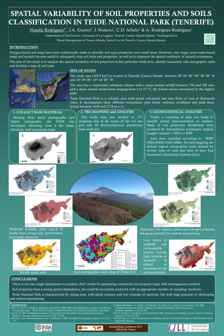
SPATIAL VARIABILITY OF SOIL PROPERTIES AND SOILS CLASSIFICATION IN TEIDE NATIONAL PARK (TENERIFE) Natalia Rodríguez 1* , J.A. Guerra 2 , J . Notario 1 , C.D . Arbelo 1 & A. Rodríguez-Rodríguez 1

E N D
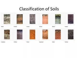
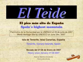
SPATIAL VARIABILITY OF SOIL PROPERTIES AND SOILS CLASSIFICATION IN TEIDE NATIONAL PARK (TENERIFE) Natalia Rodríguez1*, J.A. Guerra2, J. Notario1, C.D. Arbelo1& A. Rodríguez-Rodríguez1 1Department of Soil Science, University of La Laguna, Tenerife, Canary Islands (Spain). *nrodeug@ull.es 2 Rural Management of Canary Islands, Santa Cruz de Tenerife, Canary Islands (Spain). INTRODUCTION Polygon-based soil maps have been traditionally made to describe soil types properties over small areas. However, over larger areas raster-based maps and models become useful to adequately map soil units and properties, as well as to represent the spatial continuity of natural ecosystems. The aim of this study is to analyze the spatial variability of soil properties in this particular study area, identify taxonomic and cartographic units and develop a map of soil types. SITE OF STUDY The study area (189.9 km2) is located in Tenerife, Canary Islands between 28º 09’ 00’’-28º 20’ 00’’ N and 16º 29’ 00’’-16º 44’ 00’’ W The area has a continental subalpine climate with a mean annual rainfall between 250 and 550 mm, and a mean annual temperature ranging from 3 to 15 ºC, the lowest values correspond to the highest peak. Teide National Park is a volcanic area with recent volcanism and lava flows of tens of thousands years. It encompasses three different ecosystems: pine forest, endemic scrubland and peak flora, spread between 1650 and 3718 m.a.s.l. • COLLECT BASE MATERIAL • Starting from aerial photographs and digital cartography, the DEM was developed, obtaining from it the slope, elevation and orientation maps • PRE-MAPPING and ANALYSIS • The study area was divided in 173 sampling sites at the nodes of the 1x1 km grid and 20 physicochemical parameters were analyzed. • 3. GEOSTATISTICAL ANALYSIS • Firstly, a screening of data was made to identify spatial autocorrelation or outliers. Maps of soil properties distribution were produced by interpolation techniques: kriging (nugget variance < 50%) or RBF. • Soils were classified according to WRB (ISSS-ISRIC-FAO 2006).For soil mapping we defined logical cartographic units, formed by several types of soils that have or have had functional relationship between them. Moderate available water typical of Sandy loam young soils, derived from pyroclastic materials Relatively low organic carbon and nitrogen contents, but great potential for carbon sequestering Low values of available and exchangeable cations. Locally high contents of available K related to alteration of the acid pyroclastic Soil cartographic units map of Teide N.P. Mainly acidic soils CONCLUSIONS There is not one single interpolator to produce chief results for generating continuous soil property maps with homogeneous surfaces. Soil properties have a strong spatial dependency, but could be accurately predicted with an appropriate number of sampling locations. Teide National Park is characterized by young soils, with sandy textures and low contents of nutrients, but with high potential of developing and carbon sequestering. REFERENCES Dobos, E., Carré, F., Hengl, T., Reuter, H.I. & Tòth, G. 2006. Digital Soil Mapping as a support to production of functional maps — EUR 22123 EN. Office for Official Publication of the European Communities, Luxemburg Lark, R. M. 2000. Estimating variograms of soil properties by the method‐of‐moments and maximum likelihood. European Journal of Soil Science 51 (4): 717-728. McBratney, A.B., Mendonça Santos, M.L. & Minasny, B. 2003. On digital soil mapping. Geoderma117 (1–2): 3–52. Rodríguez-Rodríguez, A., Arbelo, C.D, Notario, J.S., Mora, J.L., Guerra, J.A. & Armas, C.M. 2004. Contenido y formas de carbono orgánico en Andosoles forestales: aproximación a su dinámica. Edafología 11 (1): 67-102. Scull, P, Franklin, J, Chadwick, O A & McArthur 2003. Predictive soil mapping: a review. Progress in Physical Geography 27 (2): 171-197. Van Reevwijk, L.P. 1993. Procedures for soil analysis. 4th Ed. International Soil Reference and Information Centre. Wageningen, Holanda.