Download
1 / 39
390 likes | 478 Vues
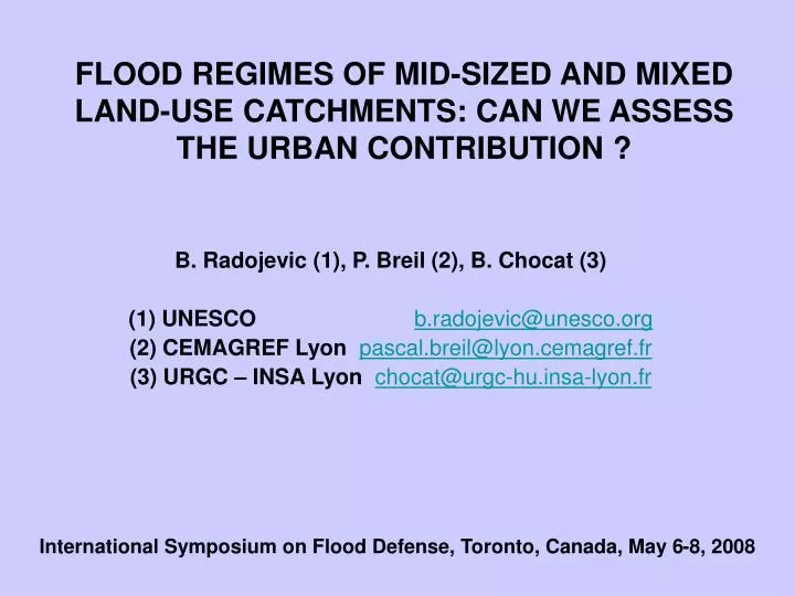
FLOOD REGIMES OF MID-SIZED AND MIXED LAND-USE CATCHMENTS: CAN WE ASSESS THE URBAN CONTRIBUTION ?. B. Radojevic (1), P. Breil (2), B. Chocat (3) (1) UNESCO b.radojevic@unesco.org (2) CEMAGREF Lyon pascal.breil@lyon.cemagref.fr (3) URGC – INSA Lyon chocat@urgc-hu.insa-lyon.fr.

E N D
FLOOD REGIMES OF MID-SIZED AND MIXED LAND-USE CATCHMENTS: CAN WE ASSESS THE URBAN CONTRIBUTION ? B. Radojevic (1), P. Breil (2), B. Chocat (3) (1) UNESCOb.radojevic@unesco.org (2) CEMAGREF Lyonpascal.breil@lyon.cemagref.fr (3) URGC – INSA Lyonchocat@urgc-hu.insa-lyon.fr International Symposium on Flood Defense, Toronto, Canada, May 6-8, 2008
Urban sprawling: a world wide trend(UNEP, 2003 ) Urban growth of Lyon city (with courtesy from Lyon city council, 2005)
Population growth in Lyon Periurban area Urban area Urban unit Data from French National Institute for Statistics and Economic Studies
2.5 2 1.5 1 0.5 0 What could be the impact of land-use change on flood discharge? Adapted from GALEA et al., 1993 Rural change • The ten years flood is doubled both for : • a change of 70% from forest to vineyard land use • an impervious rate of 20% Peak flood ratio of Post to Pre land use change 100 0.1 1 10 Recurrence interval (years) Adapted from HOLLIS, 1975 20 20 20 20 % imperviousness 15 15 15 50 % 10 10 10 Urban change x 4 x 4 5 5 5 4 4 4 x 2 x 2 2 2 2 1 1 1 0.1 0.1 0.1 1 1 1 10 10 10 100 100 100 200 200 200 2 2 2 25 25 25 50 50 50 Recurrence interval (years)
Outline of the presentation • Objective of the study • Study area • Method • Results • Conclusion
< Vulnerability in terms of flood frequency Hazard In terms of flood frequency > Objective of the study Flood risk concept The flood risk meets the local objective when the hazard frequency is smaller than the vulnerability frequency and vice versa Each aspect of the flood risk can be expressed as a recurrence interval in year units
Instrumentation within the basin Taffignon Craponne
Increase in flood frequency m3/s Years ’70’ Years ’90’
Stationary Test – number of floods (according to Lang, 1995)
Stationary test on number of floods - rural part (according to Lang, 1995)
Stationarity of the number of max. daily rainfall at Bron station
Daily max. rainfall regime for the rain gauge Bron • Daily intensity: • The most intense in the ’90’ • The lowest in the ’70’
Method • Built a semi-distributed hydrological model with the land use on the 90’ • Use the rainfall and stream-flow data to calibrate the 90’ model • Validate the 90’ model • Built a semi-distributed hydrological model with the land use on the 70’ • Use the 90’ fitted parameters and the 90’ rainfall series to simulate the 70’ stream flows • Make projection of the land use evolution and simulate the stream flow evolution- virtual series
débits débits simu. corresp. corresp. corresp. état urba. pluies 70 pluies 90 pluies 90 années 70 oui (1) non oui (3) (amont) années 90 non oui (2) oui (4) influence influence urbanisation variabilité pluies entre (1) et (2) oui oui ent re (1) et (3) non oui entre (1) et (4) oui oui entre (2) et (3) oui non entre (2) et (4) non non entre (3) et (4) oui non Method Influence of rainfall Model quality Impact of urbanisation
Model development • Dividing the l’Yzeron basin in hydrological units • Calibration of the rainfall – runoff model CANOE • Validation of CANOE
forest mainly forest Farming-grass land periurban urban The land use change over 17 years
Land use change in ‘70 and ‘90 (grid based estimation) Upstream (Craponne) Total basin (Taffignon)
Definition of hydrological units • if the % of urban grid of sub-basin is: • higher 50% option ‘strictely urban’ of CANOE was applied • if the % of périurban grid of sub-basin is: • higher 50% option ‘urbain-rural’ of CANOE was applied • if the % of rurale grid of sub-basin is: • higher 50% option ‘strictely rural’ of CANOE was applied
Rural Peri-urban Urban Distribution of hydrological units 70’ land use model 90’ land use model
Impervious areas Impervious areas Direct runoff to water courses Un-Direct runoff to water courses Semi-distributed Rainfall-Runoff Model CANOE Permeable areas ( Forest, grassland,..) Production function Runoff coef. Production function Horton’s infilt. law Production function Runoff coef. Transfer function Nash cascade Transfer function Nash cascade Transfer function Linear reservoir 3 hydrographs summation
Results of Calibration – downstream urban part - Taffignon Automne Winter Spring Summer
Description of comparison Influence of urbanisation Comparison between simulated runoff (land use 1970) with observed rainfall series of 1990 (Taffignon) and simulated runoff (land use 1990) with observed rainfall series of 1990 (Taffignon) Model Quality Comparison between simulated and observed runoff series (Taffignon, Craponne)
m3/s 1h QCX1h 3h 6h 1h QCX1h 12h QCX1h 24h 1h time t Characteristic of selected runoff for description of flood regime: QCX(d) QCX (d) are discharge values continuously overpassed for selected durations. Shorter is the duration, higher is the discharge and vice versa. QCX(d) allow to describe the pattern of floods. QCX(d) Threshold level for duration d Selected durations 1h, 3h, 6h, 12h and 24h
Model validation – rural part Null hypothesis H0 tested : The simulated population is equivalent to the observed population? “H0 accepted” “H0 rejected” “H0 accepted” Only large durations (24hours) are rejected from the statistical test. Model is validated for the flood regimes simulation
Model validation – urban + rural parts Null hypothesis H0 tested : Is the simulated population equivalent to the observed population? ok “H0 acceptable” “H0 accepted” “H0 rejected”
Flood regimes change between ’70’ and ’90’(urban units on 1970: 6% and 1990: 19%) Only the small floods are affected T=1 Null hypothesis H0 tested : The 90’population is equivalent with the 70’ population? “H0 rejected” “H0 rejected” “H0 accepted”
Flood regimes change for future development of 24% and 33% urban area Null hypothesis H0 tested : Is the future population equivalent with the present population? Imperviousness rate of 24 % Imperviousness rate of 33 % “H0 accepted” “H0 rejected”
Full bank flow 24 % urbanized (simulated) +6% 1996 - 19% urbanized (observed) +14% • - 6% urbanized • (simulated) Flood hazard evolution From 6 to 19% of urbanization only small floods are affected, only T=1year. Over 20% of urbanization, also large floods are affected. It means that both transfer and production were affected
Conclusion on flood hazard evolution • Model results are sensitive to an increase of urbanisation by 13% only (Taffignon station).It is detected over 6% • For rural part of the basin (2/3 of the total basin): No urban influence (even small floods are not effected). For urban part mainly floods with a small return period are affected. • Simulation results indicate the increase in flood frequency does not result only from the land use change. It means the rainfall regime is a major factor but … • Expected urban development on 2025 should have a very sensitive effect on flood peak increase. The effect on large floods would be very sensitive for 33% urbanisation. • Unexpected compensation effects of the periurban growth exists and should be considered as a mitigating potential if managed.
Flood vulnerability assessment (I) Flooded area boundaries are determined from a DEM analysis considering at least all grid cells connected to a water course with no more than a given height (e.g.1 meter) above the full bank altitude DEM- Digital Elevation Model
Flood vulnerability assessment (II) Flooded areas can be split into vulnerability categories from forest, grassland and farming , periurban and urban types
Flood vulnerability Evolution As a consequence of the land use change in the vicinity of the stream corridor the average acceptable flooding return period has doubled from years 79 to 96; meaning the need for protection.
Conclusion & Perspectives • The urban development increases upstream flood frequencies. • The periurban development has sensitive effect on large flood frequencies since a 33% urbanized area. • The flood risk is not proportional to imperviousness rate but rather to spatial distribution in mixed land use catchments • Mainly the vulnerability of flooded areas can explain theincrease in flood risk. Vulnerability is however manageable under 20 % and should allow to reduce flood risk. • Over 20% urban it seems necessary to have a better characterization of the hydrological functioning of periurban areas, which is not trivial!