Download

1 / 38
390 likes | 598 Vues
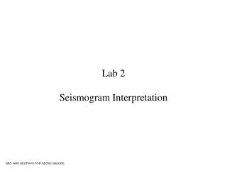
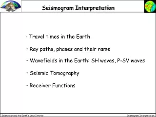
Seismogram. WEAK. STRONG. P S surface waves. Up-Down N-S E-W. Seismographs. Seismographs are devices that record ground motion during earthquakes. The first seismographs were constructed at the very end of the 19th century in Italy and Germany.

E N D
Seismogram WEAK STRONG P S surface waves Up-Down N-S E-W
Seismographs • Seismographs are devices that record ground motion during earthquakes. • The first seismographs were constructed at the very end of the 19th century in Italy and Germany.
Residents of the National Capital Region (NCR), however, should not consider themselves “lucky” that temblors of that magnitude will never affect them. In all likelihood, it will. Dr. Renato Solidum Jr., Phivolcs director, said the latest collaborative works of geologists show that the West Valley fault—which covers parts of Metro Manila—has moved in the last 1.400 years, and has a cycle of between 400 to 600 years. Aerial photographs, satellite imagery and topographic maps completed by the institute in 1991 showed movements in the fault. The next killer quake may not strike until 2058 (the last major movement took place in 1658), but this early government agencies were preparing for the worst, Solidum said. Intense damage can be expected in Marikina, Quezon City, Pasig, Makati, Pateros, Taguig and Muntinlupa, where the West Valley fault passes. Based on studies by Phivolcs and the US Geological Services, the next big quake—to hit either Metro Manila or central Visayas (again)—would be between magnitude 6 and 7. “For planning purposes and based on the data we have, what we are planning for is a magnitude 7.2 earthquake scenario,” Solidum said. In the case of Metro Manila, the scenario is based on the length of the West Valley fault. If a big quake hits the metropolis at night, the death toll could be as high as 31,000. Some 78 million square meters would be affected. Phivolcs studied the buildings in Metro Manila and found that most of them are old and needed retrofitting in order to survive the same type of shock as the Bohol quake. Source:http://www.manilatimes.net/killer-quake-can-hit-metro-or-central-visayas/65670/
SOME OF THE PHILIPPINES’ NOTABLE EARTHQUAKE EXPERIENCES AUGUST 16, 1976 JULY 16, 1990 AUGUST 31, 2012
THE MINDANAO EARTHQUAKE AND GULF OF MORO TSUNAMIThe Philippines’ WorstEarthquake/Tsunami Disaster M7.9 AUGUST 16, 1976
THE EARTHQUAKE • Occurring at night when schools and offices were closed, the fatalities were relatively low (about 800) despite extensive damage to buildings due to poor construction and/or inadequate foundations. • Bridges and roads in Mindanao and the city of Cotobato were damaged.
Unfortunately, there was no time for the Pacific Tsunami Warning Center to issue a warning before a large local tsunami struck the region just minutes after the earthquake,
THE GULF OF MORO TSUNAMI • The destructive tsunami generated in the Gulf of Moro and in the Celebes Sea killed about 90 percent of the estimated 8,000 total fatalities, hitting peope in coastal communities in North and South Zamboanga, North and South Lanao, North Cotabato, Maguindanao and Sultan Kudarat (Mindanao), and in the neighboring Sulu Islands.
THE LUZON EARTHQUAKE M7.8 JULY 16, 1990 4:26 pm
LOCATION http://en.wikipedia.org/wiki/1990_Luzon_earthquake
OCCURRENCE • The earthquake occurred on the Philippine fault system, a well-known strike-slip fault zone. • The rupture produced a 125 km-long surface scarp stretching from Dingalan, Aurora to Cuvapo, Nueva Eciia.
LESSONS LEARNED FOR DISASTER RESILIENCE • ALL NOTABLE EARTHQUAKES • PROTECTION OF BUILDINGS AND INFRASTRUCTURE IS ESSENTIAL FOR COMMUNITY RESILIENCE.
Baguio City was isolated from the rest of the Philippines for 48 hours after the quake.
BAGUIO CITY: DAMAGE TO BUILDINGS • Baguio City, a popular tourist destination, situated about 1,500 m (1 mile) above sea level, was among the areas hardest hit by the earthquake. • The collapsed and damaged buildings in Baguio City included hotels, factories, government and university buildings, and homes..[
BAGUIO CITY: DAMAGE TO LIFELINE SYSTEMS • Electric, water and communication lines were destroyed. • Kennon Road, the main vehicular route to Baguio, as well as other access routes to the mountain city, were shut down by landslides
FATALITIES • An estimated 1,621 people were killed in the earthquake, with most of the fatalities located in the Central Luzon and Cord-illera region
M7.6 EARTHQUAKE STRIKES 140 KM FROM SAMAR PROVINCE ON EAST COAST OF THE PHILIPPINES34 KM DEEP8:47 PM AUGUST 31, 2012
LESSONS LEARNED FOR DISASTER RESILIENCE • ALL NOTABLE EARTHQUAKES • PREPAREDNESS PLANNING FOR THE INEVITABLE GROUND SHAKING IS ESSENTIAL FOR COMMUNITY RESILIENCE.
LESSONS LEARNED FOR DISASTER RESILIENCE • ALL NATURAL HAZARDS • CAPACITY FOR INTELLIGENT EMERGENCY RESPONSE IS ESSENTIAL FOR COMMUNITY RESILIENCE.
Before an earthquake • Know the earthquake hazards in your area • Strap or bolt heavy furniture / cabinets to the wall • Check the stability of hanging objects like ceiling fans and chandeliers • Breakable items, harmful chemicals and flammable materials should be stored properly in the lowermost secured shelves
Before the Earthquake • Familiarize yourself with the exit routes • Know where fire extinguishers, first aid kits, alarms and communication facilities are located. Learn how to use them beforehand • Prepare a handy emergency supply kit with first aid kit, canned food and can opener, water, clothing, blanket, battery-operated radio, flashlights and extra batteries
During an earthquake • Stay calm • When you are inside a structurally sound building or home, STAY THERE • If possible quickly open the door for exit • Duck, cover hold under a sturdy desk or table • Stay away from glass windows, shelves, cabinets and other heavy objects • Beware of falling objects
During an earthquake • If you’re outside, move to an open area • Stay away from trees, power lines, posts and concrete structures • Move away from steep slopes which may be affected by landslides • If you’re near the shore and feel an earthquake, especially if it’s too strong, move quickly to a higher ground. TSUNAMIS might follow.
During an Earthquake If you’re in a moving vehicle, stop and get out! Do not attempt to cross bridges, overpasses, or flyovers which may have been damaged.