Download
1 / 8
80 likes | 335 Vues
Regional Geography of The United States. An Interactive Presentation. Name That Continent. 6. Europe. 1. 4. North America. Asia. 2. Africa. 3. South America. 5. Australia. 7. Antarctica. The Four Oceans. 4. Arctic. 1. Atlantic. 2. Pacific. 3. Indian. Large Bodies of Water.

E N D
Regional Geography of The United States An Interactive Presentation
Name That Continent 6 Europe 1 4 North America Asia 2 Africa 3 South America 5 Australia 7 Antarctica
The Four Oceans 4 Arctic 1 Atlantic 2 Pacific 3 Indian
Large Bodies of Water • The location of the United States, with its Atlantic and Pacific coasts, has provided access to other areas of the world. • The Atlantic Ocean served as the highway for explorers, early settlers, and later immigrants. • The Pacific Ocean was an early exploration route. • The Gulf of Mexico provided the French and Spanish with exploration routes to Mexico and other parts of America. • Bodies of water support interaction among regions, form borders, and create links to other areas.
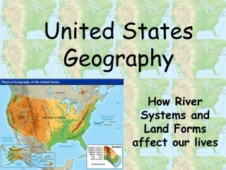
The United StatesWhere are The Appalachian Mountains, the Rocky Mountains, The Mississippi River and The Great Lakes? Great Lakes Rocky Mountains Appalachian Mountains Mississippi River The Gulf of Mexico
3 1 Name That Region 6 Canadian Shield 7 8 4 5 Basin And Range Rocky Mountains (CONTINENTAL DIVIDE) 2 Great Plains Coastal Range Interior Lowlands Appalachian Highlands Coastal Plain
North American Waterways Columbia River Missouri River Great Lakes OHIO RIVER Colorado River Rio Grande River Mississippi River
Historical Importance of Waterways • The Ohio River was the gateway to the west. • Inland port cities grew in the Midwest along the Great Lakes. • The Mississippi and Missouri Rivers were the transportation arteries for farm and industrial products. They were links to ports and other parts of the world. • The Columbia River was explored by Lewis and Clark. • The Colorado River was explored by the Spanish. • The Rio Grande forms the border with Mexico.