Download
1 / 13
140 likes | 564 Vues
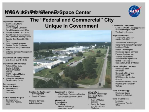
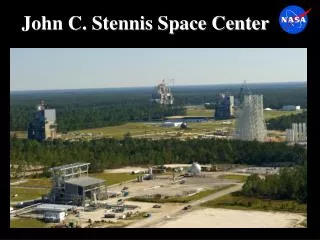
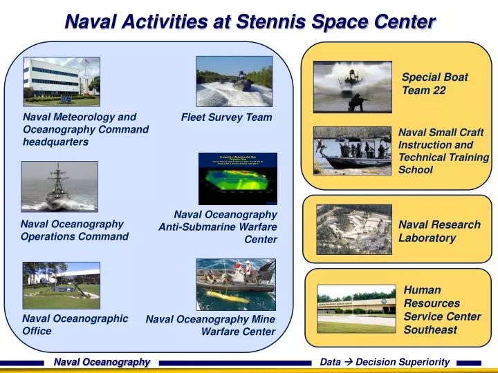
Probability of Detection (Pd) Map Varying in Time Volume View (Op Area by 200 m in depth) for 5-25 July 06 Threat at 200 ft, Detector between 0 and 650 ft. Naval Activities at Stennis Space Center. Special Boat Team 22. Naval Meteorology and Oceanography Command headquarters.

E N D
Probability of Detection (Pd) Map Varying in Time Volume View (Op Area by 200 m in depth) for 5-25 July 06 Threat at 200 ft, Detector between 0 and 650 ft Naval Activities at Stennis Space Center Special Boat Team 22 Naval Meteorology and Oceanography Command headquarters Fleet Survey Team Naval Small Craft Instruction and Technical Training School Naval Oceanography Anti-Submarine Warfare Center Naval Oceanography Operations Command Naval Research Laboratory Human Resources Service Center Southeast Naval Oceanographic Office Naval Oceanography Mine Warfare Center
Special Boat Team 22 SOCOM’S premier Riverine Force capable of executing the full spectrum of Special Operations in any Maritime environment worldwide • Organize, train and equip Naval Special Warfare personnel to conduct thefull spectrum of special operations in a riverine environmentto support Fleet and Joint Commanders worldwide • Prepare Security Force Assistance elements capable of building foreign maritime surrogate forces in accordance with Commander, United States Special Operations Command Priorities: Operating BY, WITH and THROUGH • Deploy NSW Task Units / Team level battle staffs for command and control of Naval Special Warfare forces as required
NAVSCIATTS NAVSCIATTS conducts Foreign Internal Defense (FID) in support of Combatant Commanders IAW Commander, US Special Operations Command priorities using In-Resident Training and Mobile Training Teams (MTTs) to prepare partner nation forces to conduct small craft operations in riverine or littoral environments.”
Naval Oceanography Chain of Command Commander, Naval Meteorology and Oceanography Command Fleet Numerical Meteorology and Oceanography Center (FNMOC) Monterey, CA Naval Meteorology and Oceanography Professional Development Center (NMOPDC) Gulfport, MS U.S. Naval Observatory (NAVOBSY) Washington, D.C. Naval Oceanographic Office (NAVOCEANO) Stennis Space Center, MS Naval Oceanography Operations Command (NOOC) Stennis Space Center, MS The Naval Meteorology and Oceanography Command: - Delivers accurate, relevant and timely oceanographic, meteorological, hydrographic, precise time and astrometric operational capabilities that enable predictive, physical battlespace awareness, effective decision-making for maritime warfighting, and the operational safety of Naval and Joint forces.
Side Scan Sonar Side Scan Sonar Master Contact Database Master Contact Database Pd Map (averaged over4nmifor each grid point) Pd Map (averaged over4nmifor each grid point) Temp: CTD section A - B A B Pd Radials (unaveraged for each grid point) Pd Radials (unaveraged for each grid point) A Historical Imagery Historical Imagery Tactical Imagery Tactical Imagery B Cold core feature Warm core feature Naval Oceanographic Office Annotated and Analyzed Imagery Collection Assets Tactical Products Ocean Modeling Global Regional Local A Kuroshio 6
Fleet Survey Team (FST) A specialized team of military and civilian experts providing Hydrographic and Oceanographic knowledge of the littoral environment to support Safety of Navigation • Rapidly deployable teams • 4 - 6 personnel, 9 m RHIB or Fly-Away Survey Kit for Boat of Opportunity • Expeditionary Surveys – Beaches and Rivers • Expeditionary Survey Vessels (ESV), w/bolt-on sensor • package for nearshore assessments. • Deployable to Amphibious Squadrons (PHIBRONs) • International Cooperative Surveys • Host country participation, Boats of Opportunity • Theater Security Cooperation • Global Partnership Building through Maritime Safety, Security, and Training • Humanitarian Assist / Disaster Relief • Post-hurricane surveys – Katrina, Rita, Gustav, Ike • Post-earthquake surveys – Indonesia, Haiti, Chile • 96 hrs to departure upon tasking Tailored Products and delivery in the field
Naval OceanographyOperations Command Commands operational directorates for Naval Oceanography
Naval Oceanography Anti-Submarine Warfare Center Provides ASW commanders with environmental knowledge that defines the battlespace for planning and operations
Naval Oceanography Mine Warfare Center Assists commanders with: • Planning • Tactics • Post-exercise assessment
Mine Warfare: Maritime Homeland Defense Port & Harbor Surveys • Continuous Intelligence Preparation of the Environment • Baseline high resolution side scan sonar surveys • Near shore current modeling • Optical properties • Port Folders: key infrastructure, survey and oceanographic data, MCM plans Operational Response Capability • NOMWC UUV Platoon • Rapid responder/force multiplier • Developing tactics and procedures in complex confined areas • NOMWC/NAVO Environmental MIW Team • Provides on-scene tactical support
Navy DoD SupercomputingResource Center (Navy DSRC) “Main Engine” for Naval Oceanographic Office (NAVOCEANO) ocean modeling analyses and predictions Systems provided by DoD High Performance Computing Modernization Program (HPCMP) 5 DSRCs total in USA Navy DSRC is physically in three Stennis Space Center locations (NCCIPS, NAVOCEANO and 9600 Bunker Complex) Serves DoD R&D as well as Operational Oceanography HPCMP funds 100% of investment, CNMOC funds 20% of operations cost CNMOC allocated computing capacity – dedicated system partitions Operational Modeling Capability vs Cost (per CPU hour): 1997 0.3 TF $45.18/hr 2001 8.4 TF $2.38/hr 2004 32 TF $1.67/hr 2007 58 TF $0.35/hr 2010 226 TF $0.13/hr 2013 866 TF $0.06/hr 12
Navy at Stennis: Impact • • DoD and contractors – 2,489 • NASA and contractors – 2,203 • • Department of Commerce • and contractors – 240 • • Other Resident Agencies – 476 • Total workforce – approx. 5,400 • Average salary with benefits – $87,000 *Totals as of Sept. 30, 2010