Download
1 / 5
50 likes | 56 Vues
Analysis of Surface Velocity Fields. CReSIS The Ohio State University Ohio State University is responsible for five primary tasks Developing regional-scale geophysical data sets from satellite data Developing new techniques for measuring the physical properties of firn and ice

E N D
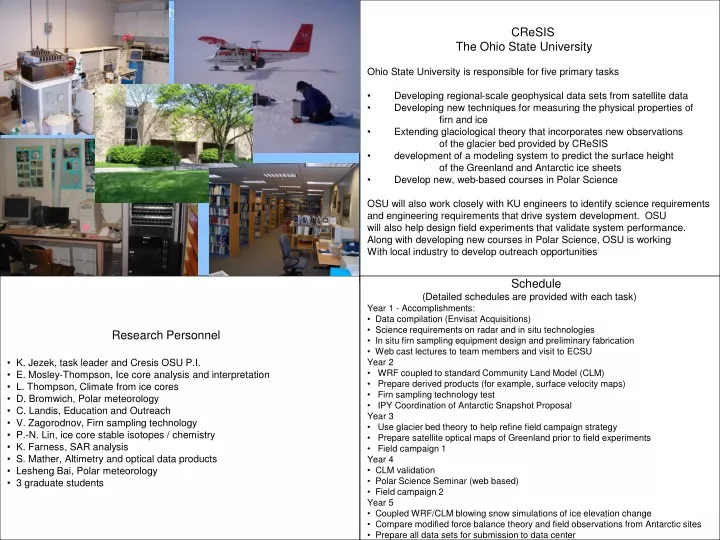
Analysis of Surface Velocity Fields • CReSIS • The Ohio State University • Ohio State University is responsible for five primary tasks • Developing regional-scale geophysical data sets from satellite data • Developing new techniques for measuring the physical properties of • firn and ice • Extending glaciological theory that incorporates new observations • of the glacier bed provided by CReSIS • development of a modeling system to predict the surface height • of the Greenland and Antarctic ice sheets • Develop new, web-based courses in Polar Science • OSU will also work closely with KU engineers to identify science requirements • and engineering requirements that drive system development. OSU • will also help design field experiments that validate system performance. • Along with developing new courses in Polar Science, OSU is working • With local industry to develop outreach opportunities • Research Personnel • K. Jezek, task leader and Cresis OSU P.I. • E. Mosley-Thompson, Ice core analysis and interpretation • L. Thompson, Climate from ice cores • D. Bromwich, Polar meteorology • C. Landis, Education and Outreach • V. Zagorodnov, Firn sampling technology • P.-N. Lin, ice core stable isotopes / chemistry • K. Farness, SAR analysis • S. Mather, Altimetry and optical data products • Lesheng Bai, Polar meteorology • 3 graduate students • Schedule • (Detailed schedules are provided with each task) • Year 1 - Accomplishments: • Data compilation (Envisat Acquisitions) • Science requirements on radar and in situ technologies • In situ firn sampling equipment design and preliminary fabrication • Web cast lectures to team members and visit to ECSU • Year 2 • WRF coupled to standard Community Land Model (CLM) • Prepare derived products (for example, surface velocity maps) • Firn sampling technology test • IPY Coordination of Antarctic Snapshot Proposal • Year 3 • Use glacier bed theory to help refine field campaign strategy • Prepare satellite optical maps of Greenland prior to field experiments • Field campaign 1 • Year 4 • CLM validation • Polar Science Seminar (web based) • Field campaign 2 • Year 5 • Coupled WRF/CLM blowing snow simulations of ice elevation change • Compare modified force balance theory and field observations from Antarctic sites • Prepare all data sets for submission to data center
Analysis of Surface Velocity Fields Analysis of Surface Velocity Field and Velocity Gradients The Ohio State University This task will measure and compile the surface velocity fields for the polar ice sheets. Velocity fields are already available for portions of the Antarctic from the MAMM project. Additional Radarsat InSAR data were for interior Antarctica during AMM-1 and new data about the perimeter have been collected through 2005. Velocity gradients and derived field will be analyzed using a proposed variant of the conventional force budget technique. The results will be used in comparison with Cresis imaging radar data to investigate properties of the glacial bed. In addition, the task will develop maps of Cresis study sites using optical satellite imagery and satellite altimeter systems. As part of this task, the PI will visit ECSU to give presentations on Polar Science and to interact with students and staff. Two web-based Polar Science Seminars will also be offered. • Research Personnel • K. Jezek, task leader and Cresis OSU P.I. • K. Farness, InSAR processing • S. Mather, DEM preparation and site maps creation • 1 graduate student will be involved with theory development • and comparison with Cresis data • Schedule • Year 1 - Accomplishments: • Assemble available SAR Data and available derived velocities • Assemble available DEM Data (Ekholm, Bamber, IceSAT) • Initial development of complete 3-d force theory • Year 2 • Host 2 ECSU students • Complete integrated 200 m DEM of Greenland • Create SAR mosaics and begin InSAR processing (Envisat) • Apply 3-d force theory to Antarctic MAMM data • IPY Coordination of Antarctic Snapshot Proposal • Year 3 • Finish ascending InSAR Processing begin descending InSAR • Begin theory application to the Greenland Ascending data • Prepare satellite optical maps of Greenland prior to field experiments • Year 4 • Finish Descending InSAR and merge velocity products • Compare force theory results to Greenland in situ experiments • Develop optical maps of Antarctic field sites • Polar Science Seminar (web based) • Year 5 • Compare theory and field observations from Antarctic sites • Prepare all data sets for submission to data center
High Resolution Analysis of the Physical and Chemical Properties of Snow and Firn using Multiple Technologies The Ohio State University Ice Core Paleoclimate Group Conductivity Electrodes Volcanic events, annual layers Bandsaw cut Mill cut emitter Rotor bit Laser diodes receiver Melter High resolution, in situ measurements of the physical and chemical properties of firn and ice, along with annual snow accumulation are essential for correct interpretation of airborne and satellite-borne remote sensing data. Density is one of the most difficult properties to measure and is best evaluated in situ. At least three different tools will be constructed, tested, and deployed to measure density with high vertical resolution and increased precision over current methods. Near-surface densities that change rapidly with depth will be given special attention. Ideally the speedograph will be calibrated so that many shallow (< 20 meter) profiles can be measured quickly in a region. This is critical as density can be highly variable over small distances, especially in regions where the snow facies are not dry and the degree of melt and refreezing is laterally variable. Speedograph penetration is f(density) Schedule • Years 1 and 2 [Design, Fabrication, Testing ] • High Resolution Density Setup (HIRESD) • Fabrication of the ICAS (Ice Core Analysis System) • - Fabrication of Speedograph • Testing all three devices with firn cores on hand at OSU • Inter-lab calibration with Japan (Gamma Rays) or AWI (X-rays) • Year 3 Greenland field testing, equipment modification • Field testing HIRDES and Speedograph • Make refinements needed as a result of field tests • Return of some cores for further validation by repeat measurements in • the cold room and laboratory analyses [dust, δ18O and major ions] • Year 4 Greenland field work; equipment modification • - Characterization of in situ density at multiple • field locations in Greenland • Return of some cores for further validation by repeat measurements • in the cold room and laboratory analyses [dust, δ18O and major ions] • - Refine equipment as needed; refurbish as needed • Year 5In situ density and other physical properties at Greenland • and Antarctic field locations to support CReSIS objectives Research Personnel Ellen Mosley-Thompson Victor Zagorodnov Lonnie G. Thompson Ping-nan Lin 1 graduate student involved in analysis of physical properties of firn / ice
Modeling System for Simulating the Elevation Change of the Ice Sheets over Greenland and Antarctica The development of a modeling system to predict the surface height of the Greenland and Antarctic ice sheets is proposed to complement and help interpret airborne and satellite-based measurements of ice sheet elevation change. The modeling system will be built on the polar version of the newly available Weather Research and Forecasting (WRF) model that is presently being developed by the Polar Meteorology Group of the Byrd Polar Research Center. The Community Land Model (CLM) that is scheduled to be coupled to WRF in 2006 by NCAR will be adapted to work over polar ice sheets. For the dry snow zone, blowing snow effects as well as densification of accumulated snow will be considered. For the melting areas, refreezing, runoff, and the effects of accumulated snow on the underlying ice will be simulated. It is anticipated that the coupled atmosphere-land surface model will be run continuously with assimilation of observations keeping the model atmosphere close to reality while the land surface albedo, snow cover on land, vegetation description, and sea ice coverage will be updated regularly from satellite observations. The modeling results will be compared and contrasted with available satellite and airborne measurements of ice sheet elevation change, taking advantage of area averaging of both to enhance accuracy. Year 2: Polar WRF coupled to the standard version of the Community Land Model (CLM) will be evaluated over Greenland and Antarctica. Year 3: CLM adapted and validated for the dry snow zone of ice sheets. A densification model for snow compression will be implemented into CLM. A separate blowing snow model will be optimized and coupled to CLM. Year 4: CLM adapted and validated for the melting areas to consider refreezing, runoff, and the effects of accumulated snow on the underlying ice. Year 5: Coupled Polar WRF-CLM-Blowing snow simulations of the surface elevation change of Greenland and Antarctica for 2000-2008. Variations tested against available satellite and airborne measurements of ice sheet elevation change and analyzed in relation to the climate controls. Research Personnel David H. Bromwich Lesheng Bai Graduate student
Education and Outreach Our vision is to educate students about the fundamental principles of earth science and the unique role of the polar regions in earth systems.Our objective is to train students who will be ableto critically and creatively apply these principles in their chosen careers. S&T outreach will be integrated into regular BPRC activities that include annual visits by primary and secondary school students from Central Ohio. BPRC also hosts student groups from local colleges and teacher organizations. BPRC is working with McGraw Hill Company to increase access to polar science information. Schedule Year 1 - Accomplishments ECSU/HINU presentations Continue discussions with McGraw Hill and production of K-12 material Jezek web cast lecture Numerous visits by K-12 students, teachers, parents, college students and teachers Proposal to Battelle to host 3 day-long climate change session Submit proposal to GLOBE RFP (energy budget focus) Invited talk at ECSU and HINU 2 undergrad presentations at OSU Denman Research Forum Year 2 ECSU summer students at OSU Lonnie Thompson web-cast lecture BETHA Program Develop additional courses (at OSU and partner institutions) for UG/G track Produce educational material in collaboration with McGraw Hill K-12 Teacher Workshop/Lesson Development Web Enhancement to make educational materials available Produce educational material Implement Battelle-funded quarterly workshops Partial support of GRA to assist with BPRC Learning Center Year 3 Host 2nd Teacher Workshop Establish visual database for educators Continue web enhancements Develop communication network of teachers and students and scientists Invitational for under-represented groups (societal implications focus) Lesson development with data analyses Possible IPY participation w/ a small teacher group Zagorodnov ice coring ‘hands-on’ experience for students Year 4 Host 3rd Teacher Workshop Invitational for under-represented groups (policy and international focus) Student production of "the best of"...images, day in the life of, etc. Seek partners interested in producing “learning modules” Potential partner is WGBH Boston David Bromwich web cast lecture Year 5 Finalize ongoing projects • Education and Outreach Team • Carol Landis – Educator • All Senior OSU Faculty and Staff • BPRC Administrative Staff • One graduate student (year 2)